Author: Sona Volentierova

  • Sivý kameň Castle, Končita

    Sivý kameň Castle, Končita

    The ruins of the Sivý kameň Castle are located on an andesite cliff above the village of Podhradie near Prievidza. Although relatively little of the castle has survived to this day, the castle cliff provides a beautiful view of the surrounding landscape.
    Under the castle

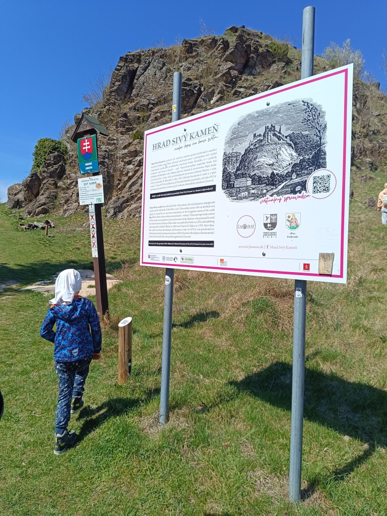
    The remains of the castle from the mid-14th century are visible directly from the village. A short climb from the village center will soon take you to a dirt road. Here, a sign with the inscription Sivý Kameň will alert you to the right direction. The entire climb to the castle takes approximately 15 minutes.

    Nowadays, when visiting the castle, we can observe its small remains, which at least indicate its size and the remains of the masonry. From the inner Gothic castle, the perimeter walls of the prismatic tower have been preserved.
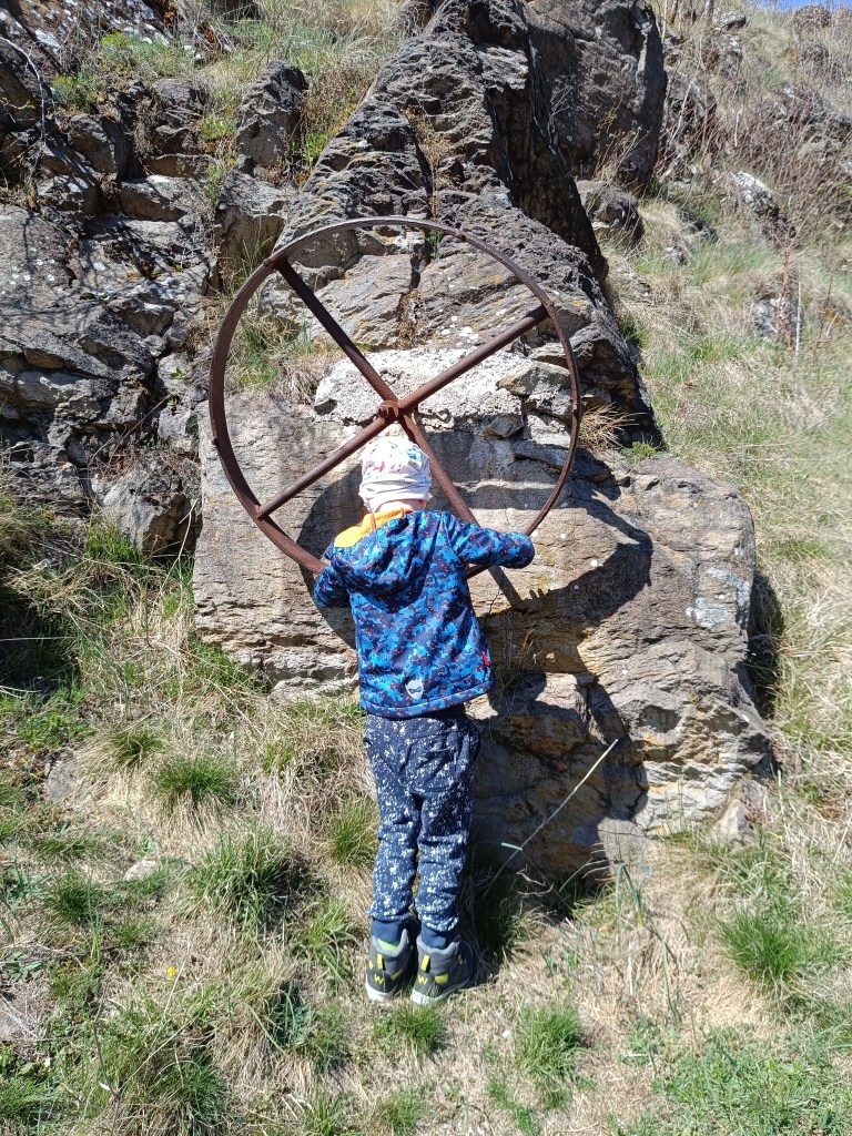
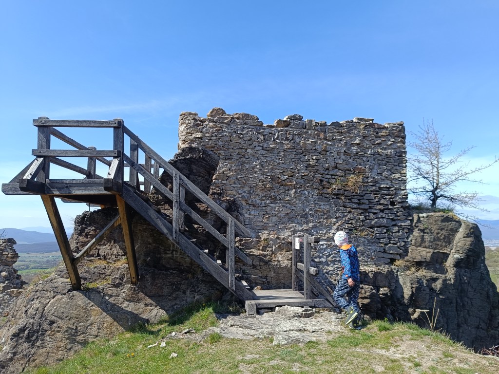
    Andessite cliff, on which the castle is build
    One of the few remains of the castle

    The Sivý Kameň Castle was built shortly before 1350 as a royal castle. The construction of the castle was necessitated by the circumstances that arose after the death of Matúš Čák in 1321. Since there was no other castle in the vicinity besides Bojnice Castle, the need arose to build another administrative center.

    Later the castle belonged to different families. In 1430 both castles reverted to the crown. In 1431 the king donated the castle of Sivý Kameň to Gregor Majthényi and his heirs. Since then the castle and the estate have remained in permanent possession of the Majthényi family.

    The castle began to decline in the late 16th and early 17th centuries. In 1626, Gabriel Bethlen’s rebels attacked the castle and other Majthényi properties and thoroughly plundered them.

    The first decade of the 18th century brought further attacks on the castle, this time by Rákoczi’s soldiers. Soon the important estate became a ruin. The remains of the castle were subsequently dismantled by the inhabitants of Podhradie.

    Končitá
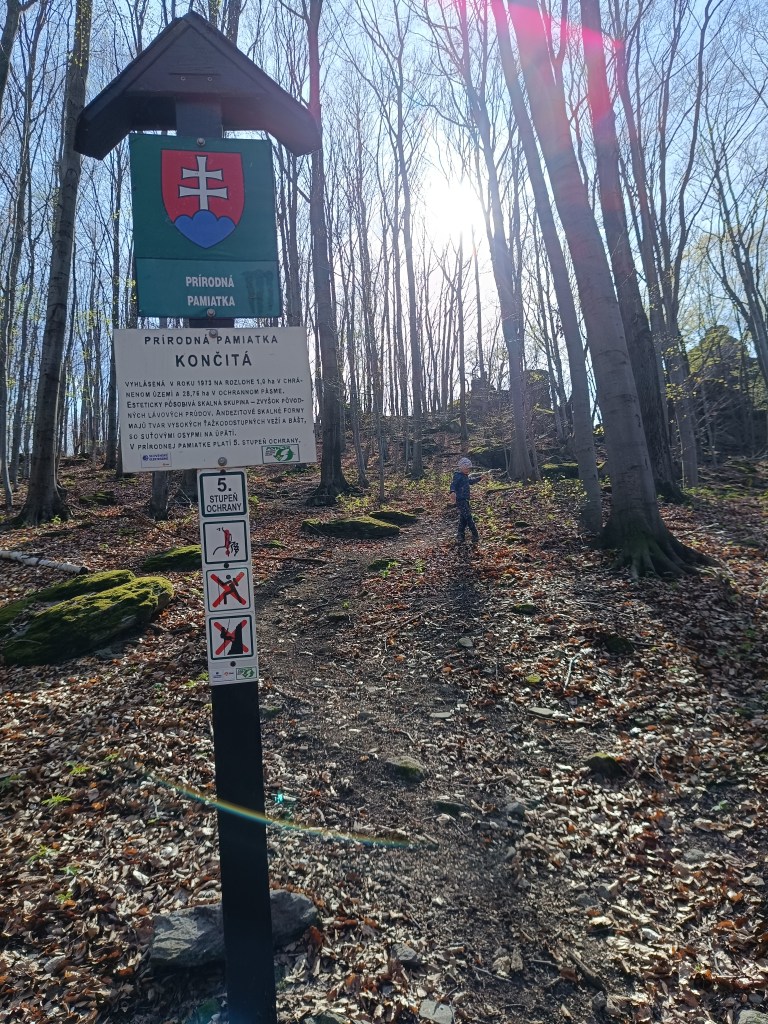
    Natural monument končitá

    From the cottage below Končita, in Gebňárova Valley, which we can reach from the village of Kamenec pod Vtáčnikom, an unmarked trail leads to the peak cliffs of Končita.

    Behind the stream rise the rock formations of Končita, to which a well-trodden path leads. Končita was declared a Natural Monument in 1973.

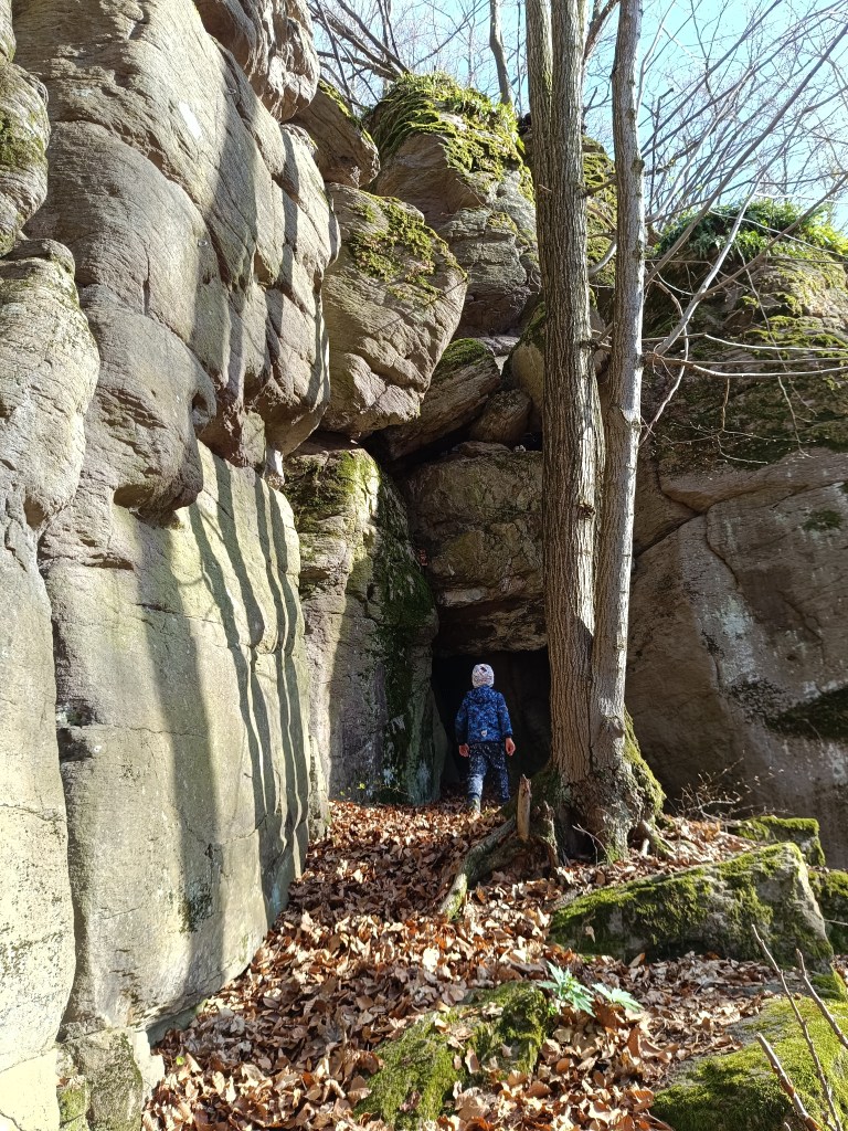
    In the vicinity there are smaller and larger rockeries covered with deep green moss. The Končitaj cliffs are dominated by a 30-meter-high andesite tower. From Končita, following the ridge to the left, we come to the Devil’s Paths. There are huge boulders also covered with green moss, rocky cliffs, windows and narrow gorges.
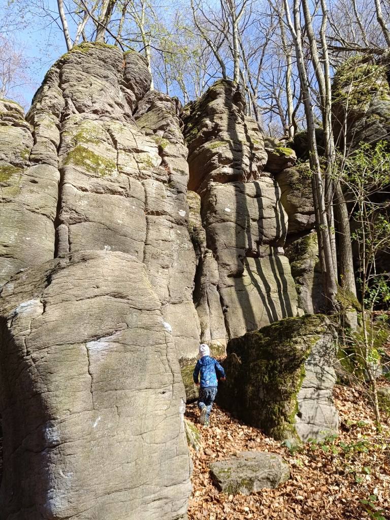
    Devil’s Paths
    a cave in the stone

  • Hrad Sivý kameň, Končitá

    Hrad Sivý kameň, Končitá

    Zrúcanina hradu sivý kameň sa nachádza na andezitovom brale nad obcou Podhradie neďaleko Prievidze. Hoci sa z hradu do súčastnosti zachovalo pomerne málo, hradné bralo poskytuje krásny výhľad na okolitú krajinu.

    Pod hradom

    Pozostatky hradu z polovice 14. storočia sú viditeľné priamo z obce. Krátkym stúpaním z centra obce sa čochvíľa dostanete k poľnej ceste. Tu vás o správnom smere upozorní tabuľa s nápisom Sivý Kameň. Celý výstup na hrad trvá približne 15 minút.

    V súčasnosti môžeme pri návšteve hradu pozorovať jeho nepatrné pozostatky, ktoré naznačujú aspoň rozlohu a zvyšky muriva. Z vnútorného gotického hradu sa zachovali obvodové múry hranolovej veže.

    Andezitové bralo, na ktorom je hrad postavený
    Jednen z mála pozostatkov hradu

    Hrad Sivý Kameň bol postavený krátko pred rokom 1350 ako kráľovský hrad. Stavbu hradu si vyžiadali pomery, ktoré nastali po smrti Matúša Čáka v roku 1321. Nakoľko sa okrem Bojnického hradu v okolí žiaden iný nenachádzal, vznikla potreba vybudovania ďalšieho administratívneho centra. 

    Neskôr hrad patril rôznym rodom. V roku 1430 pripadli oba hrady naspäť korune. V roku 1431 kráľ daroval hrad Sivý Kameň Gregorovi Majthényimu a jeho dedičom. Od toho času zostal hrad i panstvo v trvalej držbe rodiny Majthényiovcov. 

    Koncom 16. a na začiatku 17. storočia začal úpadok hradu. V roku 1626 povstalci Gabriela Bethlena napadli hrad aj ostatné majetky Majthényiovcov a dôkladne ich vyplienili. 

    Prvé desaťročie 18. storočia prinieslo hradu ďalšie útoky, tentoraz Rákocziho vojakov. Čoskoro sa z významného panstva stala ruina. Pozostatky hradu následne rozobrali obyvatelia Podhradia.

    Končitá

    Prírodná pamiatka končitá

    Od chaty pod Končitou, v Gebňárovej doline, ku ktorej sa dostaneme z obce Kamenec pod Vtáčnikom, vedie neoznačený chodník  k vrcholovým bralám Končitej.

    Za potokom sa dvíhajú skalné útvary Končitej, ku ktorým vedie vychodený chodníček.Končitá bola v roku 1973 vyhlásená za Prírodnú pamiatku

    V okolí sú menšie aj väčšie skalky obrastené sýto zeleným machom. Bralám Končitej dominuje 30 metrov vysoká andezitová veža. Od Končitej po hrebeni smerom vľavo prídeme na Čertové chodníky. Nachádzajú sa tu obrovské balvany tiež pokryté zeleným machom, skalné bralá, okná a úzke tiesňavy. 

    čertove chodníky
    Jaskyňa v skalnom brale

  • Bzovík

    Bzovík

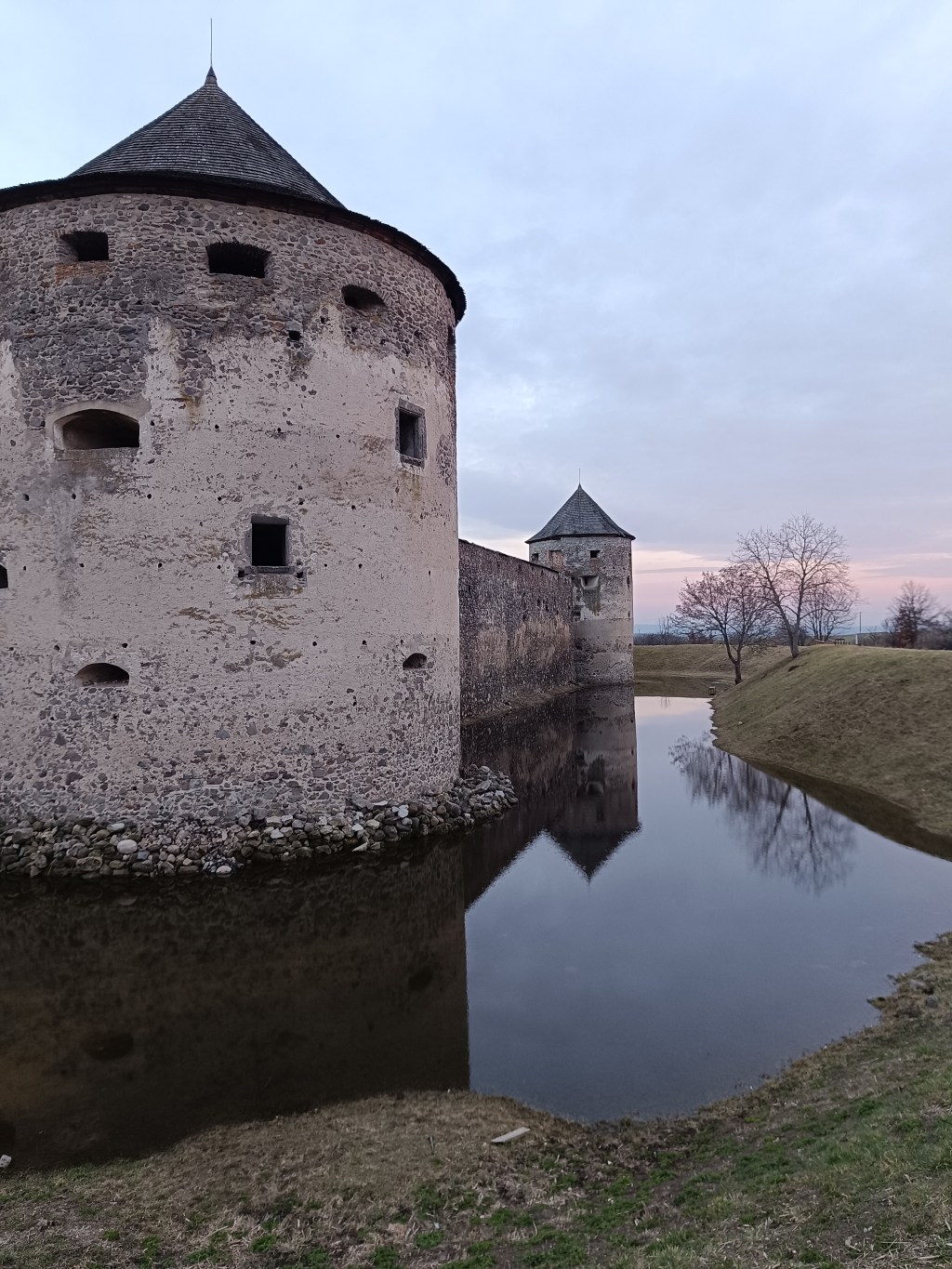
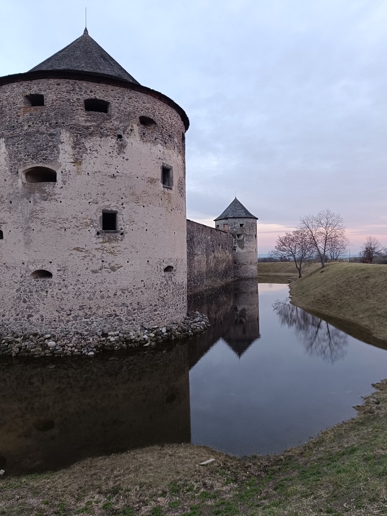
    It is originally a Benedictine (later Premonstratensian) monastery rebuilt into a fortress (castle), near the village of Bzovík.

    The monastery in Bzovík was founded in the first half of the 12th century. The Benedictines were replaced sometime between 1179 and 1181 by the Premonstratensians from Olomouc, who spread spiritual culture and education, but also new economic knowledge and new methods of tilling the land.

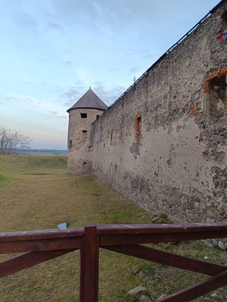
    Outside walls

    The Romanesque double-towered church, to which a monastery building with a paradise courtyard and a cloister was later added after renovations, was one of our most important Romanesque architectural monuments. The church and monastery were often the target of attacks during the 15th century; the building burned down several times, after which it was immediately repaired and partially rebuilt.

    Sigismund Balaša expelled the monks from the monastery around 1530 and immediately began rebuilding the monastery into a manor house surrounded by massive fortifications. The walls were given massive shooting range and internal galleries. Dwellings for soldiers and farm buildings were added to them from the inside. The entire area was protected by wide moats and massive corner bastions.

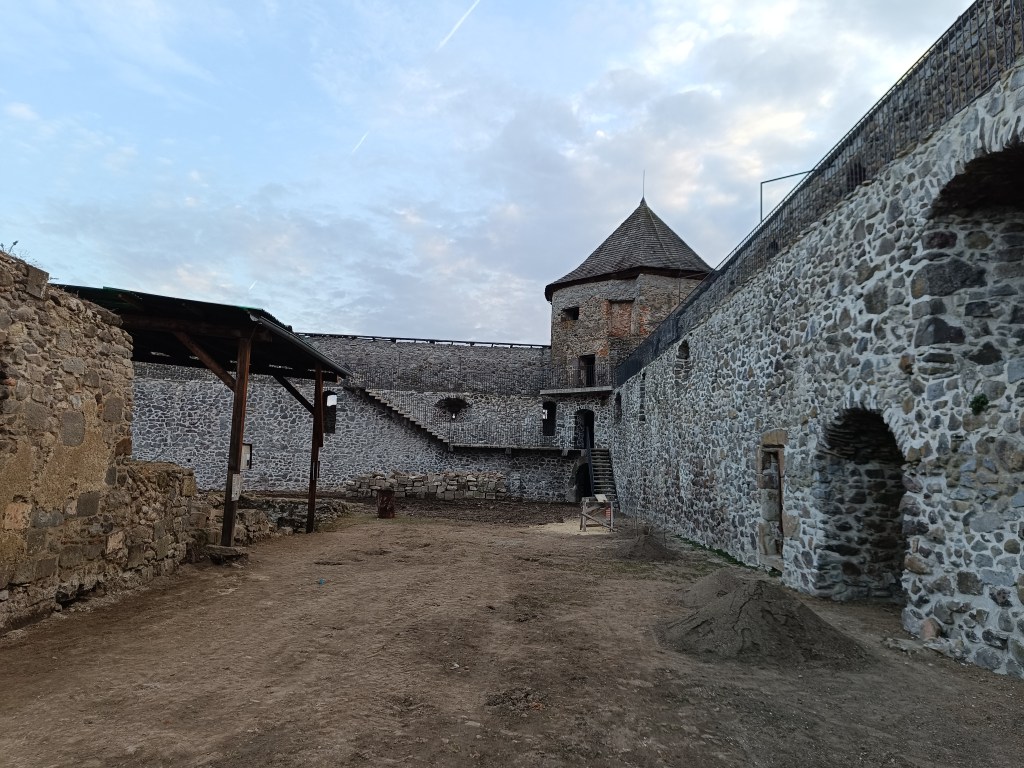
    Object is in reconstruction

    In 1620 the monastery burned down, but at the end of the 17th century it was returned to the church. In 1678 it was conquered by the rebels of Imrich Tököli.

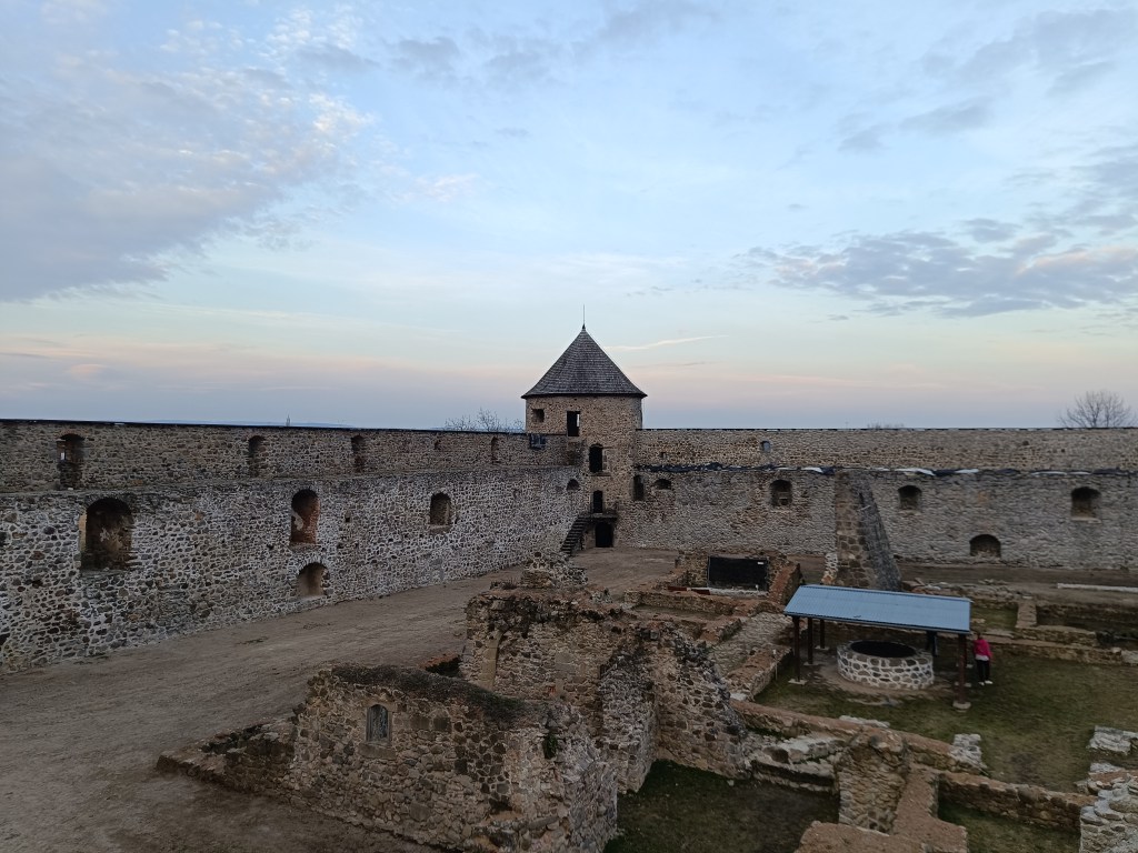
    The next period was already approaching its demise. After a short ownership by the Jesuit order and the Archbishop of Esztergom, the building began to fall into disrepair at the beginning of the 19th century. The final blow in the process of decay was dealt to it by the fighting during World War II and the subsequent destruction by the local population.

    The outer walls are better preserved than the inner structures.

    The former monastery complex is in ruins, except for the outer fortifications, which show signs of preservation and reconstruction. You can park right next to the building.

    Moat with water in it

  • Bzovík

    Bzovík

    Je to pôvodne benediktínsky (neskôr premonštrántsky) kláštor prestavaný na pevnosť (zámok), neďaleko obce Bzovík.

    Kláštor v Bzovíku vznikol v prvej polovici 12. storočia. Benediktínov vystriedali niekedy medzi rokmi 1179 – 1181 premonštráti z Olomouca, ktorí šírili duchovnú kultúru a vzdelanosť, no tiež nové hospodárske poznatky a nové spôsoby obrábania pôdy.

    vonkajšie hradby

    Románsky dvojvežový kostol, ku ktorému pribudla neskôr po dostavbách kláštorná budova s rajským dvorom a krížovou chodbou, bol jednou z našich najvýznamnejších románskych stavebných pamiatok. Kostol s kláštorom sa v priebehu 15. storočia často stávali terčom útokov; viackrát objekt vyhorel, načo ho vzápätí opravili a čiastočne prestavali.

    Žigmund Balaša vyhnal z kláštora rehoľníkov okolo roku 1530 a hneď nato začal kláštor prestavovať na kaštieľ obohnaný mohutným opevnením. Múry dostali mohutné strielne a vnútorné ochodze. K nim pristavali z vnútornej strany obydlia pre vojakov a hospodárske budovy. Celý areál chránili široké priekopy a mohutné nárožné bašty.

    Objekt stále rekonštruujú

    V roku 1620 kláštor vyhorel, koncom 17. storočia sa opäť vrátil cirkvi. V roku 1678 ho dobyli povstalci Imricha Tököliho.

    Ďalšie obdobie už spelo k jeho zániku. Po krátkom vlastníctve rádu jezuitov a ostrihomského arcibiskupa začal objekt začiatkom 19. storočia pustnúť. Poslednú ranu v procese chátrania mu uštedrili boje počas druhej svetovej vojny i následné ničenie miestnymi obyvateľmi.

    Vonkajšie hradby sú viac zachované ako vnútorné stavby

    Areál bývalého kláštora sa nachádza v stave zrúcaniny, okrem vonkajšieho opevnenia, ktoré vykazuje známky zachovalosti a rekonštrukcie. Zaparkovať môžete rovno pri objekte.

    Priekopa s vodou

  • SNP – girl’s project #day3

    SNP – girl’s project #day3

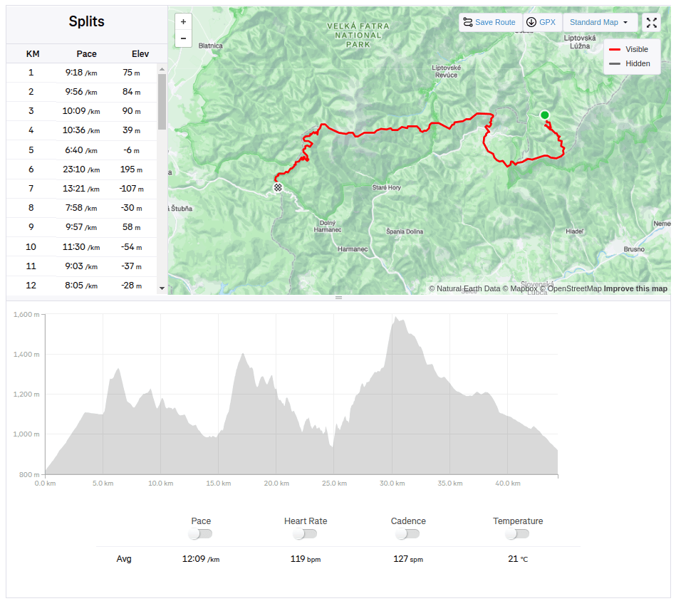
    The third stage was from Hiadeľské sedlo to Šturec sedlo. And since Hiadeľské sedlo cannot be reached by car, we had to hike there. This added the first extra kilometers to the SNP route, namely 5.1km and 287 vertical meters. However, the weather was beautiful and the initial -2degrees celsius quickly turned into plus values, so we even took off our jackets in the saddle and continued only in long-sleeved shirts. Today, the problem wasn’t that our water freeze, it was more a problem to have enough of it.

    Kozí Chrbát

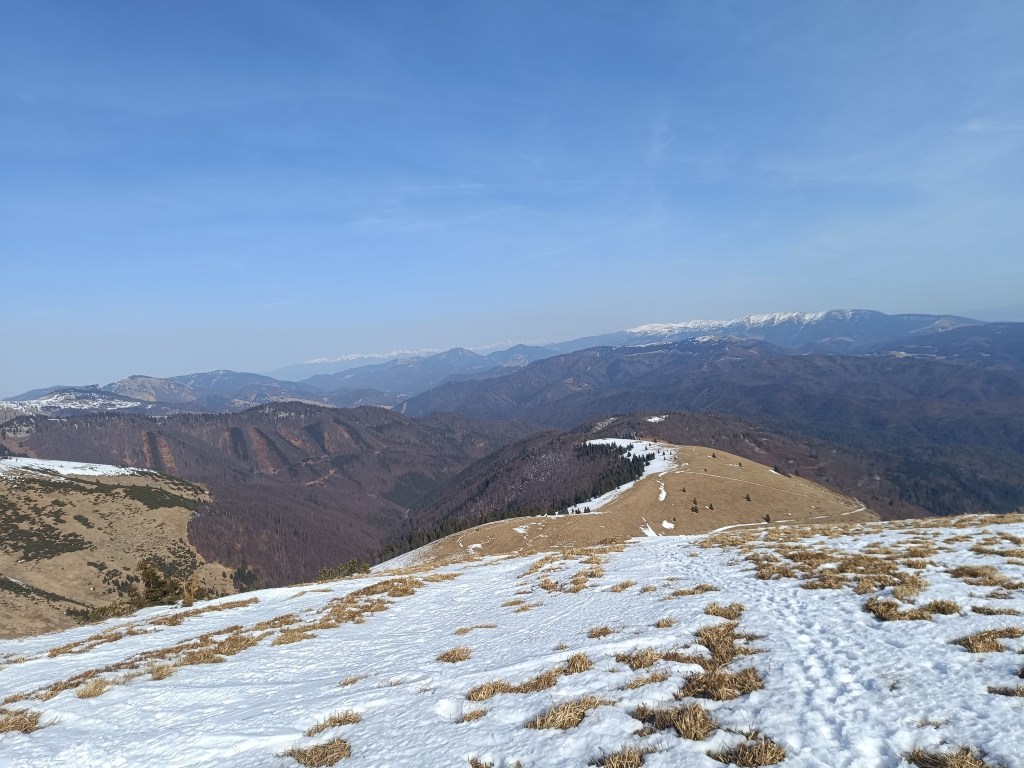
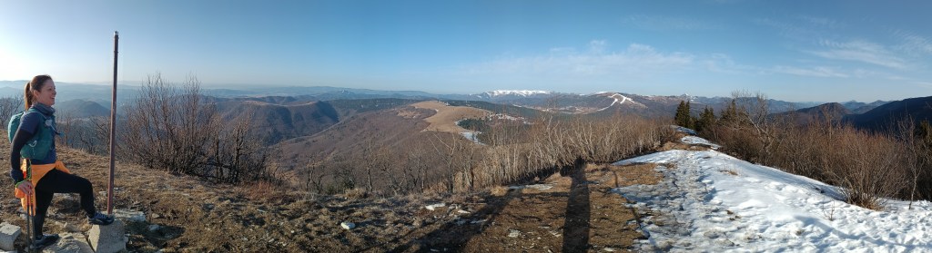
    We continue to Kozí Chrbát, a hill with a beautiful view, I definitely recommend it, then continue via Kečka to Donovaly. There is still some snow on the ridge in shady places, but most of it has already disappeared. The descent through the forest to Donovaly was worse, where ice cover is still present on the cross-country ski trails. But we managed it and in Donovaly we take a break for coffee and radler. It is warm and we are thirsty.

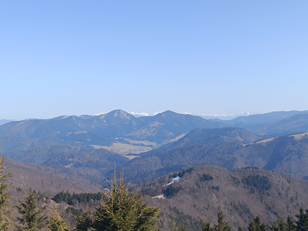
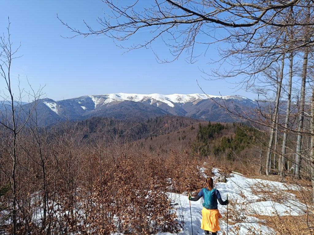
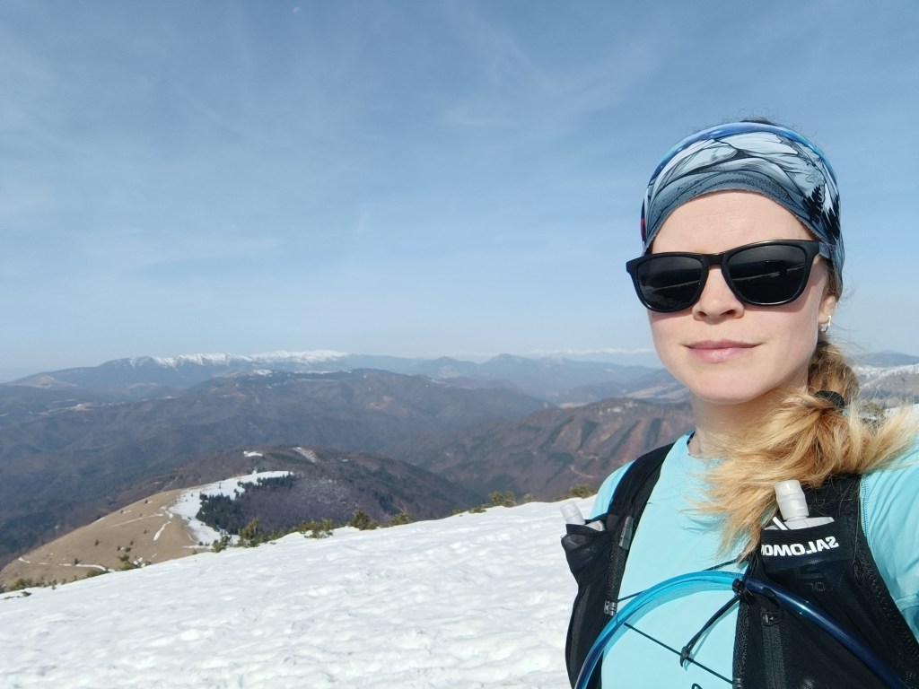
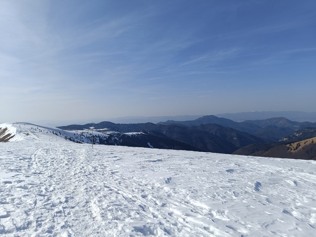
    The visibility was great, the High Tatras are visible in the background

    Refreshed, we climb to Zvolen, overcoming approximately 400 meters in altitude, but we are rewarded with great views. From Zvolen we continue along the forested ridge to the Veľký Šturec saddle (which is still quite far from the Malý Šturec saddle, where we end the stage).

    The ridge between Zvolen and Križna (in the background)

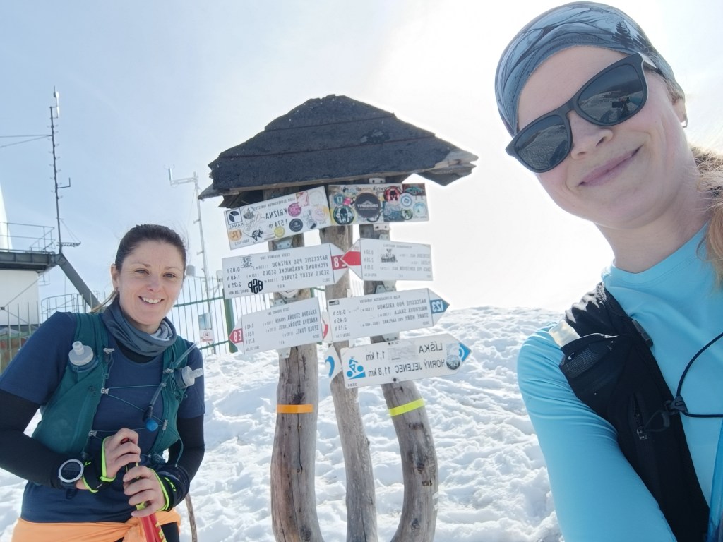
    We climb over larger and smaller hills until we reach Krížna, which is still completely covered in snow. On the last big climb we wade through the snow, our feet are wet, the snow is melting, but with the vision of the last climb we climb up to Krížna (1574 meters above sea level).

    At the bottom of climb to Križna
    And the last few metres
    Križna finally

    The descent to Kráľova studňa turns into dancing in wet snow, in some places there was up to 5 cm of water on the path. We have a flood in our shoes, but cola at Kráľova studňa raises our morale. The last 10 km downhill run to the finish. But half of them were covered in wet snow with water flowing through them.

    Cez 10km na snehu

    Jožko is waiting for us at the finish line with a non-alcoholic beer, a great surprise.

    44.33km, 2263m ascend, 8h 58 min active time, 9h 41min total
  • SNP – girl’s project #deň3

    SNP – girl’s project #deň3

    Tretia etapa bola z Hiadeľského sedla do sedla Šturec. A keďže do Hiadeľského sedla sa nedá dostať autom, tak sme si tam museli vyšľapať. Tým sme si pridali prvé extra kilometre k trase SNP, konkrétne 5.1km a 287 výškových metrov. Počasie však bolo krásne a počiatočných -2 sa veľmi rýchlo menilo na plusové hodnoty, v sedle sme už dokonca vyzliekali bundy a pokračovali len v tričkách s dlhým rukávom. Dnes nám voda veru nezamrzla, skôr bol problém, aby sme jej mali dosť.

    Kozí Chrbát

    Pokračujeme na Kozí chrbát, krásny výhľadový kopec, určite ho odporúčam, ďalej cez Kečku na Donovali. Na hrebeni sa v tienistých miestach ešte trochu drží sneh, ale väčšina z neho už zmizla. Horši bol zostup lesom na Donovaly, kde sa na bežkárskych trasách drží ľadová pokrývka. Ale zvládli sme a na Donovaloch si dávame pauzu na kávu a radler. Je teplúčko a voda v nás len tak mizne.

    Viditeľnosť bola skvelá, v pozadí vidno Vysoké Tatry

    Osviežené stúpame na Zvolen, prekonávame približne 400 výškových metrov, ale sme odmenenné parádnymi výhľadmi. Zo Zvolena pokračujeme zalesneným hrebeňom, do sedla Veľký Šturec (ktorý má teda do sedla Malý Šturec kde končíme etapu ešte poriadne ďaleko)

    Hrebeňom medzi Zvoelnom a Križnou (v pozadí)

    Preliezame väčšie aj menšie kopčeky až sa dostávame pod Krížnu, ktorá je ešte celá zahalená snehom. Posledné veľké stúpanie sa brodíme snehom, nohy mokré, sneh sa topí, ale s vidinou posledného stúpania šlapeme hore na Krížnu (1574mnm).

    Začíname stúpať na Krížnu
    Posledných pár metrov
    Na Krížnej

    Zbeh na Kráľovu studňu sa mení na tancovanie v mokrom snehu, miestami na cestičke stojí aj 5 cm vody. V teniskách máme potopu, ale kofola na Kráľovej studni zdvíha morálku. Ešte posledných 10 km zbeh do ciela. Akurát, že polka z nich bola pokrytá mokrým snehom pomedzi ktorý tiekla voda.

    Cez 10km na snehu

    V ciely nás už čaká Jožko s nealko pivkom, parádnym prekvapením.

    44.33km, 2263m stúpania, 8h 58 min aktívny čas, 9h 41min total
  • Divín castle and Kalamárka

    Divín castle and Kalamárka

    Near the Ružiná reservoir in the south of central Slovakia lies the village of Divín, above which the ruins of Divín Castle rise.

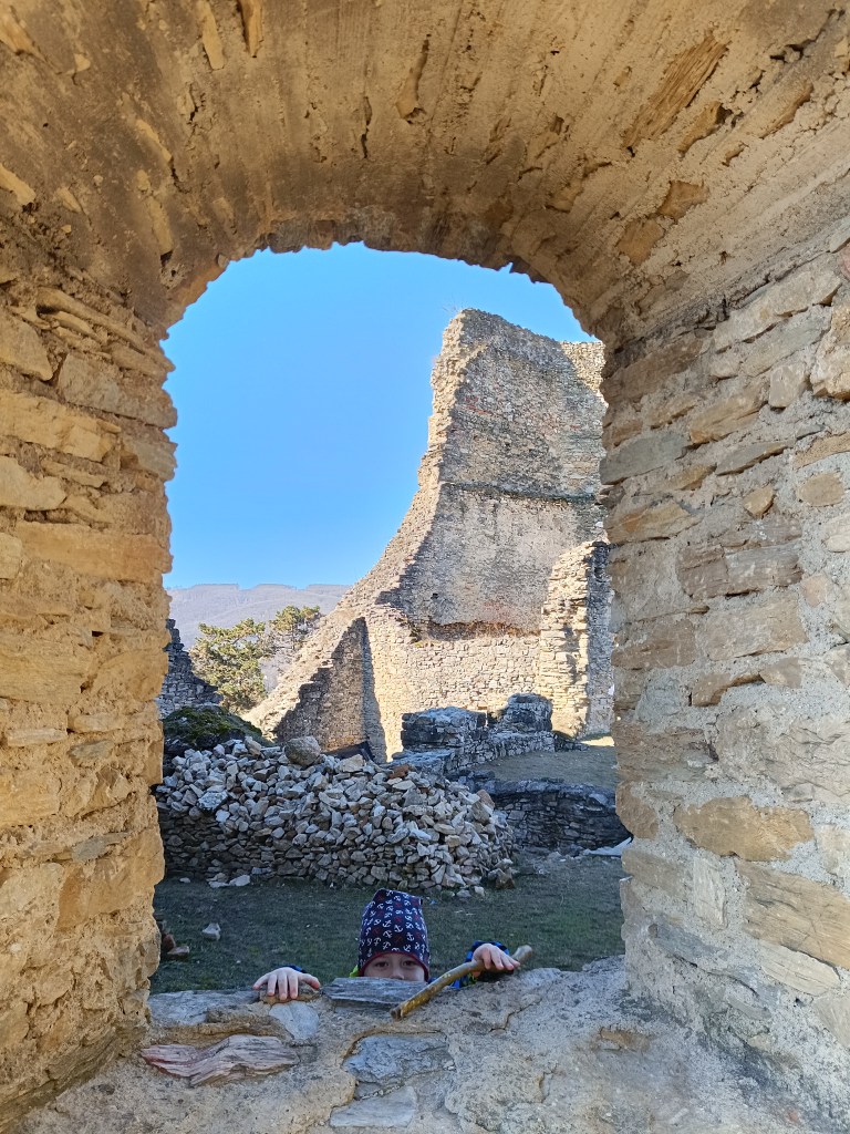
    The castle was built at the end of the 13th century to protect the road to the central Slovak mining area. Especially in the second half of the 16th century, it played an important role in the defense system of central Slovak towns against the Turks. In the second half of the 17th century, it was unfortunately made famous by its owner Imrich Balassa, who raided and plundered the surrounding villages. After his death in 1683, the imperial army captured the castle and it has been in ruins since then. Only some of the walls, window openings and loopholes have been partially preserved.

    Caslte Divín

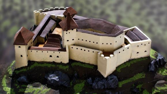
    The original castle, today’s upper castle, was built on top of a limestone cliff. The castle’s ground plan is elongated in a west-east direction. It is adapted to the shape of the top of the rocky cliff. A thick perimeter wall, which regularly bends according to the unevenness and irregularity of the terrain, formed the outer shell of the castle. Residential and farm wings were added to it inside. Between them was a small courtyard, on which a cistern can be assumed. The perimeter wall was not reinforced with bastions or other protrusions that would allow flanking – protecting the wall by shooting from the sides. The castle builders probably counted more on passive protection than active. Passive protection was enabled by a massive, about 2 m thick wall. Active defense was shooting through slit windows in the wall, which are still noticeable in places despite the latest brickwork.

    How the castle probably looked

    The tourist attraction of Kalamárka is one of the most important natural sites in Podpoľanie. What will enchant you in this location is the extremely rugged relief, which has a long climbing tradition, which is why it is called the andesite bastion of sport climbing.

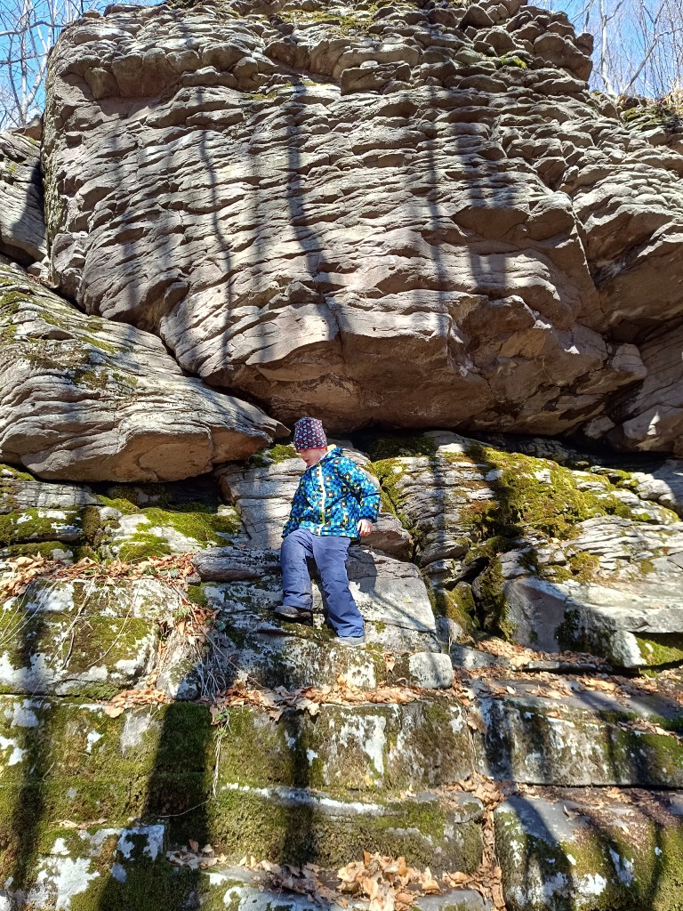
    In addition to climbers, many tourists who crave adrenaline experiences from these rock walls also come here every year. The entire summit plateau on Zadná Kaľamárka is freely accessible to tourists. There is a prehistoric hillfort there – an archaeological site, where you can see a water cistern as a trace of the first inhabitants of Kaľamárka. For climbers, this andesite cliff offers two climbing sectors, namely the upper rocks on Zadná Kaľamárka and the lower rocks on Predná Kaľamárka, which are up to 20 meters high. There is also a viewpoint over the Detva Basin and one of the most beautiful rock climbing routes in Slovakia – Indián.

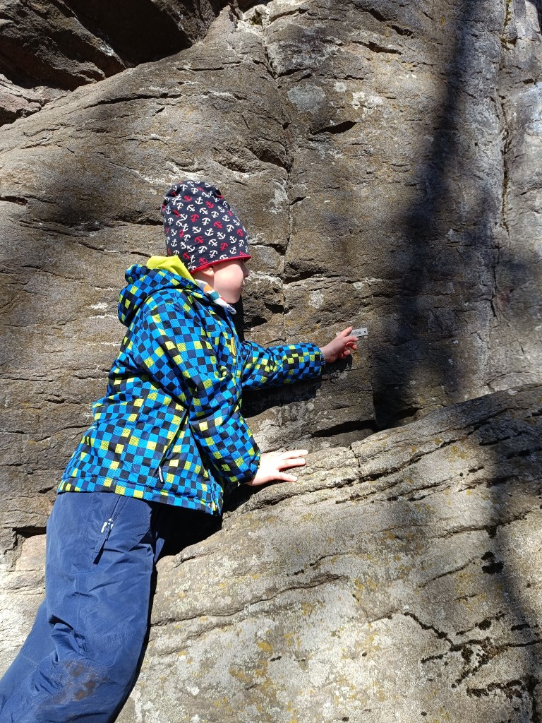
    A liitle bit of climbing can be done there with small children too
    Some of the paths has names there

    This is a very easy hike, as there is a parking lot very close to both.

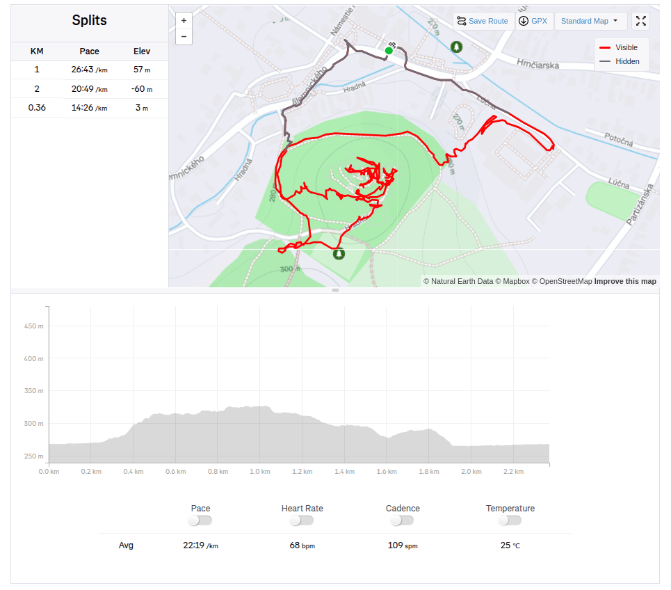
    Divín, 2.36km, 1 hod
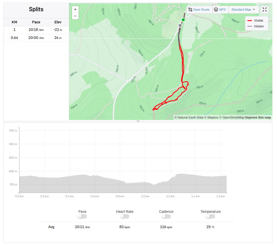
    Kalamárka: 1.6km, 40 min
  • Hrad Divín a Kalamárka

    Hrad Divín a Kalamárka

    Pri vodnej nádrži Ružiná na juhu stredného Slovenska leží obec Divín,nad ktorou sa vypína zrúcanina hradu Divín.

    Hrad postavili koncom 13. storočia na ochranu cesty do stredoslovenskej banskej oblasti. Najmä v druhej polovici 16. storočia zohral dôležitú úlohu v systéme obrany stredoslovenských miest pred Turkami. V druhej polovici 17. storočia ho nešťastne preslávil jeho majiteľ Imrich Balassa, ktorý prepadával a raboval okolité dediny. Po jeho smrti v roku 1683 cisárske vojsko hrad dobylo a odvtedy je v ruinách. Sčasti sa zachovali len niektoré múry, okenné otvory a strielne.

    Hrad Divín, pekná rozsiahla zrúcanina

    Pôvodný hrad, dnešný horný hrad postavili na vrchole vápencového brala, ktorým sa končil rad pahorkov, vybiehajúcich do močaristej kotliny. Pôdorys hradu je pretiahnutý v západo- východnom smere. Je prispôsobený tvaru temena skalného brala. Hrubý obvodový múr, ktorý sa pravidelne zalamuje podľa nerovnosti a nepravidelnosti terénu, vytváral vonkajší plášť hradu. K nemu vo vnútri pristavili obytné a hospodárske krídla. Medzi nimi bol malý dvor, na ktorom možno predpokladať cisternu. Obvodový múr nebol zosilnený baštami ani inými výstupkami, ktoré by umožňovali flankovanie- ochranu múru streľbou zo strán. Stavitelia hradu počítali pravdepodobne viac s pasívnou ochranou ako aktívnou. Pasívnu ochranu umožňoval masívny, asi 2 m hrubý múr. Aktívnou obranou bola streľba cez štrbinové okná v múre, ktoré sú aj napriek najnovšiemu zamurovaniu miestami badateľné. 

    Maketa pôvodného hradu

    Turistická atraktivita Kalamárka je jednou z najvýznamnejších prírodných lokalít v Podpoľaní. To, čo Vás v tejto lokalite očarí, je extrémne členitý reliéf, ktorý má za sebou už dlhú horolezeckú tradíciu, preto sa nazýva ako andezitová bašta športového lezenia. 

    Okrem horolezcov sa tu ročne vystrieda aj množstvo turistov, ktorí bažia po adrenalínových zážitkoch z týchto skalných stien. Celá vrcholová plošina na Zadnej Kaľamárke je turistom voľne dostupná. Nachádza sa tam praveké hradisko – archeologická lokalita, kde môžete vidieť cisternu na vodu ako stopu po prvých obyvateľoch Kaľamárky. Pre horolezcov ponúka toto andezitové bralo dva sektory na lezenie, a to horné skaly na Zadnej Kaľamárke a dolné skaly na Prednej Kaľamárke, ktoré sú vysoké do 20 metrov a nanovo preistené borhákmi. Nachádza sa tam aj vyhliadkový bod na detviansku kotlinu a jedna z najkrajších skalkárskych ciest na Slovensku – Indián.

    Trošku zaliezť si tu môžu aj menšie deti
    niektoré cesty majú aj vyznačené pomenovanie

    Ide o veľmi nenáročnú turistiku, keďže pri oboch sa nachádza parkovisko veľmi blízko

    Divín, 2.36km, 1 hod
    Kalamárka: 1.6km, 40 min
  • SNP – girl’s project #day2

    SNP – girl’s project #day2

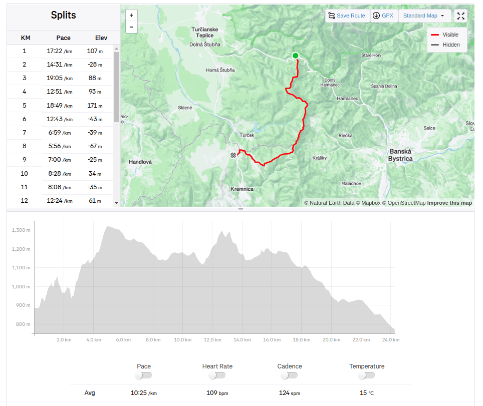
    We start our second stage from the Šturec saddle to Kremnické Bane. It’s cold, the thermometer in the car shows -6 degrees Celsius. We step out of the car and find out that not only is it cold, but there’s also a pretty strong cold wind blowing… The nearest opportunity to do the stage is in two weeks, so I clench my teeth (I don’t really like the cold weather, my fingers and hands freeze painfully quickly) and we start..

    Above saddle Šturec

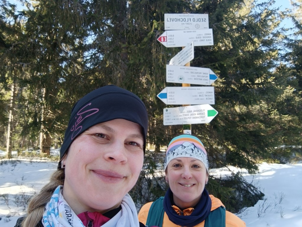
    We spent some time looking for the start of the red trail, but then we were accompanied by a beautifully marked hiking trail the whole time. We climb over Priečný vrch covered in frozen snow, and then to the Flochová saddle. I think there is half a meter of snow up there. A beautiful winter fairy tale.

    Sedlo Flochová – najvyšší bod

    From Flochová it’s a wavy ridge to Skalka and it’s so cold that the water in my hydration pack freezes. At Skalka we take a short break for coffee and a protein bar and continue to Kremnické Bane.

    Every break has an unwanted effect on me, my body quickly cools down and my fingers freeze again and again – the painful tingling lasts an unpleasant 10-15 minutes until my body warms up again.

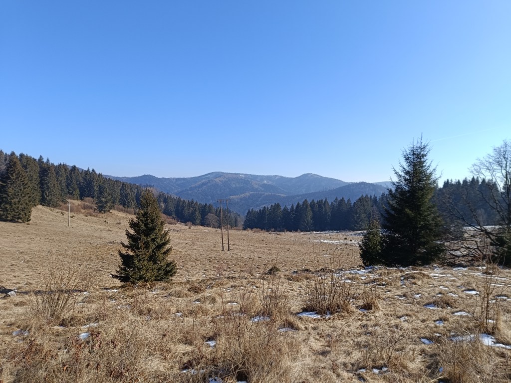
    We run down a beautiful tree-lined path and after 3 kilometers we run out of the forest into sun-drenched meadows and suddenly it is warm, a different world, without snow and with sun-warmed meadows.

    Above Krahule

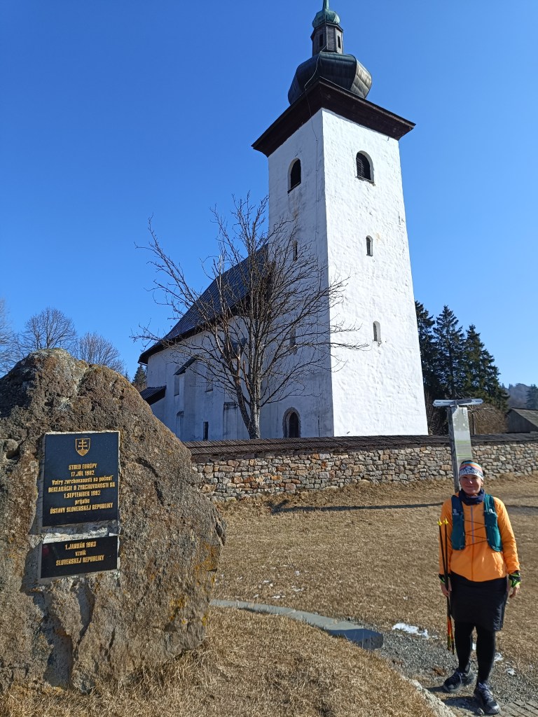
    On the way, we turn towards the Center of Europe, next to the ancient Church of St. Ján Krstiteľ there is an erected stone. It announces that this is the geographical center of Europe.

    Geografical centre of Europe

    This important geographical point is marked by a small monument near the defensive wall of the church. On the occasion of the founding of the Slovak Republic, the foundation stone of Slovak statehood was also laid here.

    24.28km, 1124m ascend, 4h 12min
  • SNP – girl’s project #deň2

    SNP – girl’s project #deň2

    Štartujeme našu druhú etapu zo sedla Šturec do Kremnických Baní. Je zima, teplomer v aute ukazuje -6 stupňov Celzia. Vystupujeme a zisťujem, že nie len, že je kosa, ešte aj fúka celkom silný studený vietor… Najbližšia možnosť ísť etapu je ale až o dva týždne a tak zatínam zuby (zimu ja veľmi nemusím, rýchlo mi začnú bolestivo mrznúť prsty na rukách) a štartujeme..

    Nad sedlom Šturec

    Chvíľu sme síce hľadali nástup na červenú značku, ale potom nás už celý čas sprevádzala krásne značená turistická trasa. Cez priečny vrch stúpame zamrznutých snehom a v sedle Flochovej je ho podľa mňa aj pol metra. Krásna zimná rozprávka.

    Sedlo Flochová – najvyšší bod

    Z Flochovej je to na Skalku vlnitým hrebeňom a je taká zima, že mi zamŕza voda v hydrovaku. Na Skalke si robíme krátku prestávku na kávu a tyčinku a pokračujeme do Kremnických Baní.

    Každá prestávka má pre mňa neželaný efekt, telo mi rýchlo chladne a zas a znova mi zamŕzajú prsty – bolestivé mravenčenie trvá nepríjemných 10-15 minút, kým telo zas zohrejem.

    Zbiehame krásnou stromovou alejou a po 3 kilometroch vybehneme z lesa na slnkom zaliate lúky a zrazu je teplo, iný svet, bez snehu a so slnkom prehriatymi lúkami.

    Nad Krahulami

    Cestou ešte odbáčame k Stredu Európy, vedľa starobylého Kostola sv. Jána Krstiteľa sa nachádza vztýčený kameň. Oznamuje, že práve tu sa nachádza geografický stred Európy.

    Geografický stred Eur=opy

    Tento dôležitý geografický bod je označený malým pamätníkom pri obrannom múre kostola. Pri príležitosti vzniku Slovenskej republiky tu položili aj základný kameň Slovenskej štátnosti.  

    24.28km, 1124m stúpania, 4h 12min