Tag: with kids

  • From Žarnovica to Nová Baňa

    From Žarnovica to Nová Baňa

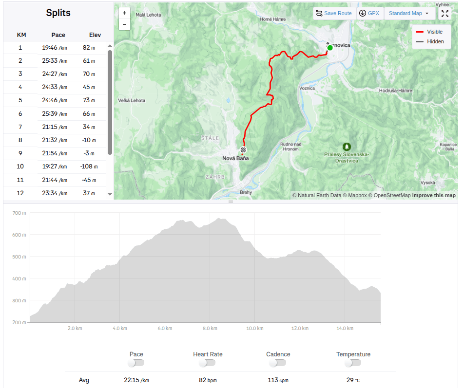
    Our first big hike with David. Only me and him, the first time hiking, which could be called a ridge hike, without the possibility of shortening.

    It mainly required courage, patience, playfulness and a lot of food and water 🙂

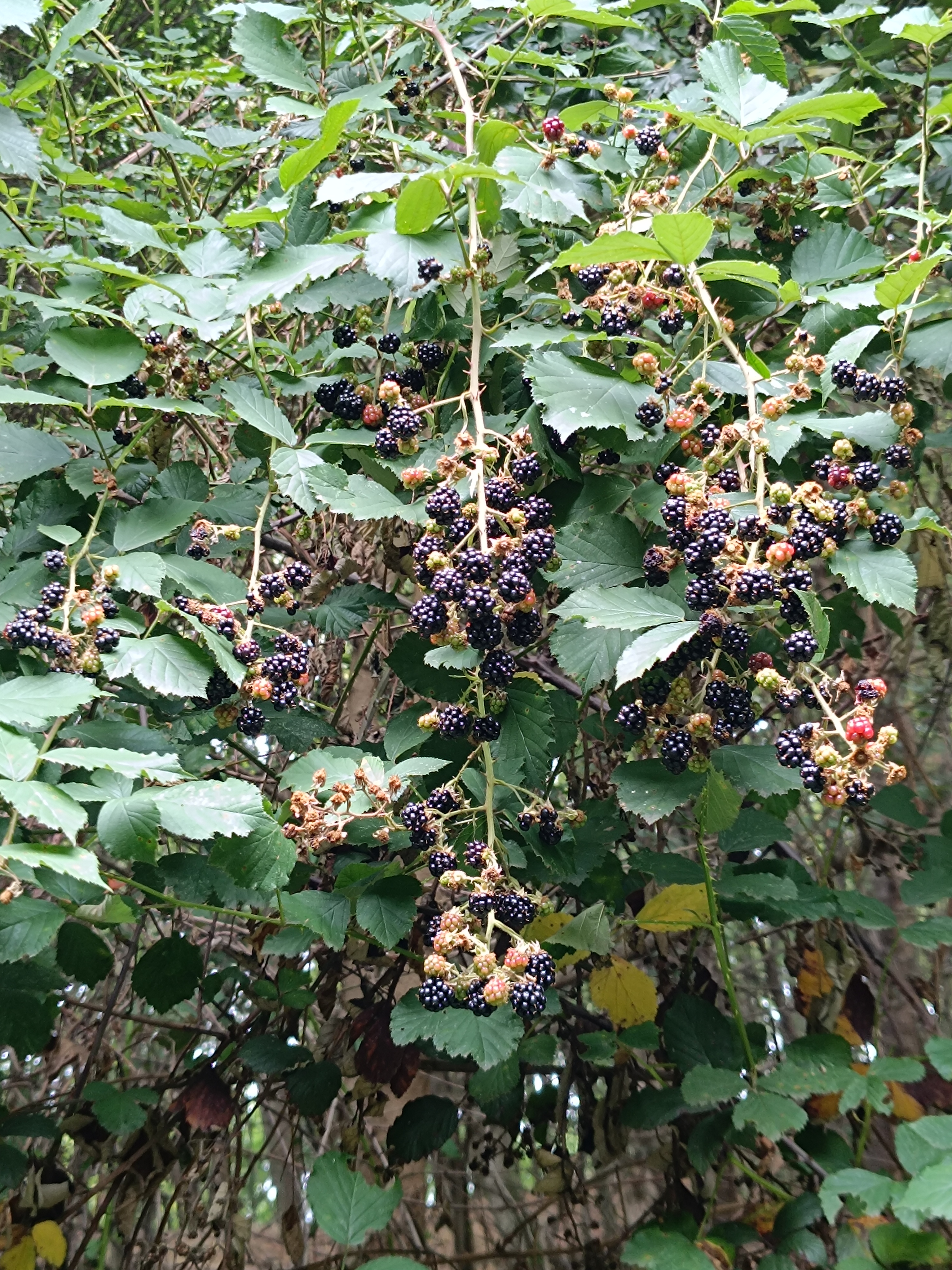
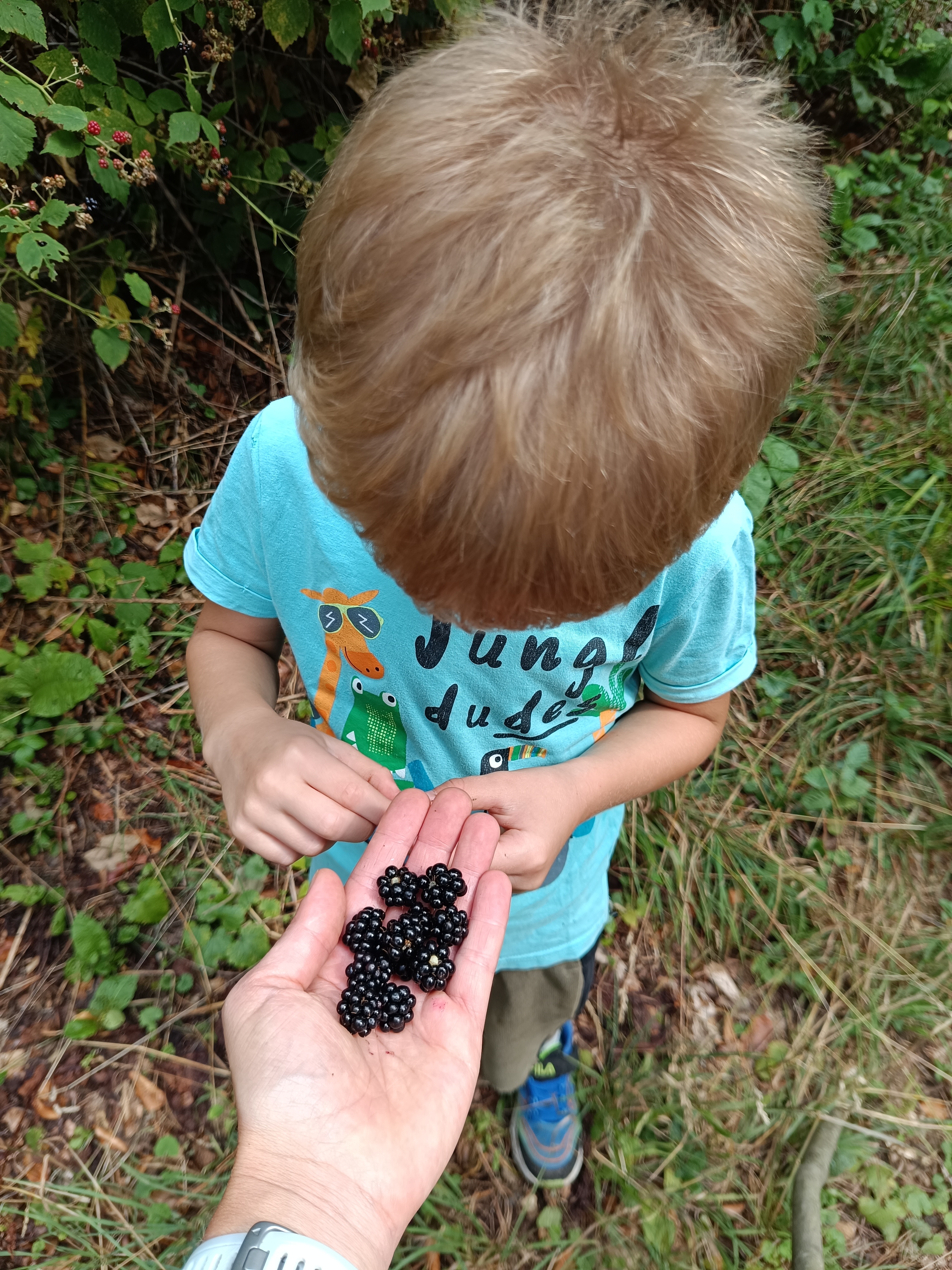
    We start under the Calvary in Žarnovica and follow the blue hiking trail the whole time. As we climb, we enter the forest, where it is pleasantly cool, in some places we must climb over fallen logs – remnants of logging, in other places we stop to pick up lots of sweet blackberries.
    In a clearing under the power lines we managed to meet three small wild boars and a little further in the forest a deer. David even found a praying mantis, invisible to me because it was the color of dry grass.
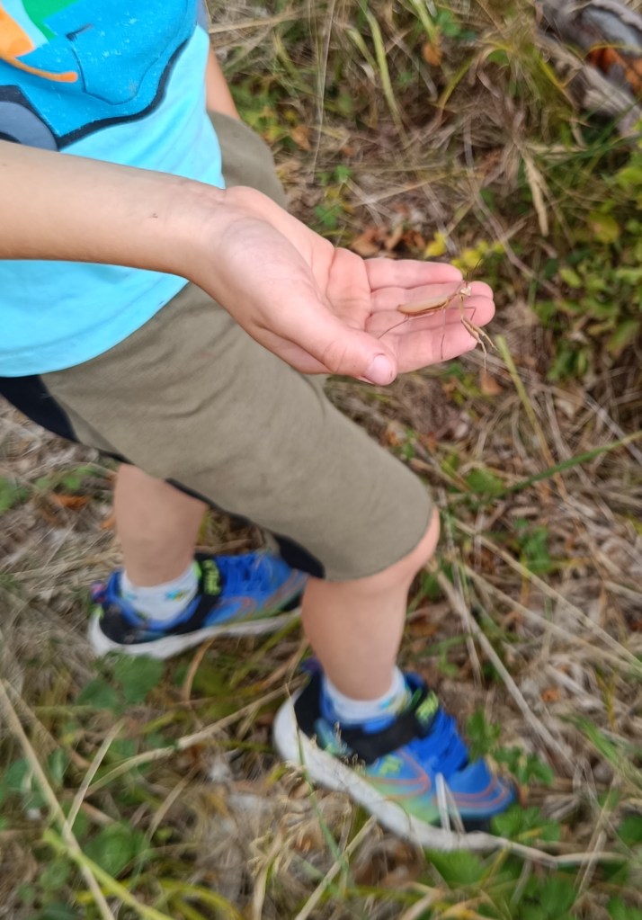
    praying mantis

    A picnic in the meadow gave us strength and a bag of sweets helped us overcome the crisis 🙂 We refreshed ourselves in a spring below Ihanovo, where there was plenty of water despite the dry summer.
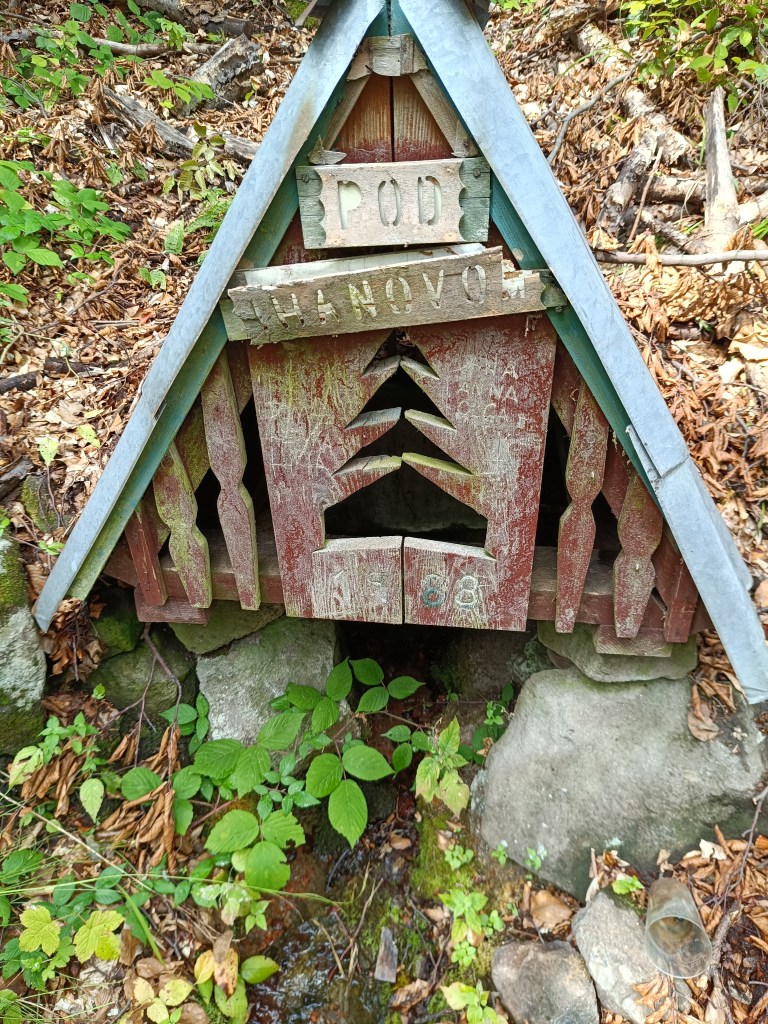
    well

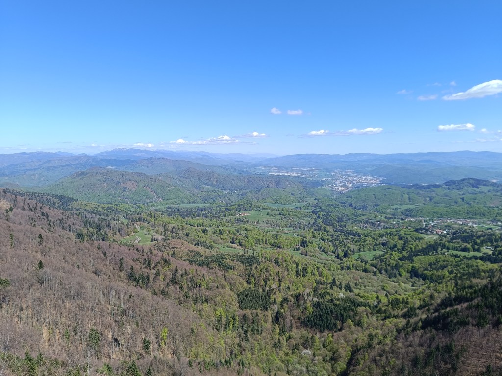
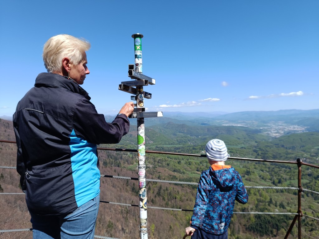
    The highest point was hill Johan, which is also part of the Novobanské povesti educational trail. It also offers the most beautiful views.
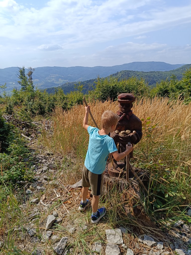
    hill Johan

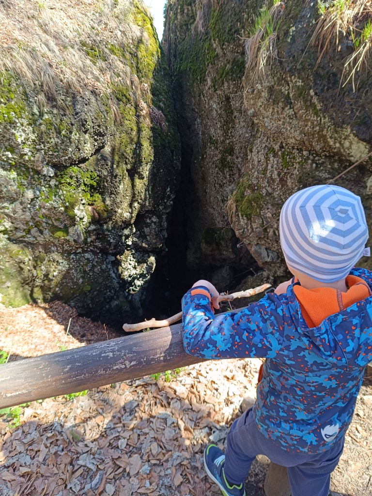
    The last few kilometers, Dávid made up games for us (now we can’t step on any stone…) and so it went by quickly. We ended the hike at the Zvonička in Nova Baňa, Dávid with a well-deserved popsicle and juice and I with a craft beer.
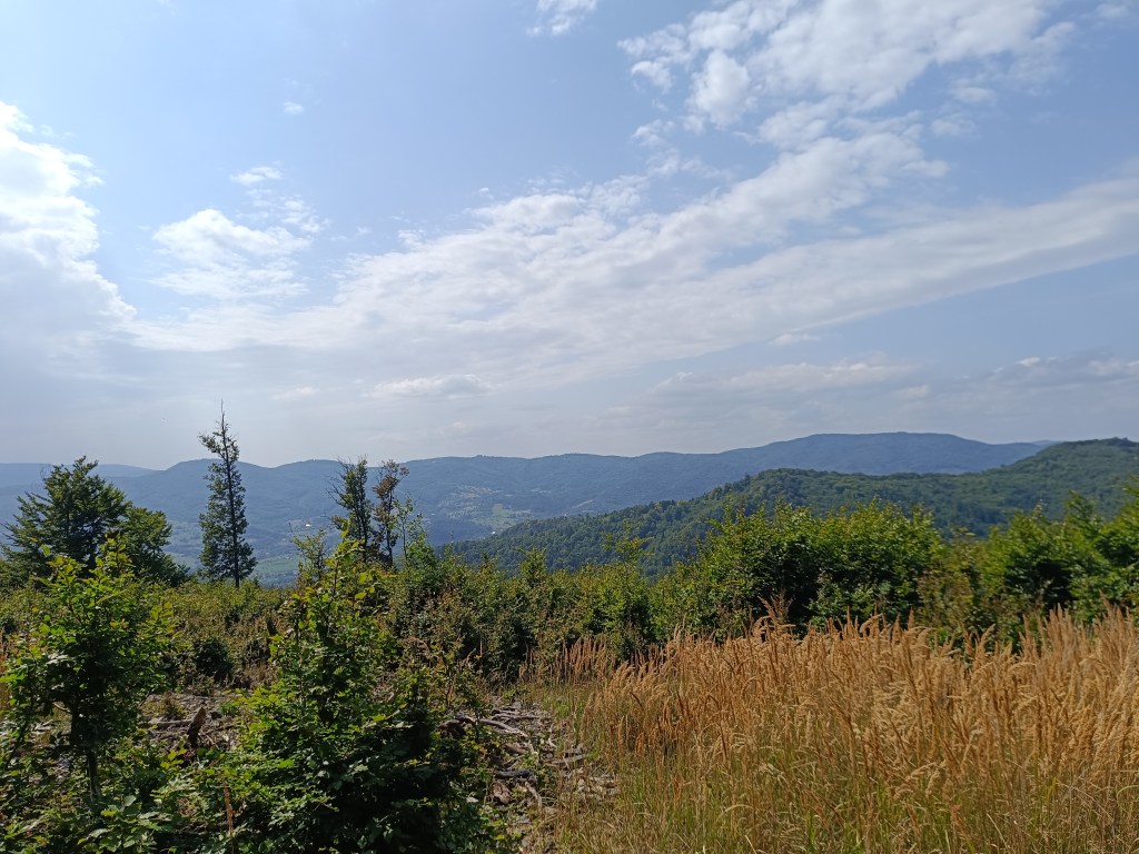
    Views from Johan

    Yes, it was long, sometimes challenging to motivate, and my legs were sore from standing and waiting, but it was also beautiful, and I am incredibly proud of him.

    He was freshly 6 years old at the time of the hike.
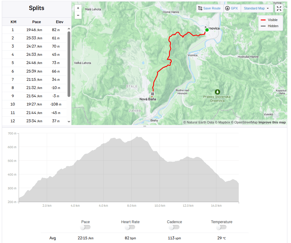
    15.59km, 582m ascend, 5h46 min active time, 8h 33min total
  • Zo Žarnovice do Novej Bane

    Zo Žarnovice do Novej Bane

    Naša prvá veľká turistika s Dávidom. Iba vo dvojici, prvý krát turistika, ktorá by sa dala nazvať hrebeňovkou, bez možnosti skrátenia.

    Chcelo to hlavne odvahu, trpezlivosť, hravosť a kopu jedla a veľa vody 🙂

    Začíname pod kalváriou v Žarnovici a celý čas ideme modrou turistickou značkou. Stúpaním vstupujeme do lesa, kd eje príjemný chládok, miestami preliezame popadané haluziny – zvyšky po ťažbe, inde sa zas zastavujeme na sladkých černiciach.

    V prieseku popod elektrické vedenie sa nám podarilo stretnúť tri malé diviačiky a kúsok ďalej v lese zas srnčeka. Dávid dokonca našiel modlivku, pre mňa neviditeľnú, keďže mala farbu suchej trávy.

    Modlivka

    Piknik na lúke nám dodal síl a sáčok cukríkov pomohol prekonať krízu 🙂 Osviežili sme sa v studničke pod Ihanovom, kde bolo dosť vody aj napriek suchému letu.

    Studnička

    Najvyšší bod bol vrch Johan, ktorý je aj súčasťou náučného chodníka Novobanské povesti. Zárovaň ponúka aj najkrajšie výhľady.

    Vrch Johan

    Posladných pár kilometrov nám Dávidko vymýšľal hry (teraz nemôžeme stupiť na žiadny kameň…) a tak nám to rýchlo ubiehalo. Túru sme zakončili na novobanskej Zvoničke, Dávidko zaslúženým nanukom a džúsom a ja craftovým pivkom.

    Výhľady z vrchu Johan

    Áno, bolo to dlhé, miestami na motiváciu náročnejšie, pre nohy od obstávania boľavé, ale bolo to aj krásne, a ja som na neho nesmierne hrdá.

    V čase túry mal čerstvých 6 rokov.

    15.59km, 582m stúpania, 5h46min aktívny čas, 8h 33min spolu
  • Skalka, Krahulský štít

    Skalka, Krahulský štít

    Dávid had wanted to go to Skalka for a long time, I don’t know why he chose this particular hill, but he mentioned it to me very often. So we decided to make this childhood dream come true.

    We drove to Skalka by car and from there we walked to the red marked tourist trail – the path of the heroes of the SNP (and mommy, can we walk the entire path of the heroes of the SNP?) He really enjoyed climbing the rocks and was also fascinated by the via ferrata chimney on Skalka, where he also wants to go, of course:)

    Feratta Chimney

    We went along the ridge to the Görgely Tunnel. It was built in the 16th century and bears the name of the famous fighter for Hungarian independence, General Görgely Artur.

    Its origin is attributed to the period after 1498, when Thurzo, as an experienced entrepreneur (Thurzo-Fugger mining company), was aware of the costs associated with transporting metals along circular roads from Banská Bystrica to Kremnica. The connection between Kremnica and Banská Bystrica existed only as a lengthy detour along two roads. Thus, the tunnel in the Kremnické vrchy was, and even after the demise of the Thurzo-Fugger mining company, remained an important connection between Kremnica and Banská Bystrica.

    After World War II, the tunnel and its access roads fell into disrepair due to lack of interest, and in 1955 the tunnel was almost completely filled in. In an effort to save this unique historical monument and tourist attraction of the Kremnica Mountains, members of the Slovak Tourists’ Club from Banská Bystrica and Kremnica decided in 1996 to reconstruct and reinforce the tunnel with steel reinforcements. It is 30 meters long.

    View with Banská Bystrica in the background
    Viewpoint on the ridge of the Kremnica Mountains
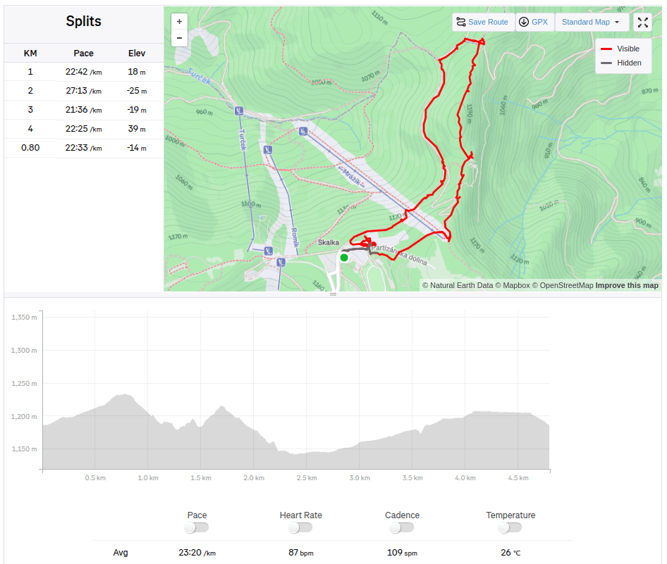
    4.8km, 1:51 active, 166m ascend

    And since we had already been to this location, we also went to see the lookout tower on Krahulsky štít, it is about 2.5km from Krahule through fairly easy terrain. The lookout tower offers a beautiful view of Kremnica and the mountains in the background – Vtáčnik, Sitno…

    On its top floor we find signposts to well-known surrounding destinations with the distance as the crow flies, e.g. Center of Europe, Cottage Hostinec, etc. Directly below the observation tower is a wooden terrace with seating and a view of Kremnica. Wooden benches and tables are also located in the immediate vicinity of the observation tower.

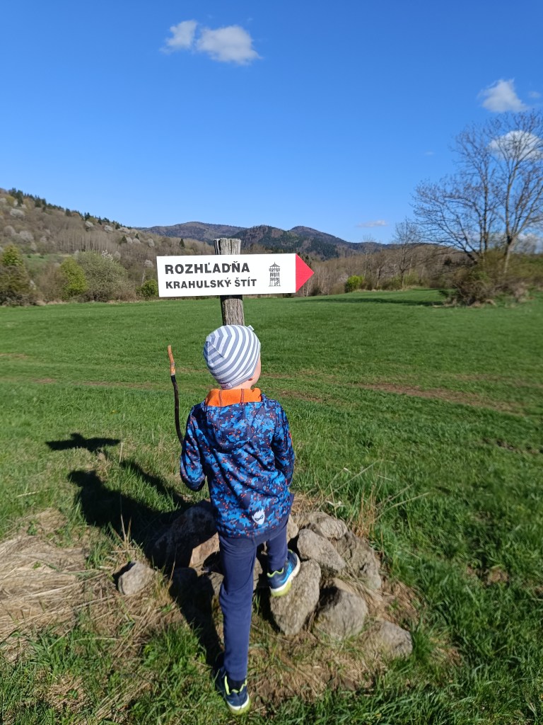
    Marking to Krahulský štít
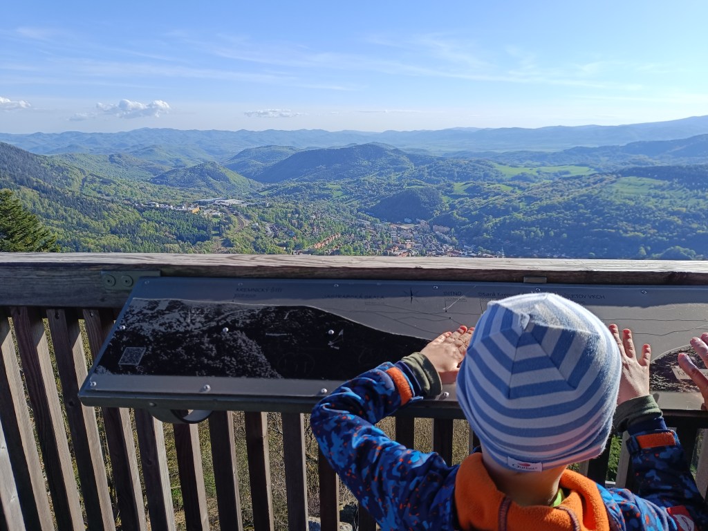
    View from lookout tower

    We stopped along the way to see the geographical center of Europe, but we were actually more interested in the church that is very close by. It has a beautiful blue altar and breathes history.

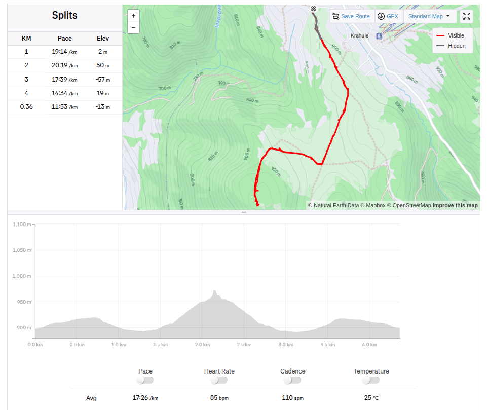
    4.36km, 1:16 active, 126m ascend
  • Skalka, Krahulský štít

    Skalka, Krahulský štít

    Dávi duž dlho chcel ísť na Skalku, neviem prečo si vybral práve tento kopec, ale spomínal mi to veľmi často. A tak sme sa rozhodli, že mu tento destký sen splníme.

    Na skalku sme sa vyviezli autom a odtiaľ sme išli pešo na čersvenú turistickú značku – na cestu hrdinov SNP (a mamíííí môžeme prejsť aj celú cestu hrdinov SNP?) Veľmi ho bavilo loziť po skalách a fascinovala ho aj ferata komín na skalke, kam tiež samozrejme chce ísť:)

    Výstup z feraty komín

    Išli sme hrebeňom až po Gorgelyho tunel.  Bol postavený v 16. st. a nesie meno známeho bojovníka za maďarskú samostatnosť, generála Görgeyho Artura.

    Jeho vznik sa pripisuje obdobiu po roku 1498, kedy Thurzo ako skúsený podnikateľ (Thurzovsko-Fuggerovská banská spoločnosť) si uvedomoval náklady spojené s prepravou kovov po okružných cestách z Banskej Bystrice do Kremnice. Spojenie medzi Kremnicou a Banskou Bystricou existovalo iba zdĺhavou obkľukou po dvoch cestách. A tak cesta tunelom v Kremnických vrchoch bola, a aj po zániku Thurzovsko-Fuggerovskej banskej spoločnosti, zostávala významným spojením medzi Kremnicou a Banskou Bystricou.

    Po II. svetovej vojne tunel a k nemu prístupové cesty pre nedostatok záujmu chátrali a v roku 1955 bol tunel skoro úplne zasypaný. V snahe zachrániť túto unikátnu historickú pamiatku a turistickú atrakciu Kremnických vrchov, členovia Klubu slovenských turistov z Banskej Bystrice a Kremnice sa v roku 1996 rozhodli tunel zrekonštruovaťa spevniť oceľovými výstužami. Má 30 metrov.

    Výhľad na Banskú Bystricu
    Výhľadové miesto na hrebeni Kremnických vrchov
    4.8km, 1:51 aktívny čas, 166 nastúpaných metrov

    A keďže sme už boli v tejto lokalite, išli sme pozrieť aj rozhľadňu na Krahulskom štíte, z Krahulí je to cca 2.5km vcelku nenáročným terénom. Rozhľadna ponúka najmä výhlad smerom na Kremnicu a pohoria v pozadí – Vtáčnik, Sitno…

    Na jej najvyššom poschodí nachádzame smerovníky k známym okolitým cieľom aj so vzdušnou vzdialenosťou k nim, napr. Stred Európy, Chata Hostinec, a pod. Priamo pod výhľadovou vežou je umiestnená drevená terasa s posedením a výhľadom na Kremnicu. Drevené lavice a stoly sú taktiež rozmiestnené aj v blízkom okolí rozhľadne.

    Cesta je celkom dobre označená
    Výhľad z rozhladne

    Cestou sme sa ešte zastavili pozrieť si geografický stred Európy, ale popravde nás viac zaujal kostolík, ktorý je v tesnej blízkosti. Má krásny modrý oltár a dýcha z neho história.

    4.36km, 1:16 aktívny čas, 126 nastúpaných metrov
  • Sivý kameň Castle, Končita

    Sivý kameň Castle, Končita

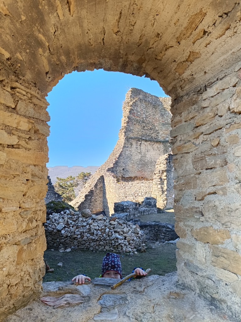
    The ruins of the Sivý kameň Castle are located on an andesite cliff above the village of Podhradie near Prievidza. Although relatively little of the castle has survived to this day, the castle cliff provides a beautiful view of the surrounding landscape.

    Under the castle

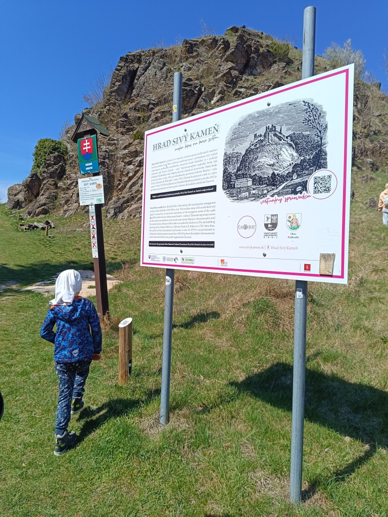
    The remains of the castle from the mid-14th century are visible directly from the village. A short climb from the village center will soon take you to a dirt road. Here, a sign with the inscription Sivý Kameň will alert you to the right direction. The entire climb to the castle takes approximately 15 minutes.

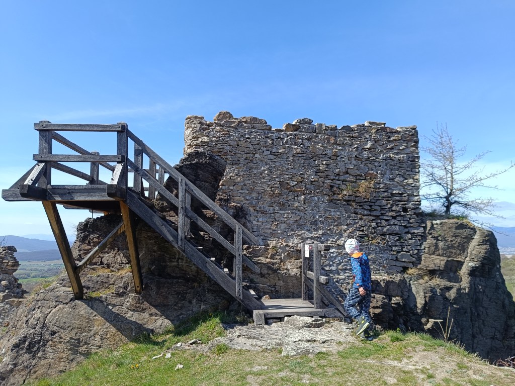
    Nowadays, when visiting the castle, we can observe its small remains, which at least indicate its size and the remains of the masonry. From the inner Gothic castle, the perimeter walls of the prismatic tower have been preserved.

    Andessite cliff, on which the castle is build
    One of the few remains of the castle

    The Sivý Kameň Castle was built shortly before 1350 as a royal castle. The construction of the castle was necessitated by the circumstances that arose after the death of Matúš Čák in 1321. Since there was no other castle in the vicinity besides Bojnice Castle, the need arose to build another administrative center.

    Later the castle belonged to different families. In 1430 both castles reverted to the crown. In 1431 the king donated the castle of Sivý Kameň to Gregor Majthényi and his heirs. Since then the castle and the estate have remained in permanent possession of the Majthényi family.

    The castle began to decline in the late 16th and early 17th centuries. In 1626, Gabriel Bethlen’s rebels attacked the castle and other Majthényi properties and thoroughly plundered them.

    The first decade of the 18th century brought further attacks on the castle, this time by Rákoczi’s soldiers. Soon the important estate became a ruin. The remains of the castle were subsequently dismantled by the inhabitants of Podhradie.

    Končitá

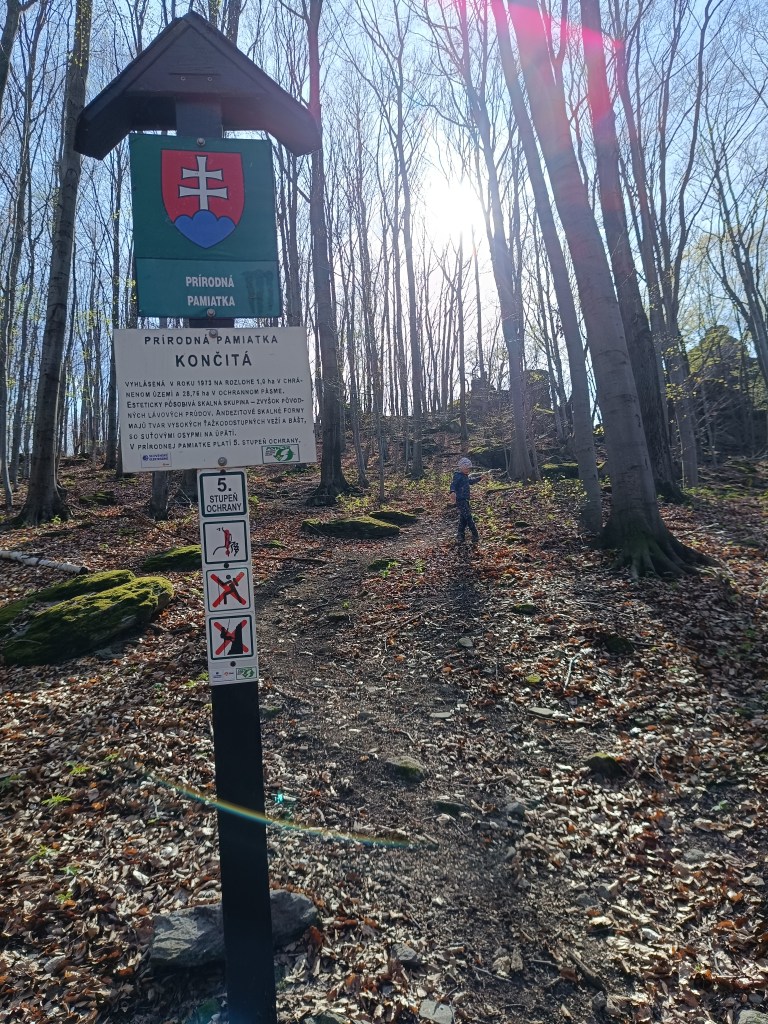
    Natural monument končitá

    From the cottage below Končita, in Gebňárova Valley, which we can reach from the village of Kamenec pod Vtáčnikom, an unmarked trail leads to the peak cliffs of Končita.

    Behind the stream rise the rock formations of Končita, to which a well-trodden path leads. Končita was declared a Natural Monument in 1973.

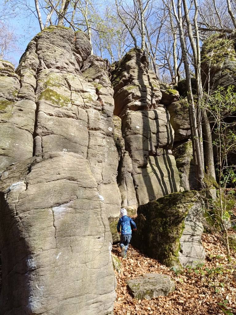
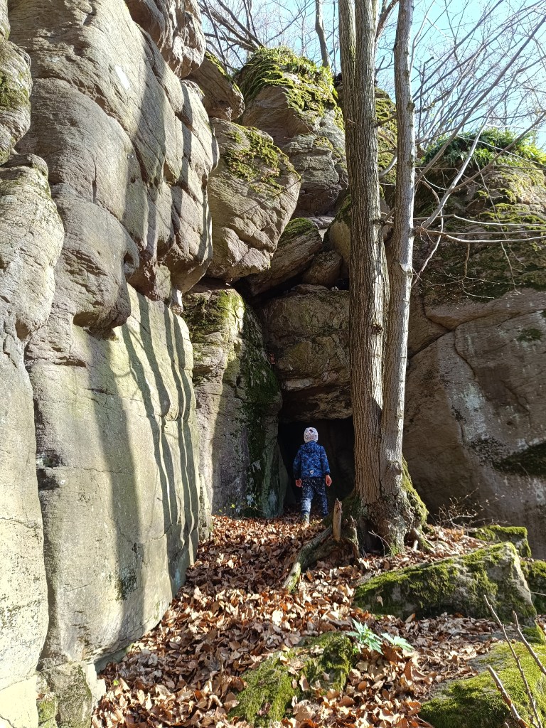
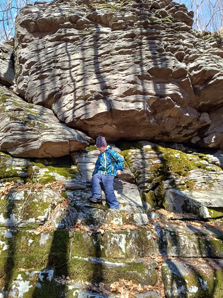
    In the vicinity there are smaller and larger rockeries covered with deep green moss. The Končitaj cliffs are dominated by a 30-meter-high andesite tower. From Končita, following the ridge to the left, we come to the Devil’s Paths. There are huge boulders also covered with green moss, rocky cliffs, windows and narrow gorges.

    Devil’s Paths
    a cave in the stone

  • Hrad Sivý kameň, Končitá

    Hrad Sivý kameň, Končitá

    Zrúcanina hradu sivý kameň sa nachádza na andezitovom brale nad obcou Podhradie neďaleko Prievidze. Hoci sa z hradu do súčastnosti zachovalo pomerne málo, hradné bralo poskytuje krásny výhľad na okolitú krajinu.

    Pod hradom

    Pozostatky hradu z polovice 14. storočia sú viditeľné priamo z obce. Krátkym stúpaním z centra obce sa čochvíľa dostanete k poľnej ceste. Tu vás o správnom smere upozorní tabuľa s nápisom Sivý Kameň. Celý výstup na hrad trvá približne 15 minút.

    V súčasnosti môžeme pri návšteve hradu pozorovať jeho nepatrné pozostatky, ktoré naznačujú aspoň rozlohu a zvyšky muriva. Z vnútorného gotického hradu sa zachovali obvodové múry hranolovej veže.

    Andezitové bralo, na ktorom je hrad postavený
    Jednen z mála pozostatkov hradu

    Hrad Sivý Kameň bol postavený krátko pred rokom 1350 ako kráľovský hrad. Stavbu hradu si vyžiadali pomery, ktoré nastali po smrti Matúša Čáka v roku 1321. Nakoľko sa okrem Bojnického hradu v okolí žiaden iný nenachádzal, vznikla potreba vybudovania ďalšieho administratívneho centra. 

    Neskôr hrad patril rôznym rodom. V roku 1430 pripadli oba hrady naspäť korune. V roku 1431 kráľ daroval hrad Sivý Kameň Gregorovi Majthényimu a jeho dedičom. Od toho času zostal hrad i panstvo v trvalej držbe rodiny Majthényiovcov. 

    Koncom 16. a na začiatku 17. storočia začal úpadok hradu. V roku 1626 povstalci Gabriela Bethlena napadli hrad aj ostatné majetky Majthényiovcov a dôkladne ich vyplienili. 

    Prvé desaťročie 18. storočia prinieslo hradu ďalšie útoky, tentoraz Rákocziho vojakov. Čoskoro sa z významného panstva stala ruina. Pozostatky hradu následne rozobrali obyvatelia Podhradia.

    Končitá

    Prírodná pamiatka končitá

    Od chaty pod Končitou, v Gebňárovej doline, ku ktorej sa dostaneme z obce Kamenec pod Vtáčnikom, vedie neoznačený chodník  k vrcholovým bralám Končitej.

    Za potokom sa dvíhajú skalné útvary Končitej, ku ktorým vedie vychodený chodníček.Končitá bola v roku 1973 vyhlásená za Prírodnú pamiatku

    V okolí sú menšie aj väčšie skalky obrastené sýto zeleným machom. Bralám Končitej dominuje 30 metrov vysoká andezitová veža. Od Končitej po hrebeni smerom vľavo prídeme na Čertové chodníky. Nachádzajú sa tu obrovské balvany tiež pokryté zeleným machom, skalné bralá, okná a úzke tiesňavy. 

    čertove chodníky
    Jaskyňa v skalnom brale

  • Bzovík

    Bzovík

    It is originally a Benedictine (later Premonstratensian) monastery rebuilt into a fortress (castle), near the village of Bzovík.

    The monastery in Bzovík was founded in the first half of the 12th century. The Benedictines were replaced sometime between 1179 and 1181 by the Premonstratensians from Olomouc, who spread spiritual culture and education, but also new economic knowledge and new methods of tilling the land.

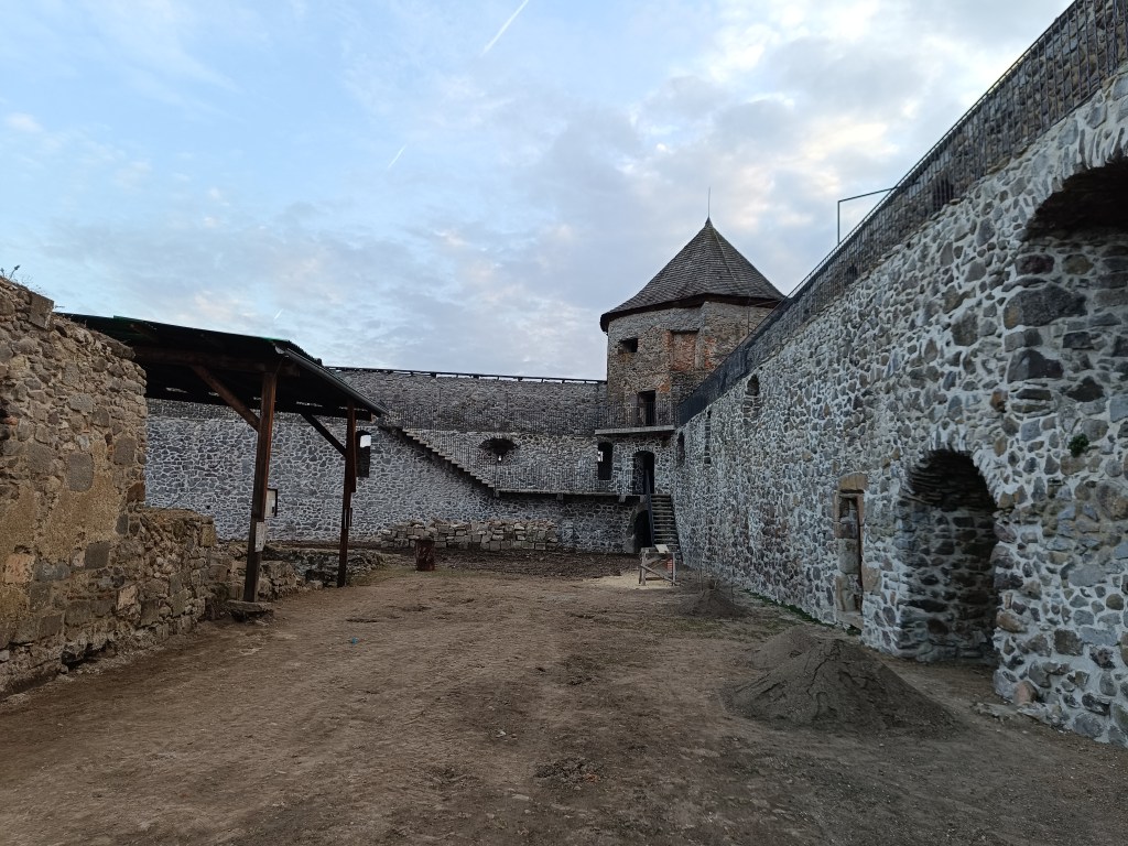
    Outside walls

    The Romanesque double-towered church, to which a monastery building with a paradise courtyard and a cloister was later added after renovations, was one of our most important Romanesque architectural monuments. The church and monastery were often the target of attacks during the 15th century; the building burned down several times, after which it was immediately repaired and partially rebuilt.

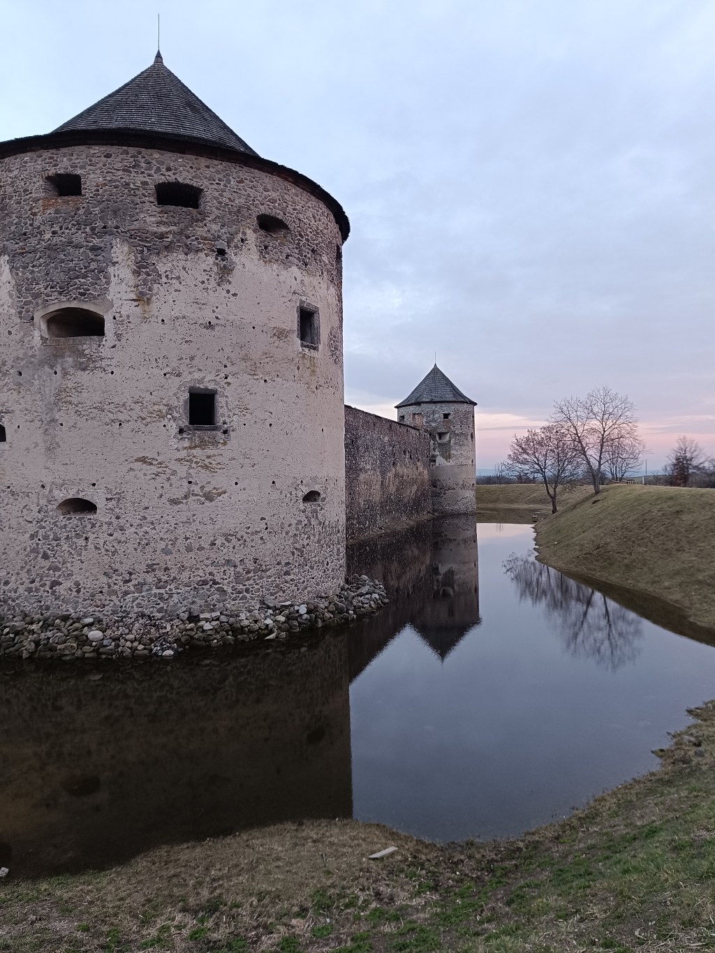
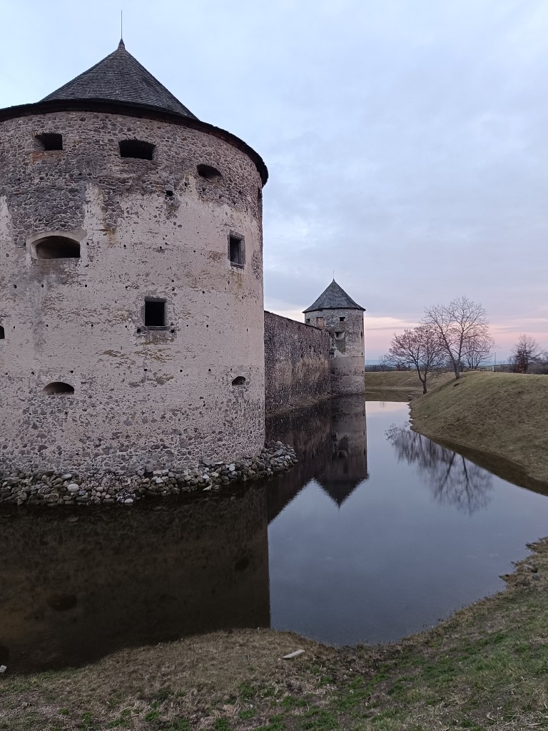
    Sigismund Balaša expelled the monks from the monastery around 1530 and immediately began rebuilding the monastery into a manor house surrounded by massive fortifications. The walls were given massive shooting range and internal galleries. Dwellings for soldiers and farm buildings were added to them from the inside. The entire area was protected by wide moats and massive corner bastions.

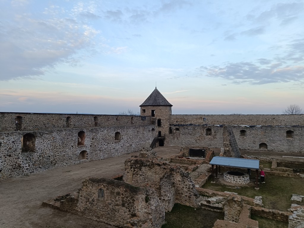
    Object is in reconstruction

    In 1620 the monastery burned down, but at the end of the 17th century it was returned to the church. In 1678 it was conquered by the rebels of Imrich Tököli.

    The next period was already approaching its demise. After a short ownership by the Jesuit order and the Archbishop of Esztergom, the building began to fall into disrepair at the beginning of the 19th century. The final blow in the process of decay was dealt to it by the fighting during World War II and the subsequent destruction by the local population.

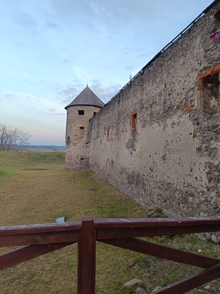
    The outer walls are better preserved than the inner structures.

    The former monastery complex is in ruins, except for the outer fortifications, which show signs of preservation and reconstruction. You can park right next to the building.

    Moat with water in it

  • Bzovík

    Bzovík

    Je to pôvodne benediktínsky (neskôr premonštrántsky) kláštor prestavaný na pevnosť (zámok), neďaleko obce Bzovík.

    Kláštor v Bzovíku vznikol v prvej polovici 12. storočia. Benediktínov vystriedali niekedy medzi rokmi 1179 – 1181 premonštráti z Olomouca, ktorí šírili duchovnú kultúru a vzdelanosť, no tiež nové hospodárske poznatky a nové spôsoby obrábania pôdy.

    vonkajšie hradby

    Románsky dvojvežový kostol, ku ktorému pribudla neskôr po dostavbách kláštorná budova s rajským dvorom a krížovou chodbou, bol jednou z našich najvýznamnejších románskych stavebných pamiatok. Kostol s kláštorom sa v priebehu 15. storočia často stávali terčom útokov; viackrát objekt vyhorel, načo ho vzápätí opravili a čiastočne prestavali.

    Žigmund Balaša vyhnal z kláštora rehoľníkov okolo roku 1530 a hneď nato začal kláštor prestavovať na kaštieľ obohnaný mohutným opevnením. Múry dostali mohutné strielne a vnútorné ochodze. K nim pristavali z vnútornej strany obydlia pre vojakov a hospodárske budovy. Celý areál chránili široké priekopy a mohutné nárožné bašty.

    Objekt stále rekonštruujú

    V roku 1620 kláštor vyhorel, koncom 17. storočia sa opäť vrátil cirkvi. V roku 1678 ho dobyli povstalci Imricha Tököliho.

    Ďalšie obdobie už spelo k jeho zániku. Po krátkom vlastníctve rádu jezuitov a ostrihomského arcibiskupa začal objekt začiatkom 19. storočia pustnúť. Poslednú ranu v procese chátrania mu uštedrili boje počas druhej svetovej vojny i následné ničenie miestnymi obyvateľmi.

    Vonkajšie hradby sú viac zachované ako vnútorné stavby

    Areál bývalého kláštora sa nachádza v stave zrúcaniny, okrem vonkajšieho opevnenia, ktoré vykazuje známky zachovalosti a rekonštrukcie. Zaparkovať môžete rovno pri objekte.

    Priekopa s vodou

  • Divín castle and Kalamárka

    Divín castle and Kalamárka

    Near the Ružiná reservoir in the south of central Slovakia lies the village of Divín, above which the ruins of Divín Castle rise.

    The castle was built at the end of the 13th century to protect the road to the central Slovak mining area. Especially in the second half of the 16th century, it played an important role in the defense system of central Slovak towns against the Turks. In the second half of the 17th century, it was unfortunately made famous by its owner Imrich Balassa, who raided and plundered the surrounding villages. After his death in 1683, the imperial army captured the castle and it has been in ruins since then. Only some of the walls, window openings and loopholes have been partially preserved.

    Caslte Divín

    The original castle, today’s upper castle, was built on top of a limestone cliff. The castle’s ground plan is elongated in a west-east direction. It is adapted to the shape of the top of the rocky cliff. A thick perimeter wall, which regularly bends according to the unevenness and irregularity of the terrain, formed the outer shell of the castle. Residential and farm wings were added to it inside. Between them was a small courtyard, on which a cistern can be assumed. The perimeter wall was not reinforced with bastions or other protrusions that would allow flanking – protecting the wall by shooting from the sides. The castle builders probably counted more on passive protection than active. Passive protection was enabled by a massive, about 2 m thick wall. Active defense was shooting through slit windows in the wall, which are still noticeable in places despite the latest brickwork.

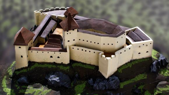
    How the castle probably looked

    The tourist attraction of Kalamárka is one of the most important natural sites in Podpoľanie. What will enchant you in this location is the extremely rugged relief, which has a long climbing tradition, which is why it is called the andesite bastion of sport climbing.

    In addition to climbers, many tourists who crave adrenaline experiences from these rock walls also come here every year. The entire summit plateau on Zadná Kaľamárka is freely accessible to tourists. There is a prehistoric hillfort there – an archaeological site, where you can see a water cistern as a trace of the first inhabitants of Kaľamárka. For climbers, this andesite cliff offers two climbing sectors, namely the upper rocks on Zadná Kaľamárka and the lower rocks on Predná Kaľamárka, which are up to 20 meters high. There is also a viewpoint over the Detva Basin and one of the most beautiful rock climbing routes in Slovakia – Indián.

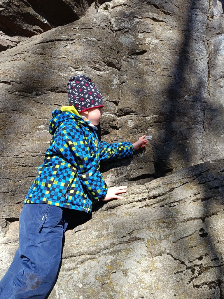
    A liitle bit of climbing can be done there with small children too
    Some of the paths has names there

    This is a very easy hike, as there is a parking lot very close to both.

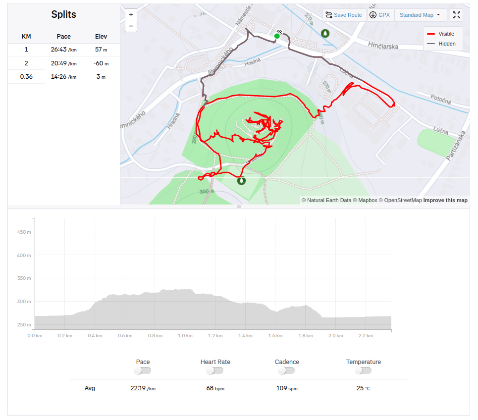
    Divín, 2.36km, 1 hod
    Kalamárka: 1.6km, 40 min
  • Hrad Divín a Kalamárka

    Hrad Divín a Kalamárka

    Pri vodnej nádrži Ružiná na juhu stredného Slovenska leží obec Divín,nad ktorou sa vypína zrúcanina hradu Divín.

    Hrad postavili koncom 13. storočia na ochranu cesty do stredoslovenskej banskej oblasti. Najmä v druhej polovici 16. storočia zohral dôležitú úlohu v systéme obrany stredoslovenských miest pred Turkami. V druhej polovici 17. storočia ho nešťastne preslávil jeho majiteľ Imrich Balassa, ktorý prepadával a raboval okolité dediny. Po jeho smrti v roku 1683 cisárske vojsko hrad dobylo a odvtedy je v ruinách. Sčasti sa zachovali len niektoré múry, okenné otvory a strielne.

    Hrad Divín, pekná rozsiahla zrúcanina

    Pôvodný hrad, dnešný horný hrad postavili na vrchole vápencového brala, ktorým sa končil rad pahorkov, vybiehajúcich do močaristej kotliny. Pôdorys hradu je pretiahnutý v západo- východnom smere. Je prispôsobený tvaru temena skalného brala. Hrubý obvodový múr, ktorý sa pravidelne zalamuje podľa nerovnosti a nepravidelnosti terénu, vytváral vonkajší plášť hradu. K nemu vo vnútri pristavili obytné a hospodárske krídla. Medzi nimi bol malý dvor, na ktorom možno predpokladať cisternu. Obvodový múr nebol zosilnený baštami ani inými výstupkami, ktoré by umožňovali flankovanie- ochranu múru streľbou zo strán. Stavitelia hradu počítali pravdepodobne viac s pasívnou ochranou ako aktívnou. Pasívnu ochranu umožňoval masívny, asi 2 m hrubý múr. Aktívnou obranou bola streľba cez štrbinové okná v múre, ktoré sú aj napriek najnovšiemu zamurovaniu miestami badateľné. 

    Maketa pôvodného hradu

    Turistická atraktivita Kalamárka je jednou z najvýznamnejších prírodných lokalít v Podpoľaní. To, čo Vás v tejto lokalite očarí, je extrémne členitý reliéf, ktorý má za sebou už dlhú horolezeckú tradíciu, preto sa nazýva ako andezitová bašta športového lezenia. 

    Okrem horolezcov sa tu ročne vystrieda aj množstvo turistov, ktorí bažia po adrenalínových zážitkoch z týchto skalných stien. Celá vrcholová plošina na Zadnej Kaľamárke je turistom voľne dostupná. Nachádza sa tam praveké hradisko – archeologická lokalita, kde môžete vidieť cisternu na vodu ako stopu po prvých obyvateľoch Kaľamárky. Pre horolezcov ponúka toto andezitové bralo dva sektory na lezenie, a to horné skaly na Zadnej Kaľamárke a dolné skaly na Prednej Kaľamárke, ktoré sú vysoké do 20 metrov a nanovo preistené borhákmi. Nachádza sa tam aj vyhliadkový bod na detviansku kotlinu a jedna z najkrajších skalkárskych ciest na Slovensku – Indián.

    Trošku zaliezť si tu môžu aj menšie deti
    niektoré cesty majú aj vyznačené pomenovanie

    Ide o veľmi nenáročnú turistiku, keďže pri oboch sa nachádza parkovisko veľmi blízko

    Divín, 2.36km, 1 hod
    Kalamárka: 1.6km, 40 min