Tag: running

  • SNP girl’s project day 7

    SNP girl’s project day 7

    We start at 6 am from our accommodation in Mlynky. Today we have in plan Dobšinský kopec, Voniarky, Čuntava and we finish in Telgárt.

    My legs haven’t fully recovered from Thursday’s run in the Veľká Fatra, running downhill really hurts. But we have to take advantage of the fact that we are already here, we’ll at least do a shorter stage.

    From our accommodation, we need to go to the Kruhové saddle, to join red SNP path. It takes one kilometer and 170 vertical metres. It’s fresh morning and we’re making our way through a little wet raspeberries from the morning dew. We sometimes shout a little, after all, we saw warning signs about the increased incidence of bears yesterday.
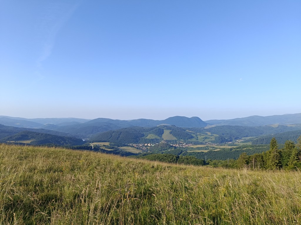
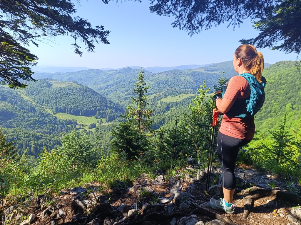
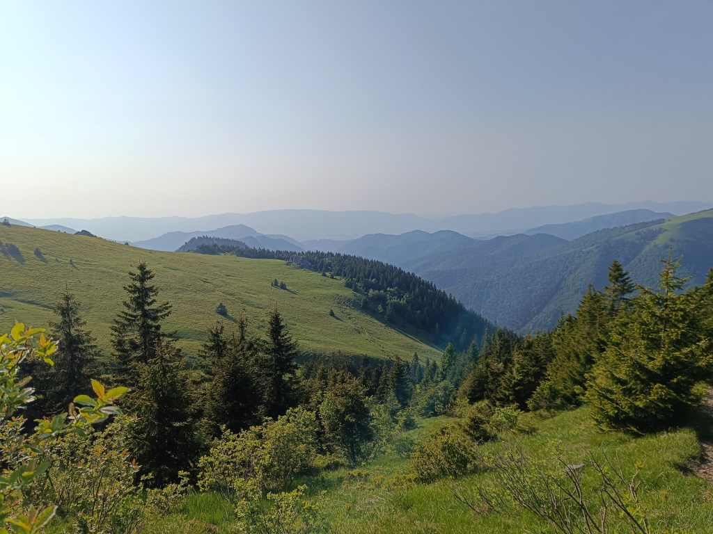
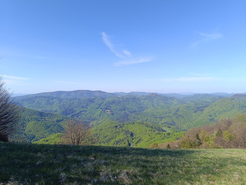
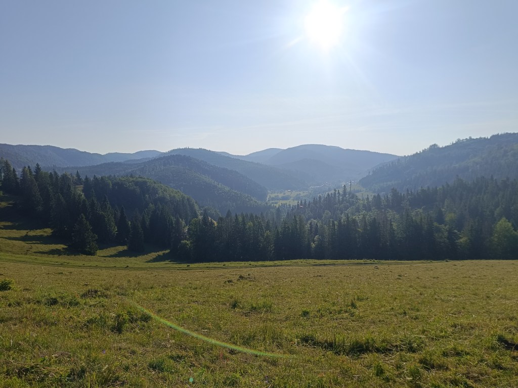
    First morning views

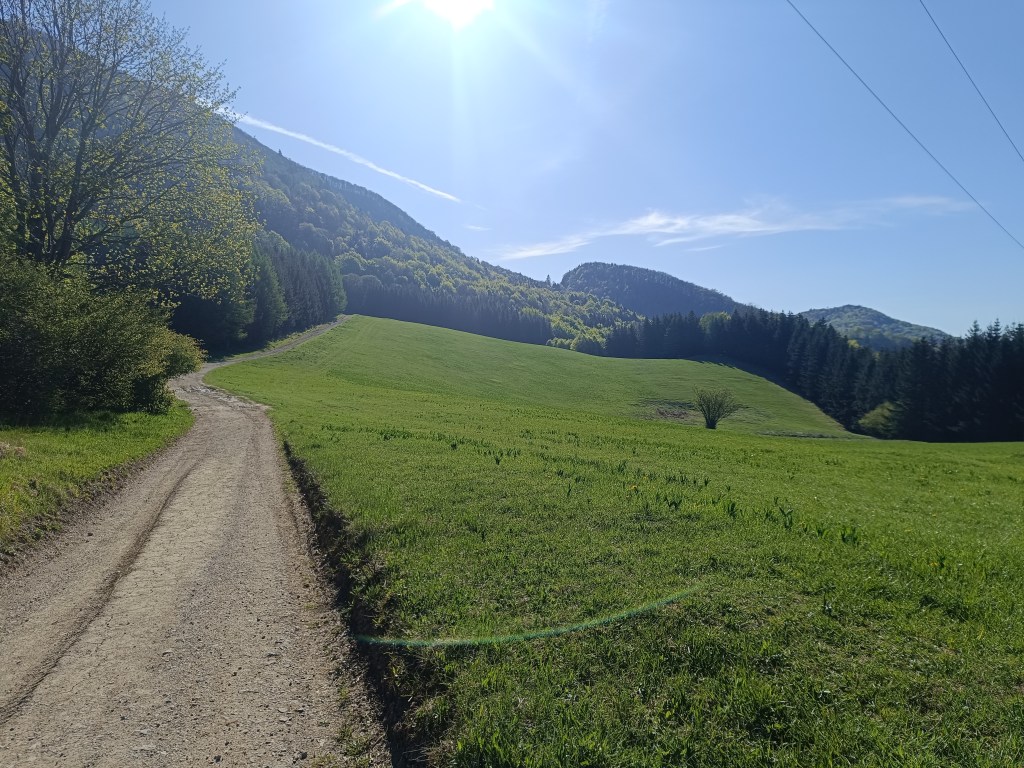
    We descend through the meadows to the Dobšiná hill, cross the asphalt and head towards Voniarky among a herd of cows. Yesterday we were here on bicycles, today on our own feet. I get water at the Gápel cottage. The path meanders through the trees, sometimes taking us to flowery meadows. It is beautiful here. Lucka and I agree that this is the most beautiful section for us so far.
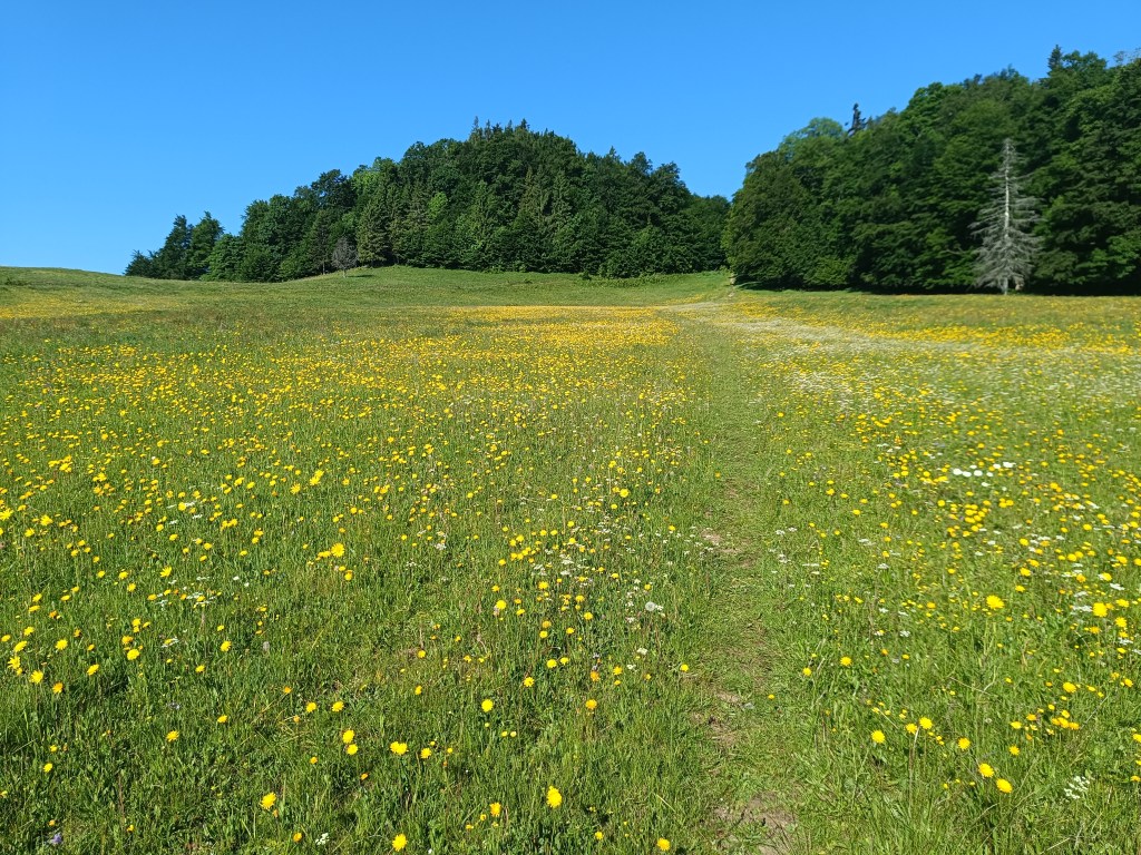
    As the sun rises, so does the temperature
    Meadows with great biodiversity are beautiful
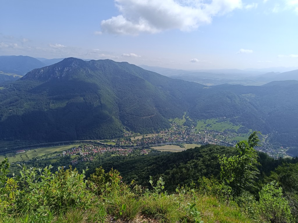
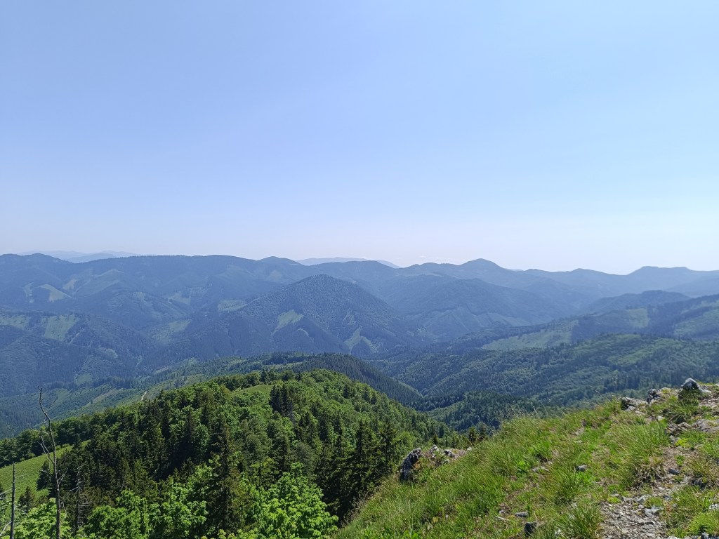
    Výhľad before Strmá prť

    From the Čuntava spot, the route continues only on a gravel road, less interesting to us than the joyful forest paths. As if to excuse it, a view of the Tatras opens up and we admire it. We are guessing it is Lomnický štít.
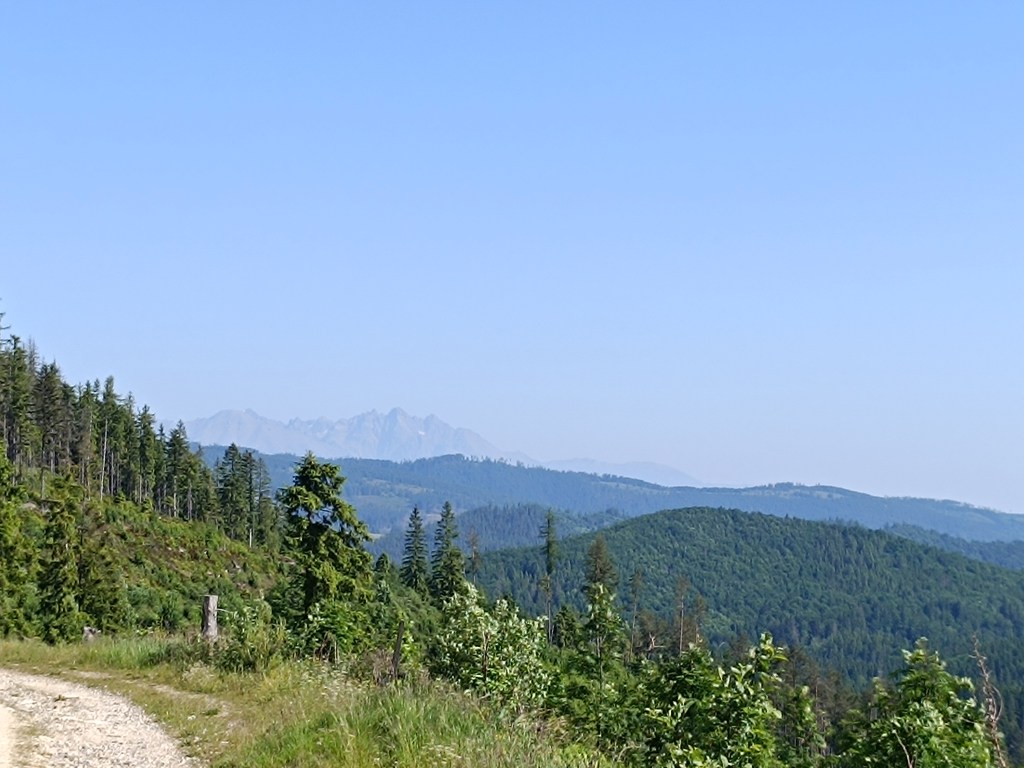
    Tatras in the background

    Around the last curve, Kráľova hoľa is now visible to us. But it will wait for us next time, during the Low Tatras ridge, we end today in Telgárt.
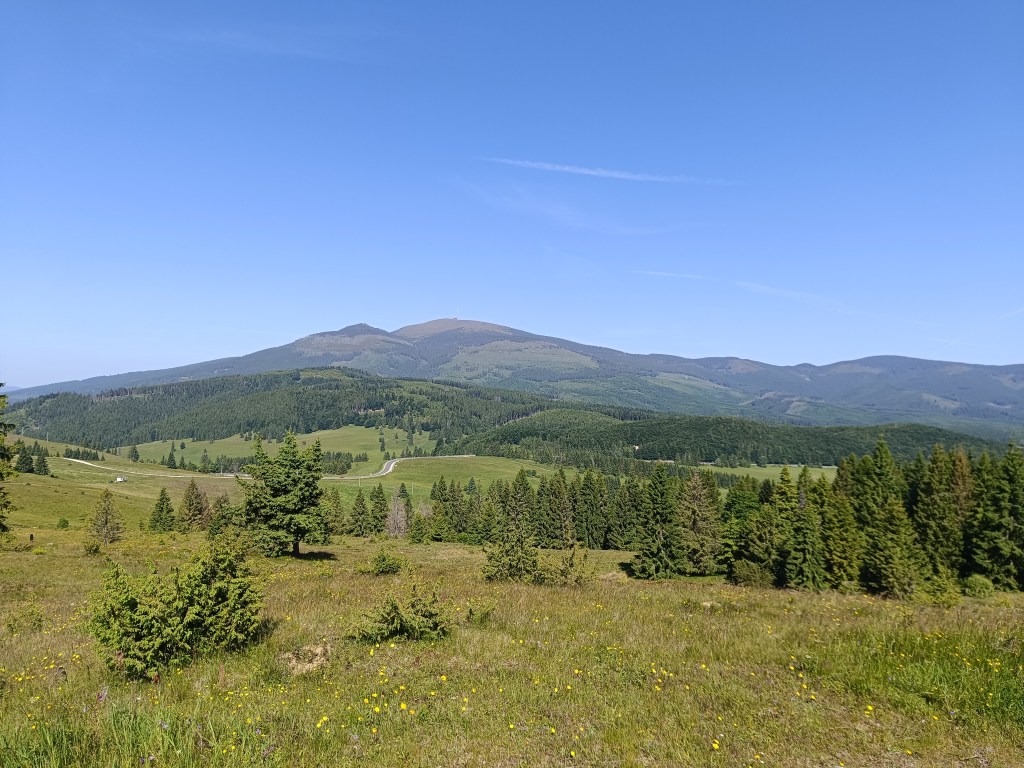
    Kráľova hoľa

    We’re already craving coffee, the route is taking us to asphalt, we don’t really like it, but whatever, there’s no getting off the red path:)
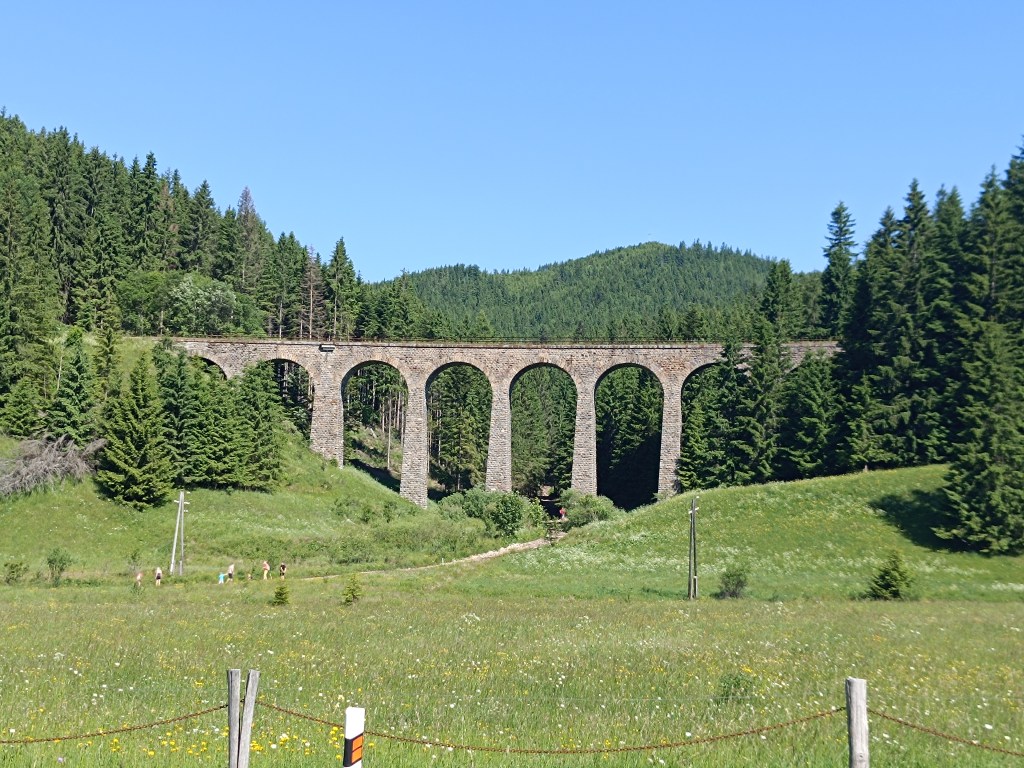
    Chmaroššký viadukt

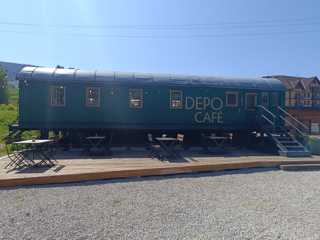
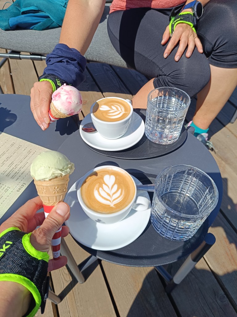
    We run along the source of the Hron River and opposite of the Chmarošský Viaduct we take a break in the famous Depo Kafe. We have to admit, their coffee is good, but the ice cream could be much better. The bridge dates back to 1933 and is the first articulated arch structure made of reinforced concrete in Czechoslovakia. The Telgártska loop is one of the most demanding railway engineering structures in Slovakia, because thanks to the Telgárt tunnel, the Telgárt and Chmarošský Viaducts, it overcomes a difficult climb of up to 31 meters and a gradient of 12.5 %. The viaduct consists of 9 arches. It is 18 m high, 113 meters long and passes over the Gregorova dolina valley, called Chmaroška. This unique viaduct was built during the economic crisis in the 1930s and more than 7,000 people participated in its construction. Men and women, mostly local residents, worked on the construction site.
    We reach Telgárt, where we meet Ľubka by the church, who very willingly brought our car from Mlynky and thus allowed us to run this stage. It was a truly beautiful stage, and a great morning in the mountains.
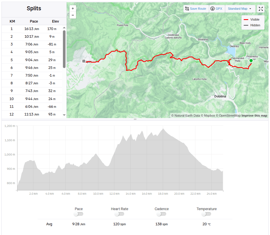
    25.42km, 931 m ascend, 4:00 active time
  • SNP girl’s project deň 7

    SNP girl’s project deň 7

    Štartujeme o 6tej ráno z ubytovania v Mlynkách. Dnes nás čaká Dobšinský kopec, Voniarky, Čuntava a v Telgárte končíme.

    Nohy sa ešte úplne nespamätali zo štvrtkového prebehu Veľkej Fatry, bežať dole kopcom vyslovene bolí. Ale príležitosť treba využiť a keď sme už tu, dáme aspoň kratšiu etapu.

    Z ubytovania to máme na červenú do sedla Kruhová kilometer a 170 výškových metrov, je sviežo a my sa predierame malinčím mokrým od rosy. Občas si trochu pokričíme, predsa len včera sme videli výstražné tabuľky o zvýšenom výskyte medveďov.

    Prvé ranné výhľady

    Lúkami zbiehame k dobšinskému kopcu, križujeme asfalt a pomedzi stádo kráv smerujeme na Voniarky. Včera sme tu boli na bicykloch, dnes po vlastných. Pri chate Gápel doberám vodu. Cestička sa kľukatí pomedzi stromy, chvíľami nás zavedie na zakvitnuté lúky. Je tu nádherne. S Luckou sa zhodujeme, že toto je pre nás zataiľ najkrajsí úsek.

    So stúpajúcim slnkom stúpa aj teplota
    Lúky s veľkou biodiverzitou sú nádherné
    Výhľad pred strmou prťou

    Od čuntavy trasa pokračuje už len štrkovou cestou, pre nás menej zaujímavou ako kľukatiace sa lesné chodníčky. Akoby na ospravedlnenie sa nám otvára výhľad na Tatry a my sa kocháme. Tipujeme to na Lomnický štít.

    Tatry v pozadí

    Za poslednou zákrutou sa nám ako na dlani ukáže Kráľova hoľa, tá nás však čaká až nabudúce, počas hrebeňovky Nízkych Tatier, dnes sa končí v Telgárte.

    Kráľova hoľa

    Už si robíme chúťky na kávu, trasa nás privádza na asfaltku, až tak sa nám to nepáči, ale čo už, z červenej sa neschádza 🙂

    Chmaroššký viadukt

    Prebiehame popri prameni hrona a oproti Chmarošskému viaduktu dávame pauzu v slávnom Depo kafe. Musíme uznať, kávu majú dobrú, len tá zmrzka by mohla byť oveľa lepšia. Most pochádza z roku 1933 a je prvou členenou oblúkovou konštrukciou zo železobetónu v Československu. Telgártska slučka patrí medzi najnáročnejšie železničné technické stavby na Slovensku, pretože vďaka Telgártskemu tunelu, Telgártskemu a Chmarošskému viaduktu prekonáva náročné stúpanie, až 31 metrov a sklon 12,5 ‰ (promile). Viadukt tvorí 9 oblúkov. Je vysoký 18 m, dlhý 113 metrov a prechádza ponad Gregorovu dolinu, nazývanú Chmaroška. Tento unikátny viadukt bol postavený počas hospodárskej krízy v 30. rokoch 20. storočia a na jeho budovaní sa podieľalo viac ako 7 000 ľudí. Na stavbe pracovali muži a ženy, väčšinou miestni obyvatelia.

    Dobiehame do Telgártu, kde sa pri kostole stretávame s Ľubkou, ktorá nám veľmi ochotne doviezla auto z Mlyniek a tým pádom nám umožnila si túto etapu prebehnúť. Bola to naozaj prekrásna etapa, a skvelé ráno v horách.

    25.42km, 931 nastúpaných metrov, 4:00 aktívny čas
  • Veľká Fatra ridge hiking trail

    Veľká Fatra ridge hiking trail

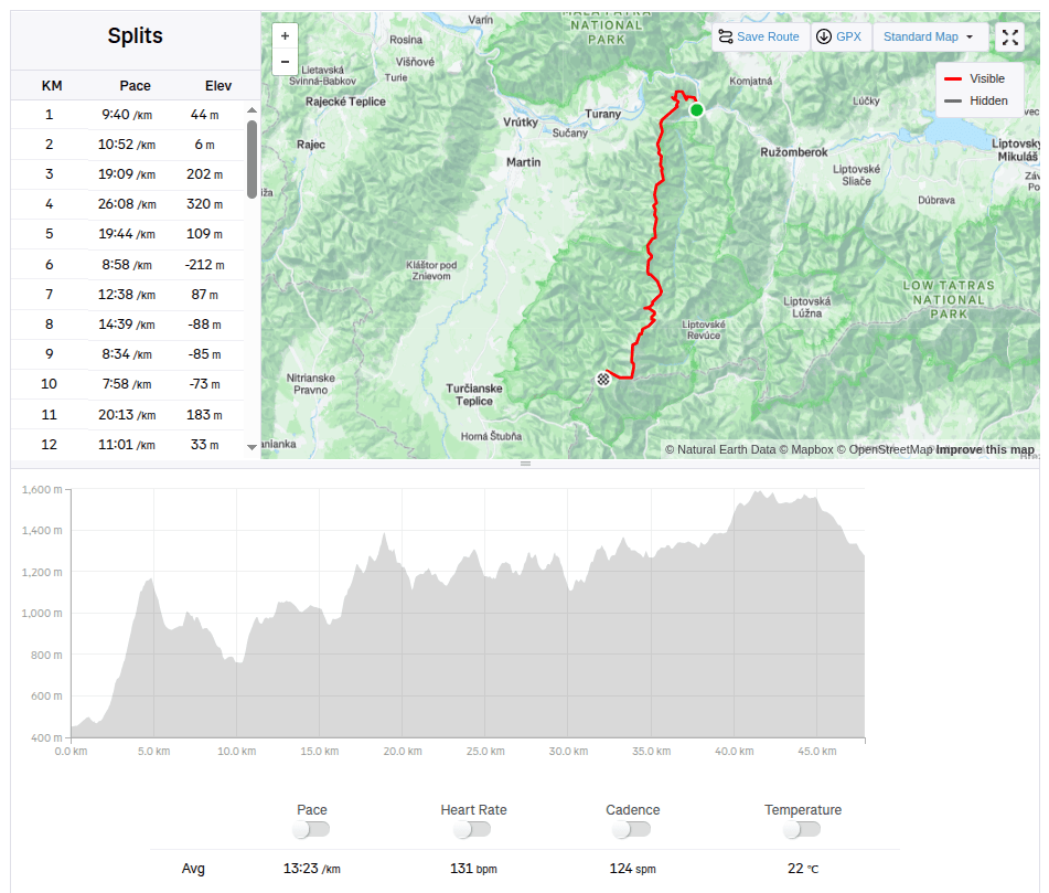
    The weather forecast was absolutely calling for taking a few days off and spending them outside the city. I immediately had the idea, let’s go through the Veľká Fatra. Jožko immediately agrees, but suggests a route that neither of us has ever done, the real Veľká Fatra ridge hiking trail, from Ľubochna (not from Ružomberok as most people, including me, usually hike). I agree without much thought.

    The plan is to run the whole hiking trail in one day, sleep at Kráľová studna, and after breakfast run down to civilisation. We pack our little backpacks, they are full and heavy, because we also take things for the colder evening, sleeping, hygiene and more food than usual, after all 47km and 3500 meters climbed will take us some time.

    View from Kopa

    In the morning we get on the bus, have breakfast and get off in Ľubochňa at 8:20. The beginning is gentle, great for start moving the stiff body. But then the real fun begins 😀 We climb steeply towards Kopa, where on the top a cross and a beautiful view await us.

    Water in Vyšný Rudno, first refreshment

    Then we descend to the Ľubochnianske saddle and again steeply up to Vyšné rudno. The road is either overgrown or there is no marking after logging and there are lots of big branches lying on the path. We push forward and through the Príslop saddle we begin the ascent to Kľak. The climb is long, because Kľak is 1394 meters above sea level, but at the top there is a great view in all directions, we sit on the rocks, take out lunch (meaning a slice of bread with butter and cheese:D ) and enjoy the views.

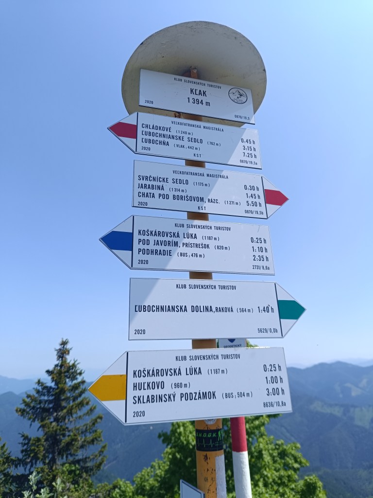
    signpost on Kľak
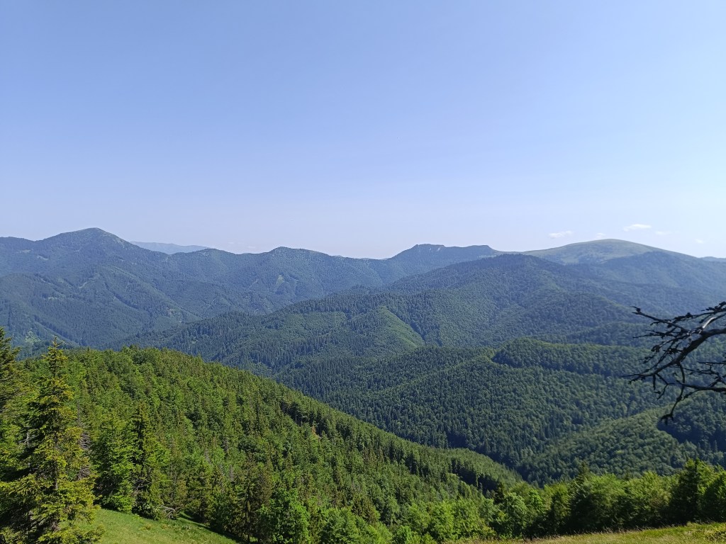
    View from Kľak

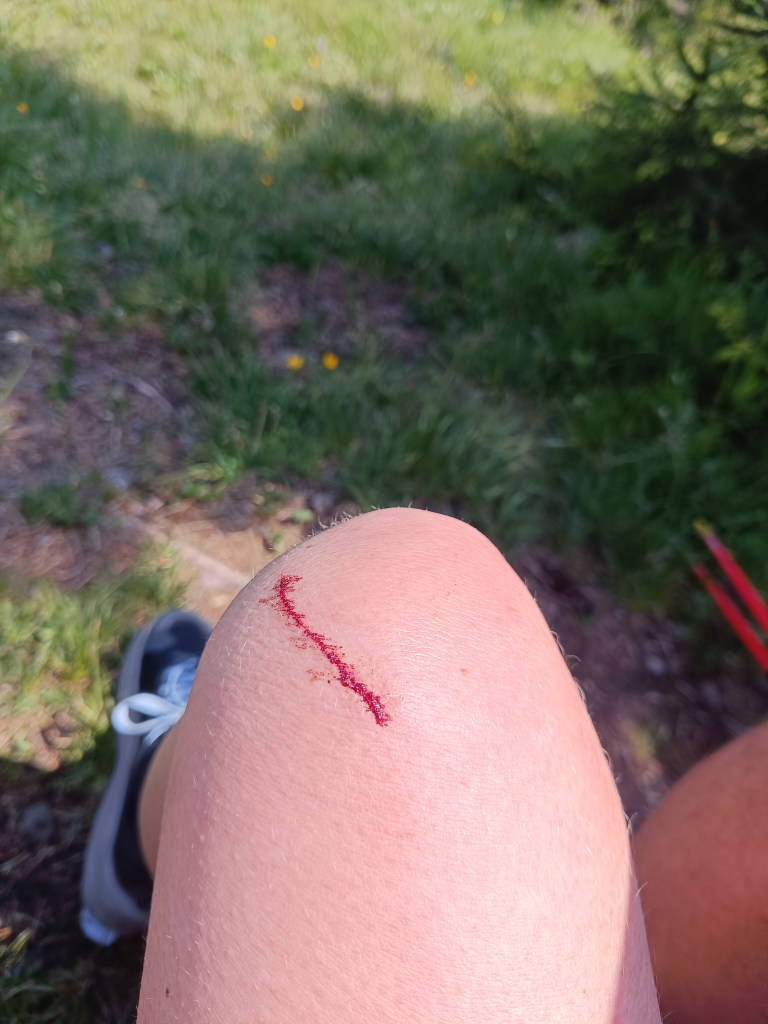
    I say to myself: fine, there is already a cottage under Borišov, there I will have a beer, it will be good: D but the route still leads either steeply up or steeply down and my energy is declining, thighs from steep downhills hurt. And as a bonus, I lightly injured my knee when I climbed the fallen tree on the way to the second well (100 altitude down from the ridge, just because of a half -liter of water? but past experience has taught us that going without water is even worse than going down the hard-earned meters to it)

    The knee then became quite swollen and turned blue.

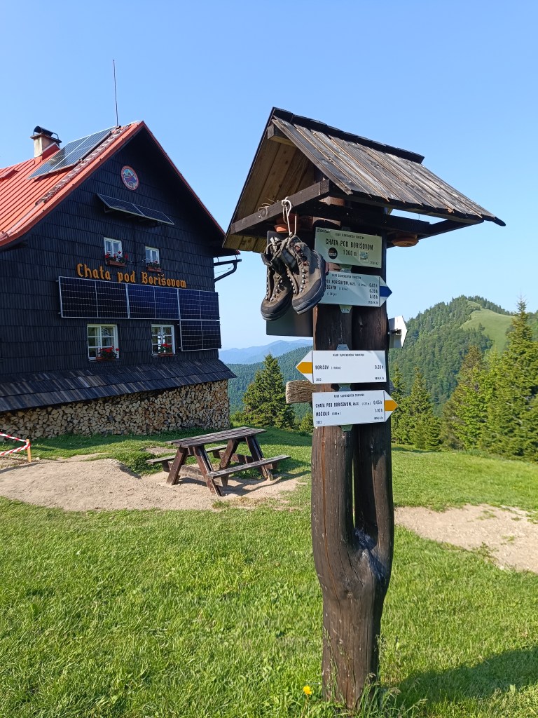
    We are climbing to Javorinka and I’m quite exhausted, I’m chewing a cookie at the top and the signpost says that we should be in Borisov in half an hour.

    on the path to Javorinka

    I tell myself, okay, she’ll be over the next hill. I climb up the hill and she’s really there… Except not under the hill I’m standing on, but on the opposite one, and not in the saddle, but a good bit uphill. I curse, grit my teeth and go.

    Jožko is already waiting for me with beer and radler.

    It’s still a long way from the hut under Borisov, but it seems surprisingly easier than before, the climbs are not as steep, the terrain less technical, but I don’t have as much energy as I would like. We walk for a while, we run for a while, the further we go, the more we walk and the less we run xD.

    On the way to Krížna

    These paths are already familiar to us, so I send Jožko ahead to arrange dinner for us on Krížna. We must hurry, so that they don’t close the kitchen, because we don’t have any food left. I run a few more straights, but then I’m definitely out of energy and from Kráľová skala I just walk.

    From Kráľova studňa

    I enter the room, lie down straight on the carpet, happy that I did it, but really exhausted.. And now Jožko is urging me to take a shower, we have 15 minutes until the kitchen closes 😀 My stomach is tight and it takes me a good hour to eat dinner. But I’m proud of myself, this was the hardest run of my life so far. We drink a beer and night falls on the Veľká Fatra.

    47.89km, 3467m ascend , 11h15min, from which 10h40min active time
  • Veľkofatranská magistrála

    Veľkofatranská magistrála

    Predpoveď počasia úplne nabádala k vziať s pár dní voľna a stráviť ich mimo mesto. Nápad som mala hneď, podme si prejsť Veľkú Fatru. Jožko hneď súhlasí, ale navrhuje varantu, ktorú ešte ani jeden z nás nešiel, tú pravú Veľkofatranskú magistrálu, z Ľubochne (nie z Ružomberka ako ju väčšina ľudí, vrátane mňa zvykne chodiť). Bez nejakých veľkých úvah súhlasím.

    Plán je za jeden deň prebehnúť magistrálu, prespať na Kráľovej studni a po raňajkách zbehnúť do sásovej. Balíme batôžky, sú plné a ťažké, berieme aj veci na chladnejší večer, prespatie, hygienu a aj jedla viac ako zvyčajne, predsa len 47km a 3500 nastúpaných metrov nám nejakú dobu bude trvať.

    Výhľad z Kopy

    Ráno nasadáme na autobus, v autobuse raňajkujeme a o 8:20 vysadáme v Ľubochni. Úvod je jemný, skvelý na rozhýbanie stuhnutého tela. Potom však začne ta pravá zábava 😀 Stúpame strmákom smer Kopa, hore na nás čaká kríž a nádherný výhľad.

    Studnička vo Vyšnom Rudne, prvé osvieženie

    Následne klesáme do Ľubochnianskeho sedla a zas stmo hore na Vyšné rudno. Cesta je buď zarastená, alebo po výrube chýba značenie a na chodníku sú poválané zvyšky ťažby. Predierame sa vpred a cez sedlo Príslop začíname výstup na Kľak. Stúpanie je dlhé, veď Kľak má 1394mnm., ale hore je parádny výhľad na všetky strany, sadáme na skaly, vyťahujeme obed (rozumej krajec chleba s maslom a syrom:D ) a kocháme sa.

    Smerovník na Kľaku
    Vyhľad z Kľaku

    Vravím si fajn, na smerovníku je už aj chata pod Borišovom, tam si dám pivko, to bude dobré 😀 Ale trasa stále vedie buď strmo hore, alebo strmo dole a síl mi ubúda, stehná zo strmých zbehov bolia. A ako bonus som si tak jemne rozťala koleno keď som preliezala padnutý strom cestou k druhej studničke (100 výškových sklesať z hrebeňa, len kvôli pollitru vody? ale minulé skúsenosti nás poučili, že bez vody je ešte horšie ako k nej sklesať tvrdo vydreté metre)

    Koleno potom celkom pekne opuchlo a zmodrelo

    Stúpame na Javorinku a ja už mám dosť, hore žujem keksík a a smerovník hovorí, že za polhodinku by sme mali byť na Borišove.

    cestou na Javorinku

    Vravím si dobre, za nasledujúcim kopčekom už bude. Vyškriabem sa na kopček a ona tam fakt je…Akurát, že nie pod kopcom na ktorom stojím ja, ale na tom protiľahlom a aj to nie v sedle, ale dobrý kus do kopca. Nadávam, zatínam zuby a idem.

    Jožko ma už čaká s pivkom a radlerom

    Z chaty pod borišovom je to ešte kus cesty, ale nám sa zdá prekvapivo ľahšia ako doteraz, stúpania nie sú také strmé, terény menej technické, len energie už nemám toľko koľko by som chcela. Chvíľu kráčame, chvíľu bežíme, čím ďalej tým viac kráčame a menej bežíme xD.

    Cestou na Krížnu

    Tieto cestičky sú nám už známe a tak na Krížnej posielam Jožka napred zajednať nám večeru, stíhame len tak tak, tak aby nám nezaveli kuchyňu, pretože jedlo už nemáme. zopár roviniek ešte pobehnem, ale potom už definítívne došli sily a od Kráľovej skaly už len kráčam.

    Z Kráľovej studne

    Vchádzam do izby, líham si rovno na koberec, šťastná, že som to dokázala, ale zato poriadne vyčerpaná.. A už ma jožko ženie do sprchy, máme 15minút do zavretia kuchyne 😀 žalúdok mám stiahnutý a tak mi trvá zjesť večeru dobrú hodinu. Ale som na seba hrdá, toto bol pre mňa zatiaľ najťažší beh v mojom živote. Popíjame pivko a na Veľkú Fatru padá noc.

    47.89km, 3467 nasúpaných metrov, 11h15min, z toho 10h40min aktívny čas
  • SNP girl’s project – day 6

    SNP girl’s project – day 6

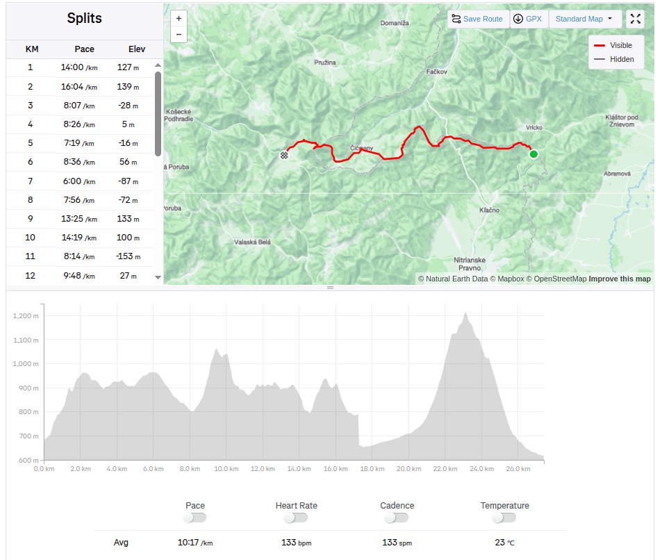
    From Vrícké sedlo via Fačkovské sedlo, Čičmany, Strážov to Zlichov.

    Yesterday was a perfect day for running, sun, 20 degrees, fresh green forests and blooming meadows.

    Jožko drove us to the start at Vrícké sedlo, we all still have a vivid memory of how we ended one stage exactly at this place. It is a fresh morning, 7 o’clock and after breakfast eaten on the way in the car and coffee from a thermos, Lucka and I set off. Jožko is going to drive the car to Zliechov and will go to meet us.

    Near Fačkov saddle

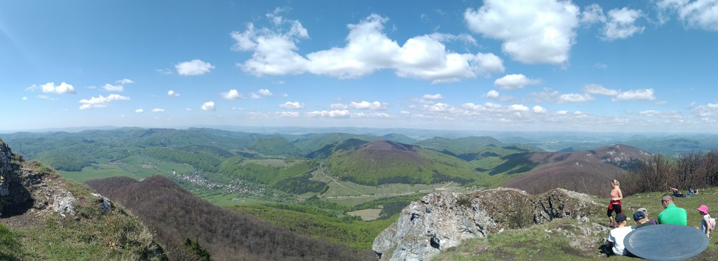
    The forest path here and there runs out into a meadow and Lucka and I chat and don’t even know how the time flies. We reach the Fačkov saddle after about an hour and a half. Here we leave the Malá Fatra and enter the Strážovské Vrchy, which are a completely unexplored part of Slovakia for me. And it’s so beautiful here. There are great views from the top of the slope.

    Views above Fačkov saddle

    This is followed by a descent to Čičmany, just before them in the middle of the meadow we meet Jožko, the score is 15.6km for girls, 12.8km Jožko.

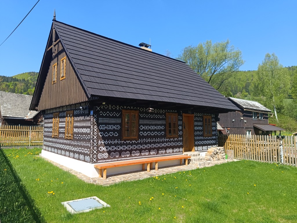
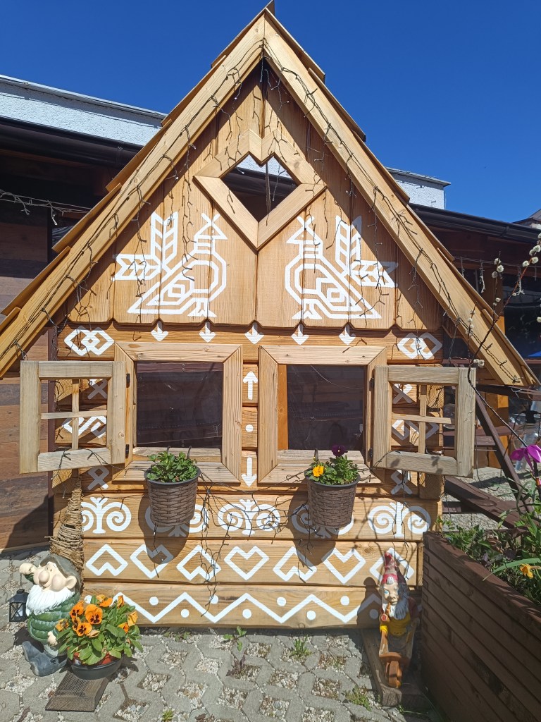
    Čičmany are known for their preserved folk architecture – painted log cabins. The architecture here resembles gingerbread houses, mainly thanks to the exterior decoration of the houses. We admire them and in the center of the village we even find an open pub connected to a souvenir shop. The things they sell are beautiful and we would buy the entire shop. However, our backpacks can only hold a magnet map of Slovakia with the SNP route marked and the point where Čičmany are located. We have coffee and non-alcoholic beer. What a pleasure, Bernard’s Grep non-alcoholic beer is really divine. I pour half of mine into an already empty bottle – it will come in handy later.

    Houses in Čičmany
    Čičmany

    We climb to Strážov, the peak itself is a bit of a detour from the SNP route, but we can’t miss it. It has a height of 1213 m above sea level and is the highest peak of the Strážovské vrchy. Thanks to its altitude and location, Strážov offers interesting and distant views. The rocky peak offers a circular panorama of the surrounding hills and neighboring mountain ranges. Under suitable conditions, it is possible to see the Malá Fatra, the Vtáčnik mountain range or Považský Inovec. It is truly beautiful there.

    A path lined with wild garlic
    Meadow under Strážov

    At the end, we only have a steep descent and one gentle slope to go and we are in Zliechov. All three of us are smiling and satisfied, today it went great.

    Strážov and its views
    28.4km, 4:41 aktive time, 1518m ascent

  • SNP girl’s project – deň 6

    SNP girl’s project – deň 6

    Z Vríckeho sedla cez Fačkovské sedlo, Čičmany, Strážov do Zlichova.

    Včera to bol deň ako stvorený na behanie, slnko, 20stupňov, svieže zelené lesy a zakvitnuté lúky.

    Na štart do Vríckeho sedla nás doviezol Jožko, ešte máme vetci v živej pamäti ako sme presne na tomto mieste jednu etapu ukončili. Ja svieže ráno, 7 hodín a po raňajkách zjedených cestou v aute a káve z termohrnčeka s Luckou vyrážame. Jožko ide zaviezť auto do Zliechova a pôjde nám oproti.

    Pri Fačkovskom sedle

    Lesný chodníček sem tam vybehne na lúku a my s Luckou kecáme a ani nevieme ako nám ide čas. Do fačkovského sedla sa dostávame asi po hodine a pol. Tu opúšťame Malú Fatra a vstupujeme do Strážovskýcyh vrchov, ktoré sú pre mňa úplne neprebádanou časťou Slovenska. A že je tu kráááásne. Z vrchu zjazdovky sú parádne výhľady.

    Výhľady nad Fačkovským sedlom

    Nasleduje klesanie až do Čičmán, tesne pred nimi v strede lúky stretáme Jožka, skóre je 15.6km baby, 12.8km Jožko.

    Čičmany sú známe svojou zachovalou ľudovou architektúrou – maľovanými zrubovými drevenicami. Architektúra tu pripomína perníkové domčeky a to hlavne vďaka vonkajšej výzdobe domčekov. Kocháme sa nimi a v strede obce dokonca nájdeme otvorenú krčmu spojenú so suvenírovým obchodíkom. Veci ktoré predávajú sú nádherné a anjradšej by sme vykúpili celý obchod. Batôžky však pojmú iba magnetku mapy slovenska s vyznačenou trasou SNP a bodom, kde ležia Čičmany. Dávame si kávu a nealko pivo. Všetci ochkáme, lebo Grepové nealko od Bernarda je fakt božské. Polku môjho si lejem do už prázdnej fľašky – ešte sa bude hodiť.

    Domčeky v Čičmanoch
    Čičmany

    Stúpame na Strážov, samotný vrchol je trochu zachádzka z trasy SNP, ale my si nemôžeme nechať ujsť. Má výšku 1213 mnm a je to najvyšší vrch Strážovských vrchov. Vďaka nadmorskej výške a polohe umožňuje Strážov zaujímavé a ďaleké výhľady. Bralnatá vrcholová časť ponúka kruhovú panorámu na okolité vrchy a susedné pohoria. Pri vhodných podmienkach je možné zhliadnuť Malú Fatru, pohorie Vtáčnik či Považský Inovec. Je tam naozaj nádherne.

    Cesta lemovaná medvedím cesnakom
    Lúka pod Strážovom

    Na záver nás už čaká len strmý zbeh a jedna mierna lúčka a sme v Zliechove. Všetci traja usmiaty a spokojní, dnes to išlo parádne.

    Strážov a jeho výhľady
    28.4km, 4:41 aktívny čas, 1518 nastúpaných metrov

  • SNP girl’s project day 4

    SNP girl’s project day 4

    We start at 8:30 in the morning in Myjava, after 2 hours in the car our stiff body doesn’t feel like it. We head to Bradlo. Bradlo is the highest peak of the Myjava Hills. However, it is mainly known for the fact that on its top stands the mound of M.R. Štefánik.

    M.R.Štefánik mound

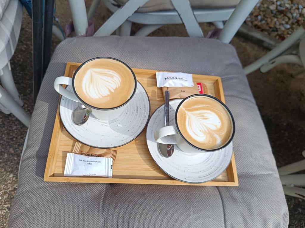
    Below Bradlo is the beautifully renovated Bradlo cottage, where we had a great cappuccino.

    First refreshment

    From Bradlo we run through Brezová pod Bradlom, a fairly long asphalt section. Then we find ourselves again in a forest, which is beautifully scented with wild garlic. We enjoy the first spring greenery.

    Beautiful, minimally human-impacted forests

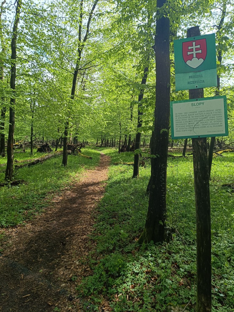
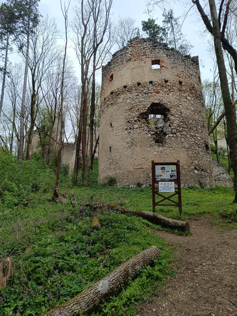
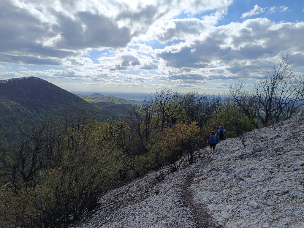
    We turn off the route to the Dobrá voda castle, because we still have strength and the table shows only 10 minutes. The Dobrá Voda castle is a Gothic castle located in the central part of the Little Carpathians and is part of the Slopy nature reserve, covering 8467 square meters. The name of the castle is derived from the numerous water springs in the area. The castle is now in ruins. Of the buildings, part of the masonry with fortifications and the remains of several buildings have been preserved. The process of its destruction is also affected by the amount of greenery that overgrows the entire object. Nevertheless, its ruins are a picturesque addition to this part of the Little Carpathian landscape.

    Dobrá voda

    We run to the village of Dobrá voda, where Jožko is already waiting for us, who ran to us from the finish line where he parked his car. He has not entirely encouraging news for us, that we still have 25 km to go (we counted with 19). But there is no other way, but to go 😀 We climb to Mihalová, where there is a beautiful Jozef Mak shelter, which serves mainly long-distance tourists.

    The sun is shining and the temperature is rising, we no longer like hte taste of water and we dream of a non-alcoholic radler or kofola. My knees are starting to hurt, my ITB tendons are starting to hurt due to neglected yoga.

    However, Jožko boosts morale, he noticed a sign near the cottage area that if we walk 250 meters from path, we should reach Stan’s pub. We don’t hesitate, and in 5 minutes we are enjoying a fresh pomelo grapefruit radler.

    Next comes an unpleasant stretch of asphalt without a sidewalk, since it is a main road, we have a bad feeling about it. Fortunately, it is only about a kilometer and we run into the trees again. Next comes the climb to Záruby. Záruby is the highest peak of the Little Carpathians.

    Path to Záruby

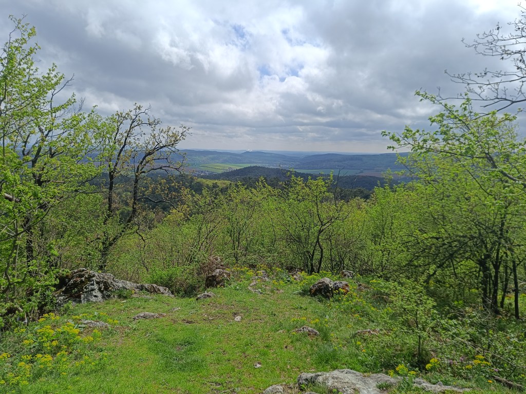
    In many parts, limestone cliffs, characteristic of this part of the mountain range, stand out. They provide interesting views of the surroundings. At the top stands a cross.

    A bit dangerous path to Ostrý kameň castle
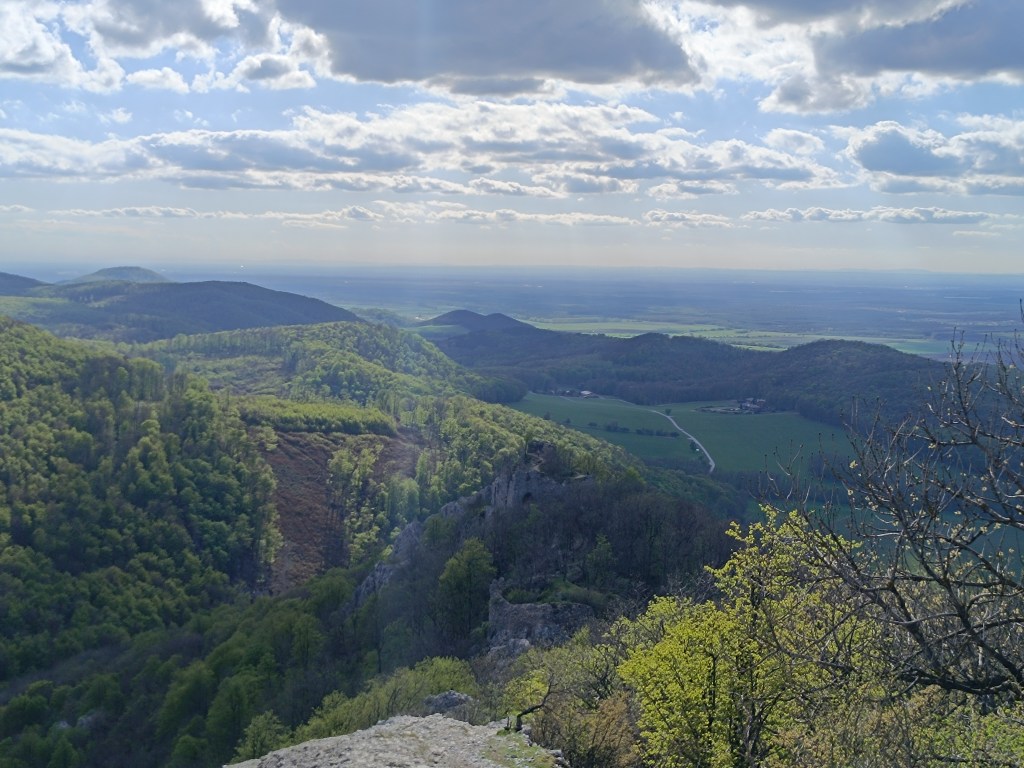
    Ruins of Ostrý kameň

    Ostrý kameň Castle was a border castle built to protect the Czech Road in the 13th century. After being damaged during the Rákóczi Uprising, the castle turned into ruins. It was built at the end of a steep mountain ridge, from which it is separated by a moat cut into the rock. It consisted of a residential palace, an observation and guard-defense prismatic tower.

    A steep descent follows, where my knees are already suffering considerably. Another 2 kilometers on asphalt to the car and we are at the finish line. Parched, we open non-alcoholic radlers to replenish fluids and sugar. Today was a difficult section, but thanks to that, tomorrow we only have a 15km long stage.

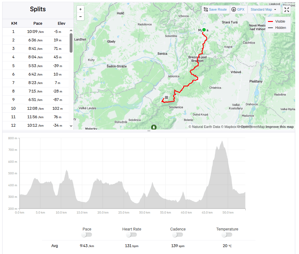
    54.2km 8:46 active time, 1733m ascend

  • SNP girl’s project deň 4

    SNP girl’s project deň 4

    Štartujeme 8:30 ráno v Myjave, po 2 hodinách v aute sa stuhnutému telu veľmi nechce. Mierime na Bradlo. Bradlo je najvyšší vrch Myjavskej pahorkatiny. Známy je však hlavne tým, že na jeho vrchu stojí mohyla M.R. Štefánika.

    Mohyla M.R.Štefánika

    Pod Bradlom je krásne zrekonštruovaná chata Bradlo, kde sme si dali skvelé kapučíno.

    Prvá občerstvovačka

    Z Bradla prebehneme Brezovou pod Bradlom, celkom dlhý asfaltový úsek strieda stúpanie. Znovu sa ocitáme v lese, ktorý je krásne prevoňaný medvedím cesnakom. Užívame si prvú jarnú zeleň.

    Krásne, človekom minimálne ovplyvnené lesy

    Zachádzame z trasy na dobrovodský hrad, veĎ sily ešte máme a tabuľka ukazuje len 10 minút. Hrad dobrá voda, je gotický hrad, teda už len zrúcanina ležiaca v strednej časti Malých Karpát a je súčasťou prírodnej rezervácie Slopy, zaberajúca 8467 metrov štvorcových. Názov hradu je odvodený od početných vodných prameňov v okolí. Hrad je dnes v stave rozvalín. Zo stavieb sa zachovala časť muriva s opevnením a zvyšky niekoľkých stavieb. Do procesu jeho deštrukcie zasahuje i množstvo náletovej zelene, ktorá celým objektom prerastá. Napriek tomu jeho ruiny sú malebným doplnkom tejto časti malokarpatskej krajiny.

    Dobrá voda

    Zbiehame do obce Dobrá voda, kde nás už čaká Jožko, ktorý k nám bežal z ciela, kde odparkoval auto. Má pre nás nie úplne potešujúcu správu, že do ciela to máme ešte 25 km (rátali sme s 19timi). Už sa ale inak nedá, len ísť 😀 Stúpame k Mihalovej, kde sa nachádza krásna útulňa Jozefa Maka slúžiaca hlavne diaľkovým turistom.

    Slnko svieti a teplota stúpa, voda nám už dávno prestala chutiť a snívame o nealko radleri, alebo kofole. Mňa začínajú trápiť kolená, kvôli zanedbanej jóge sa začali ozývať ITB šľachy.

    Jožko však dvíha morálku, pri chatovej oblasti zbadal tabuľku, že ak si zájdeme 250 metrov, tak by sme mali dojsť ku krčme u Stana. Neváhame, a o 5 minút si už užívame svieži pomelo grep radler.

    Nasleduje nepríjemný úsek po asfaltke bez chodníka, keĎže je to hlavná cesta, máme z toho nepríjemný pocit. Našťastie je to asi len kilometer a znovu vbiehame medzi stromy. Nasleduje stúpanie na Záruby. záruby sú najvyšším vrchom Malých Karpát.

    Cestou na Záruby

    Na mnohých častiach vystupujú vápencové bralá, charakteristické pre túto časť pohoria. Poskytujú zaujímavé pohľady na okolie. Na vrchole stojí kríž.

    Nepríjemný úsek na Hrad Ostrý kameň
    Ruiny hradu Ostrý kameň

    Hrad Ostrý kameň bol pohraničný hrad postavený na ochranu Českej cesty v 13. storočí. Po poškodení za Rákociho povstania sa hrad zmenil na ruiny. BOl postavený na konci strmého horského hrebeňa, od ktorého ho oddeľuje priekopa vysekaná do skaly. Skladal sa z obytného paláca, pozorovacej a strážno-obrannej hranolovej veže.

    Nasleduje prudký zostup, kde už moje kolená značne trpia. Ešte 2 kilometre asfaltom k autu a sme v ciely. Vyprahnutý otvárame nealko radlery a dopĺňame tekutiny a cukor. Dnes to bol náročný úsek, ale vďaka tomu nás zajtra čaká už len 15km dlhá etapa.

    54.2km 8:46 aktívny čas, 1733 nastúpaných metrov

  • SNP – girl’s project #day3

    SNP – girl’s project #day3

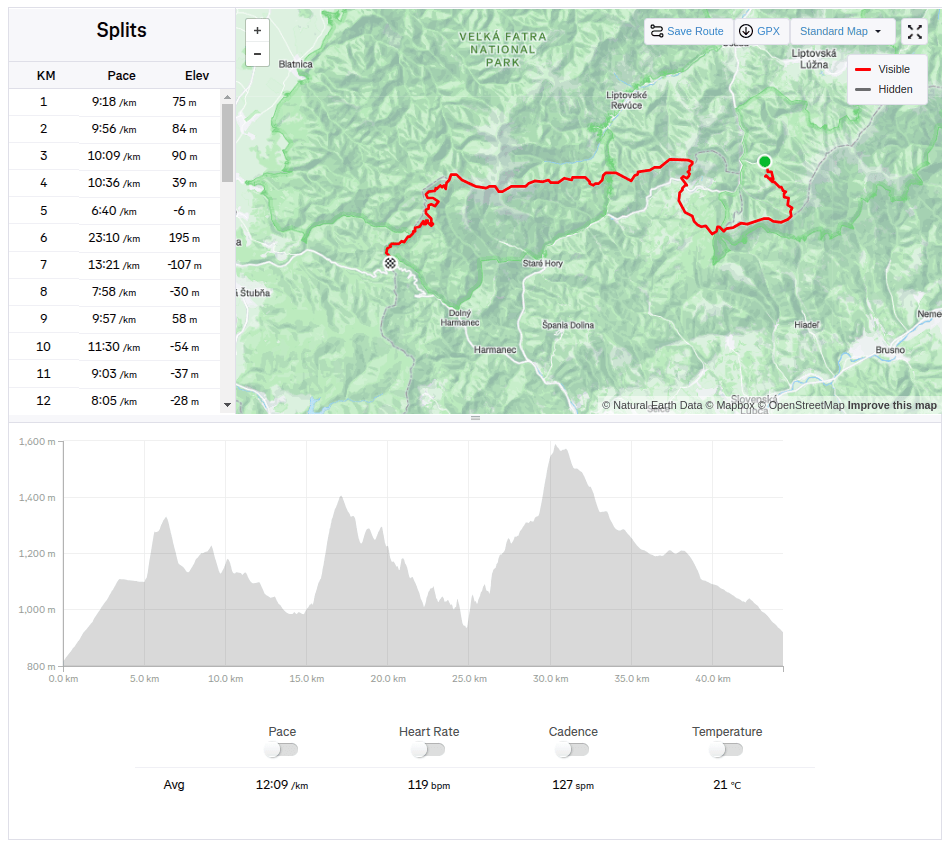
    The third stage was from Hiadeľské sedlo to Šturec sedlo. And since Hiadeľské sedlo cannot be reached by car, we had to hike there. This added the first extra kilometers to the SNP route, namely 5.1km and 287 vertical meters. However, the weather was beautiful and the initial -2degrees celsius quickly turned into plus values, so we even took off our jackets in the saddle and continued only in long-sleeved shirts. Today, the problem wasn’t that our water freeze, it was more a problem to have enough of it.

    Kozí Chrbát

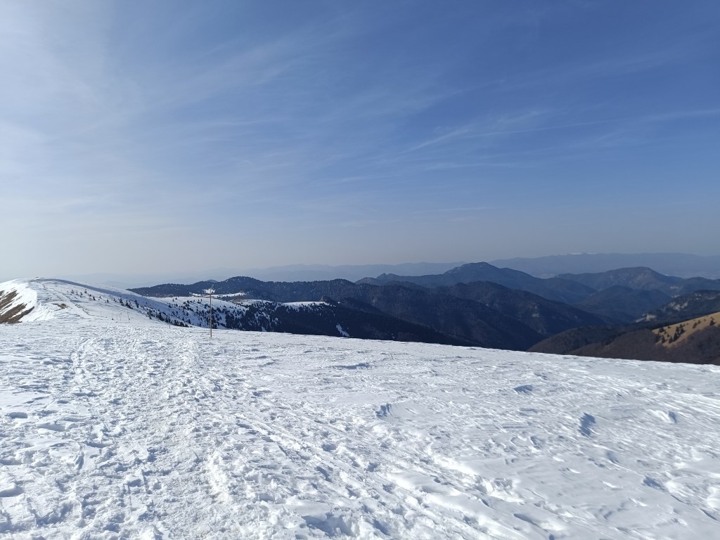
    We continue to Kozí Chrbát, a hill with a beautiful view, I definitely recommend it, then continue via Kečka to Donovaly. There is still some snow on the ridge in shady places, but most of it has already disappeared. The descent through the forest to Donovaly was worse, where ice cover is still present on the cross-country ski trails. But we managed it and in Donovaly we take a break for coffee and radler. It is warm and we are thirsty.

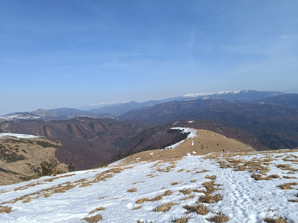
    The visibility was great, the High Tatras are visible in the background

    Refreshed, we climb to Zvolen, overcoming approximately 400 meters in altitude, but we are rewarded with great views. From Zvolen we continue along the forested ridge to the Veľký Šturec saddle (which is still quite far from the Malý Šturec saddle, where we end the stage).

    The ridge between Zvolen and Križna (in the background)

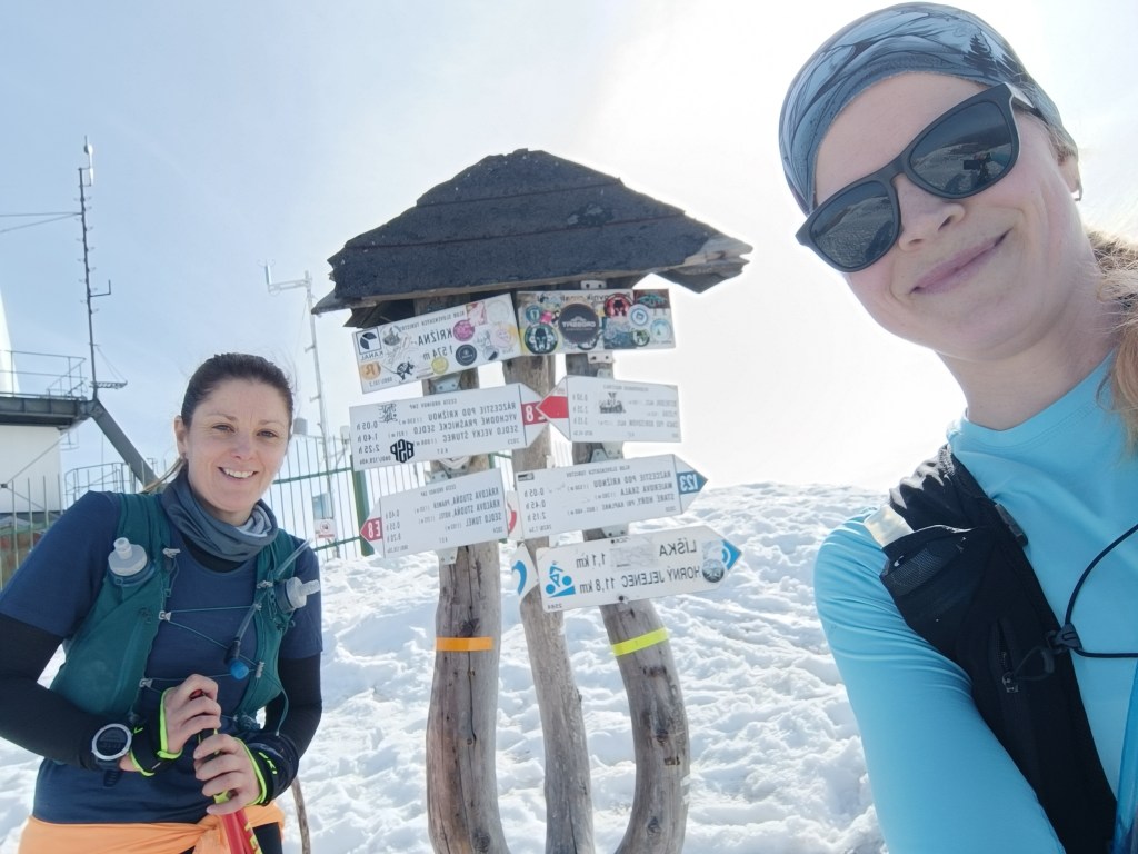
    We climb over larger and smaller hills until we reach Krížna, which is still completely covered in snow. On the last big climb we wade through the snow, our feet are wet, the snow is melting, but with the vision of the last climb we climb up to Krížna (1574 meters above sea level).

    At the bottom of climb to Križna
    And the last few metres
    Križna finally

    The descent to Kráľova studňa turns into dancing in wet snow, in some places there was up to 5 cm of water on the path. We have a flood in our shoes, but cola at Kráľova studňa raises our morale. The last 10 km downhill run to the finish. But half of them were covered in wet snow with water flowing through them.

    Cez 10km na snehu

    Jožko is waiting for us at the finish line with a non-alcoholic beer, a great surprise.

    44.33km, 2263m ascend, 8h 58 min active time, 9h 41min total
  • SNP – girl’s project #deň3

    SNP – girl’s project #deň3

    Tretia etapa bola z Hiadeľského sedla do sedla Šturec. A keďže do Hiadeľského sedla sa nedá dostať autom, tak sme si tam museli vyšľapať. Tým sme si pridali prvé extra kilometre k trase SNP, konkrétne 5.1km a 287 výškových metrov. Počasie však bolo krásne a počiatočných -2 sa veľmi rýchlo menilo na plusové hodnoty, v sedle sme už dokonca vyzliekali bundy a pokračovali len v tričkách s dlhým rukávom. Dnes nám voda veru nezamrzla, skôr bol problém, aby sme jej mali dosť.

    Kozí Chrbát

    Pokračujeme na Kozí chrbát, krásny výhľadový kopec, určite ho odporúčam, ďalej cez Kečku na Donovali. Na hrebeni sa v tienistých miestach ešte trochu drží sneh, ale väčšina z neho už zmizla. Horši bol zostup lesom na Donovaly, kde sa na bežkárskych trasách drží ľadová pokrývka. Ale zvládli sme a na Donovaloch si dávame pauzu na kávu a radler. Je teplúčko a voda v nás len tak mizne.

    Viditeľnosť bola skvelá, v pozadí vidno Vysoké Tatry

    Osviežené stúpame na Zvolen, prekonávame približne 400 výškových metrov, ale sme odmenenné parádnymi výhľadmi. Zo Zvolena pokračujeme zalesneným hrebeňom, do sedla Veľký Šturec (ktorý má teda do sedla Malý Šturec kde končíme etapu ešte poriadne ďaleko)

    Hrebeňom medzi Zvoelnom a Križnou (v pozadí)

    Preliezame väčšie aj menšie kopčeky až sa dostávame pod Krížnu, ktorá je ešte celá zahalená snehom. Posledné veľké stúpanie sa brodíme snehom, nohy mokré, sneh sa topí, ale s vidinou posledného stúpania šlapeme hore na Krížnu (1574mnm).

    Začíname stúpať na Krížnu
    Posledných pár metrov
    Na Krížnej

    Zbeh na Kráľovu studňu sa mení na tancovanie v mokrom snehu, miestami na cestičke stojí aj 5 cm vody. V teniskách máme potopu, ale kofola na Kráľovej studni zdvíha morálku. Ešte posledných 10 km zbeh do ciela. Akurát, že polka z nich bola pokrytá mokrým snehom pomedzi ktorý tiekla voda.

    Cez 10km na snehu

    V ciely nás už čaká Jožko s nealko pivkom, parádnym prekvapením.

    44.33km, 2263m stúpania, 8h 58 min aktívny čas, 9h 41min total