Tag: trail

  • Vyhne, Repište, Červená Studňa

    Vyhne, Repište, Červená Studňa

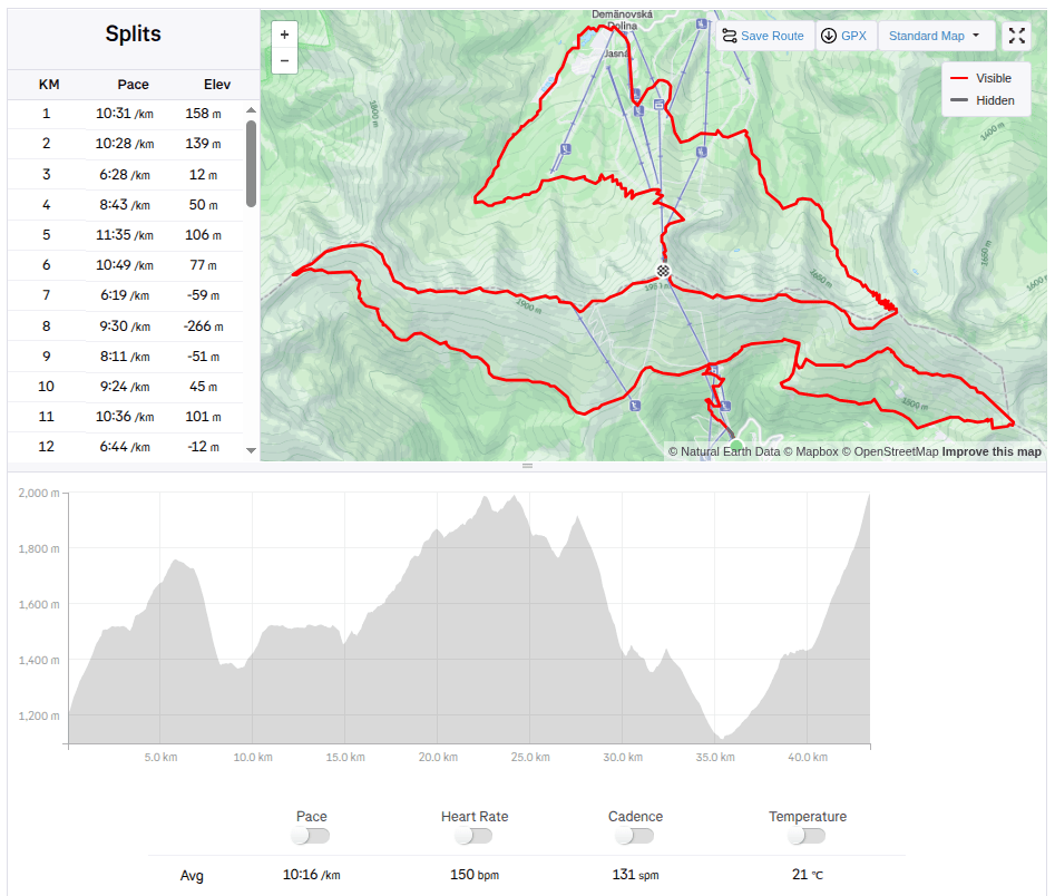
    Running at the beginning of March can still be treacherous, there can still be quite deep snow fields in the mountains, especially in shady sections the snow sometimes last until May. So we chose the route at lower altitudes. And this route is absolutely ideal for spring, it is runnable, often leads through meadows that would be too hot from the sun in summer. And in the middle of the hill there is a Hájovňa, where you can buy coffee, radler, cookies…

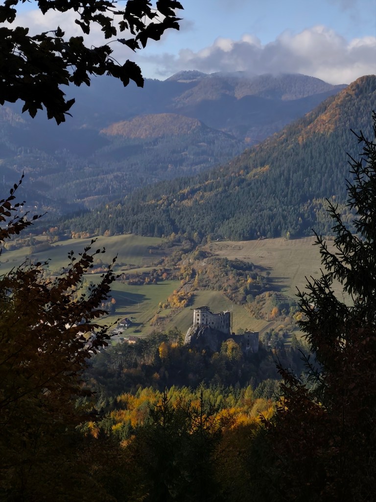
    I recommend the route in this direction, with the first stop near Repiste, where Marcus Castle is located. It is a replica of a medieval castle, which was built only in the 21st century. It includes the Chapel of St. Barbara, which is one of the stops on the Barbora Trail. The chapel stands on the spot where miners once stopped on their way to work and prayed to their patron saint for good luck and protection. However, you will not be able to get to the bottom, as it is private property that is not accessible to the public.
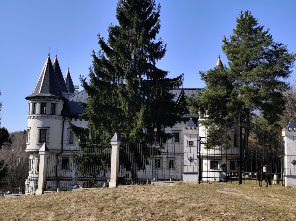
    Marcus

    From the Marcus Castle we continue along the Barborska Road to the Červená Studňa saddle, where the Červená Studňa tajch and Hájovňa are located. The construction of the tajch was designed by J. K. Hell. He wanted to use its strategic location to build a driving ditch that would bring water to the Amália shaft to power a water column pumping machine.
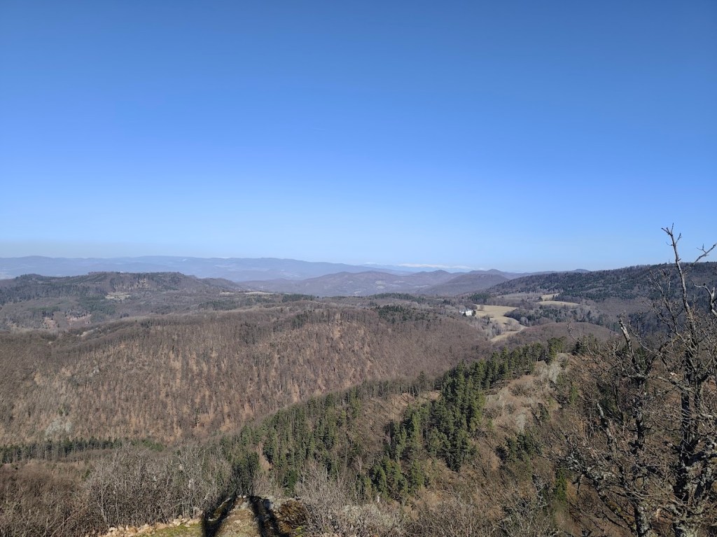
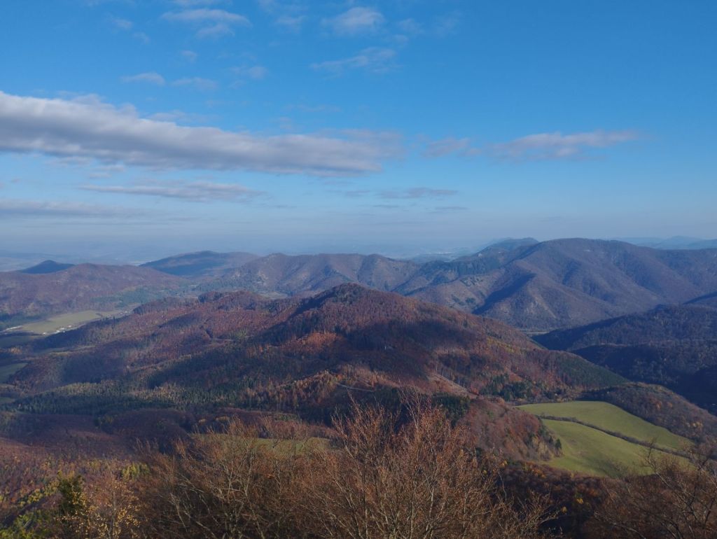
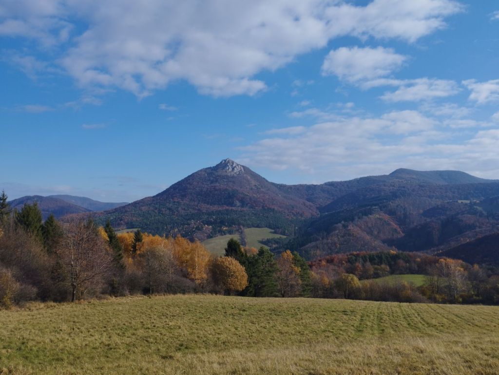
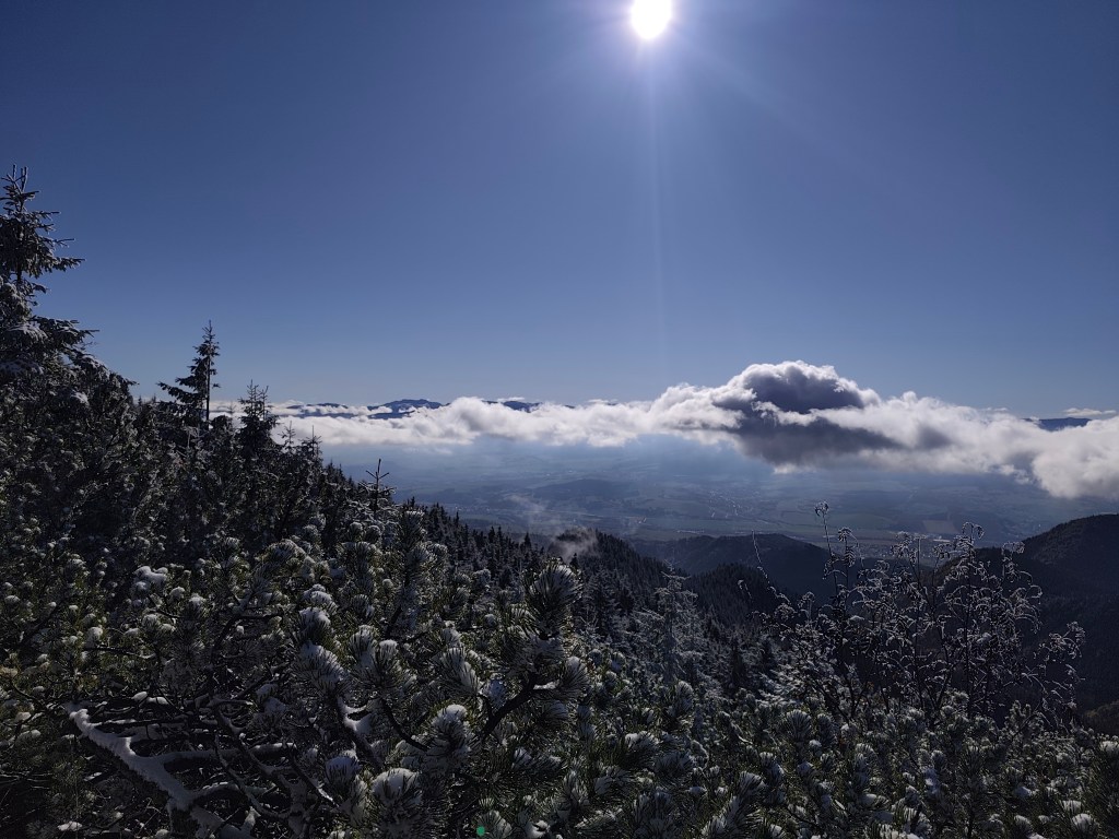
    This route has a lot of beautiful views

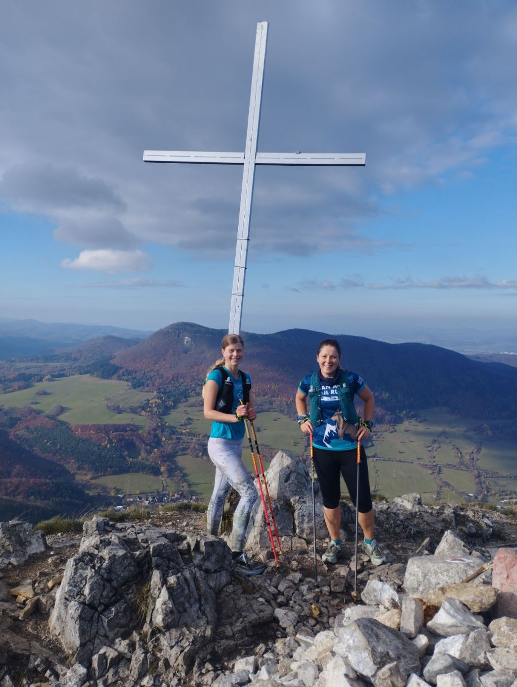
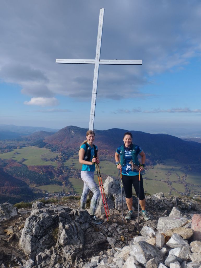
    We had coffee and a radler in Hájovňa, and since it was warm, we enjoyed them in the sun on a bench in front of Hájovňa. Back to Vyhne we went along the ridge on the opposite side of the valley, along the Andrej Kmeť educational trail. This is a nice cycle path, which also offers views of the Marcus Castle. We turn off cycle path to follow yellow marking and to see the views from Jelenia skala. From its top, under favorable conditions, you can see the beautiful landscape from Tribeč to the Low Tatras. From the surrounding hills, you will see Vtáčnik, Kremnické vrchy or Pohronský Inovec.
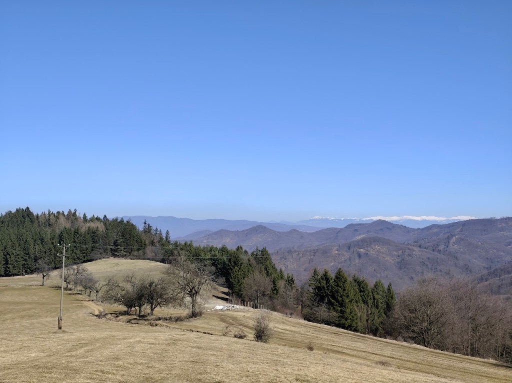
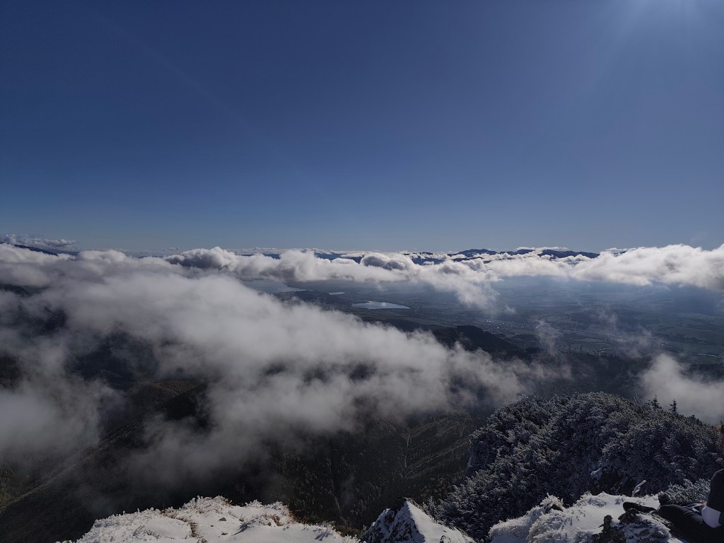
    Snow covered Lower tatras in the background

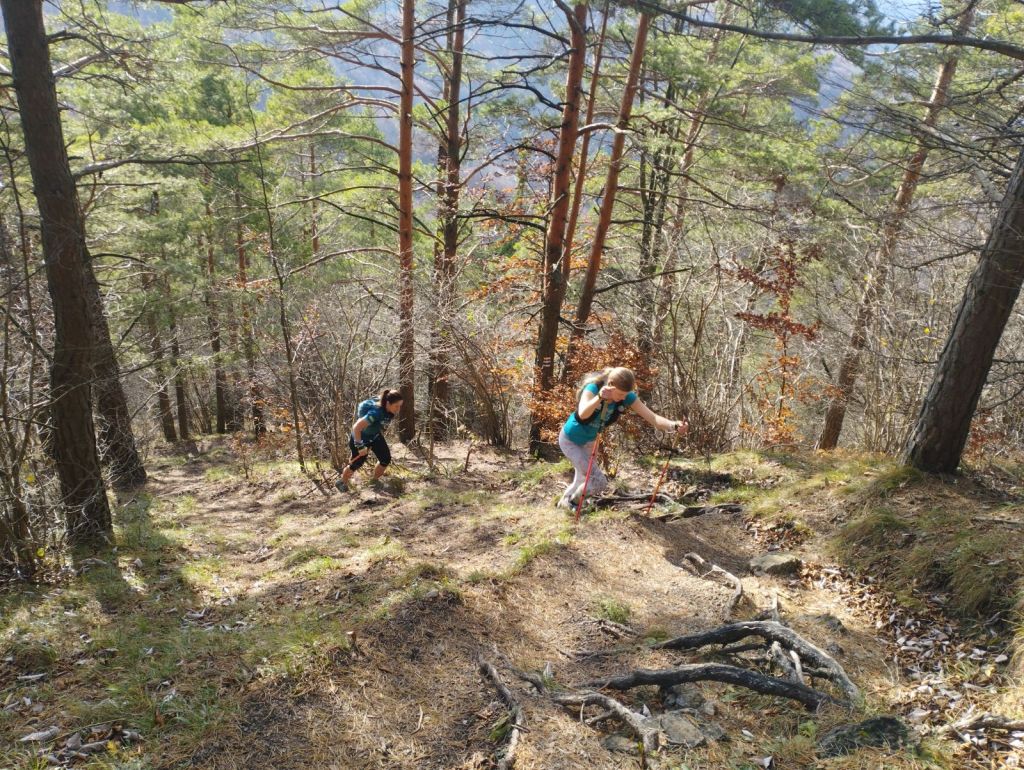
    From Jelenia skala we descend along the green path down to the valley and make up for the lost meters by climbing steeply along an unmarked forest path. We reach a not-so-used green tourist trail and follow it, descending slightly, to Hájska skala.
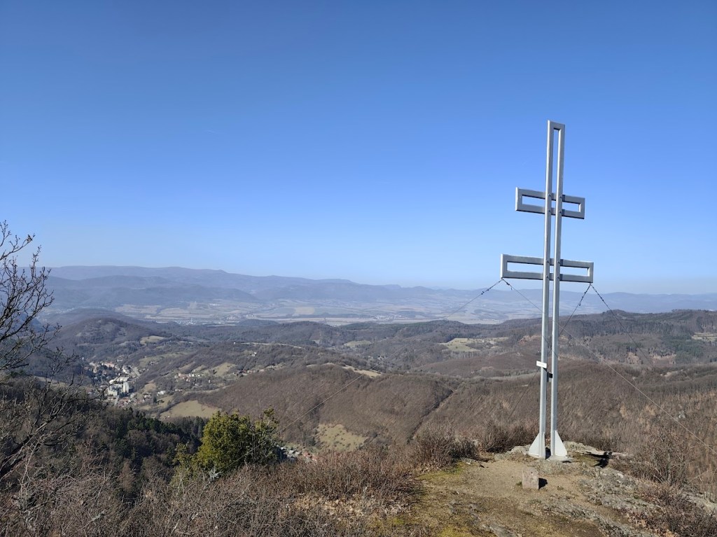
    Cross on the top of Jelenia skala

    We return to the parking lot past the spa chapel of Our Lady of the Crown. This is an early work of the famous architect Ladislav Hudec. It survived the devastating spa fire in 1945 and today stands on a hill above the village as a monument to the spa’s past glory, hiding a sculpture of St. John of Nepomuk.
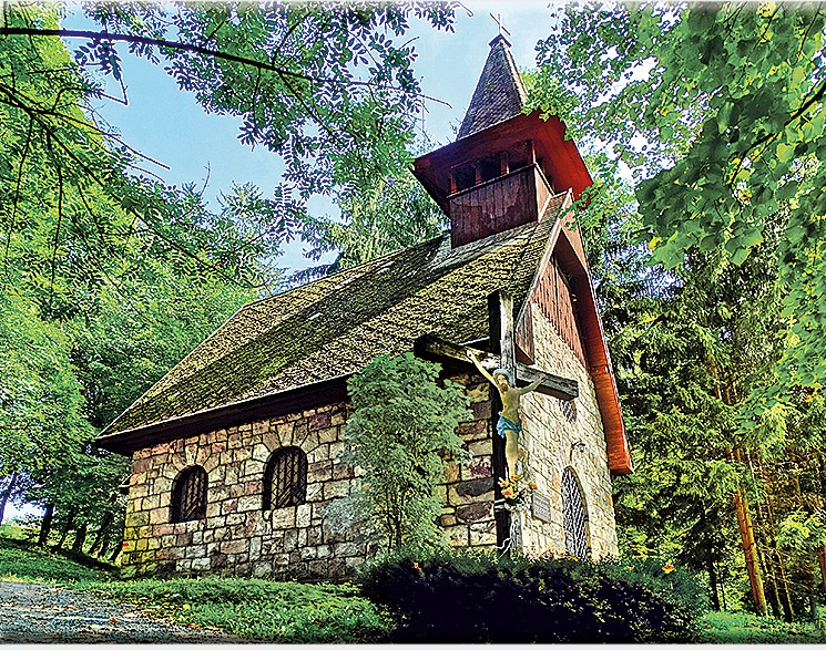
    The chappel (source internet)
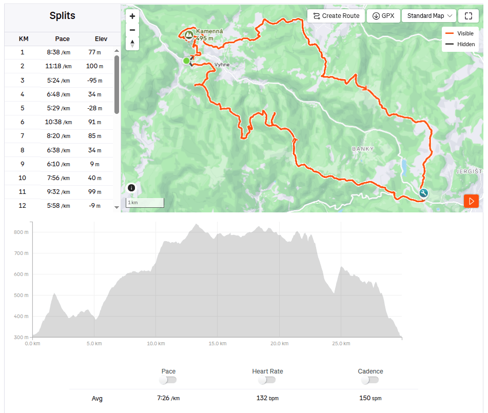
    29.93km, 3:42 active time, 4:18 total, 1233 m ascend
  • Vyhne, Repište, Červená Studňa

    Vyhne, Repište, Červená Studňa

    Behať na začiatku marca môže byť ešte zradné, na horách ešte môžu byť celkom hlboké snežné polia, hlavne v tienistých úsekoch sa niekedy držia až do mája. A tak sme trasu vyberali v nižších nadmorských výškach. A táto trasa je úplne ideálna na jar, je behateľná, caštokrát vedie lúkami, ktoré by boli v lete príliš prehriate od slnka. A v polke sa nachádza Hájovňa, kde sa dá kúpiť káva, radler, koláčik…

    Trasu odporúčam v tomto smere, s prvou zastávkou neďaleko Repisťa, kde sa nachádza hrad Marcus. Ide o repliku stredovehého hradu, ktorý bol však postavený až v 21. storočí. Jeho súčasťou je Kaplnka sv. Barbory, ktorá je jedným zo zastavení Barborskej cesty. Kaplnka stojí na mieste, kde sa kedysi baníci pristavovali cestou do práce a modlili sa k svojej patrónke za dobrú fáračku a ochranu. Dnu sa však nedostanete, ide o súkromný majetok, ktorý nie je prístupný verejnosti.

    Hrad Marcus

    Z hradu Marcus pokračujeme Barborskou cestou až do sedla Červená Studňa, kde sa nachádza rovnomenný tajch a Hájovňa. Stavbu tajchu navrhol J. K. Hell. Chcel využiť jeho strategickú polohu na vybudovanie náhonného jarku, ktorý by privádzal vodu k šachte Amália na pohon vodostĺpcového čerpacieho stroja.

    Trasa ponúka veľa krásnych výhľadov

    V Hájovni sme si dali kávu a nealko radler, a keďže bolo teplo, užili sme si ich na slniečku na lavičke pred Hájovňou. Naspäť do Vyhní sme sa vybrali po hrebeni na opačne strane doliny, po náučnom chodníku Andreja Kmeťa. Ide o peknú cyklocestu, ktorá ponúka aj výhľady na už spomínaný hrad Marcus. Z cyklotrasy odbáčame na žltú, ideme si pozrieť výhľady z Jelenej skaly. Z jej vrcholu možno za priaznivých podmienok vidieť nádhernú krajinu od Tribeča až po Nízke Tatry. Z okolitých vrchov sa vám predvedie Vtáčnik, Kremnické vrchy či Pohronský Inovec.

    Zasnežené Tatry v pozadí

    Z jelenej skaly zbiehame zelenou až dole do údolia a stratené metre zas prudko nastúpavame neznačenou lesnou cestou. Dostávame sa na nie veľmi využívanú zelenú turistickú značku a po nej miernym klesaním zbiehame až na Hájsku skalu.

    Kríž na vrchu Jelenej skaly

    Na parkovisko sa vraciame aj popri kúpeľnej kaplnke Panny Márie Kráľovnej. Ide o rané dielo známeho architekta Ladislava Hudeca prežilo ničivý požiar kúpeľov v roku 1945 a dnes stojí na kopci nad obcou ako pamätník zašlej slávy kúpeľov, ukrývajúci plastiku sv. Jána Nepomuckého.

    Kaplnka (zdroj internet)
    29.93km, 3:42 aktívny čas, 4:18 celkovo, 1233 nastúpaných metrov
  • SNP girl’s project day 9

    SNP girl’s project day 9

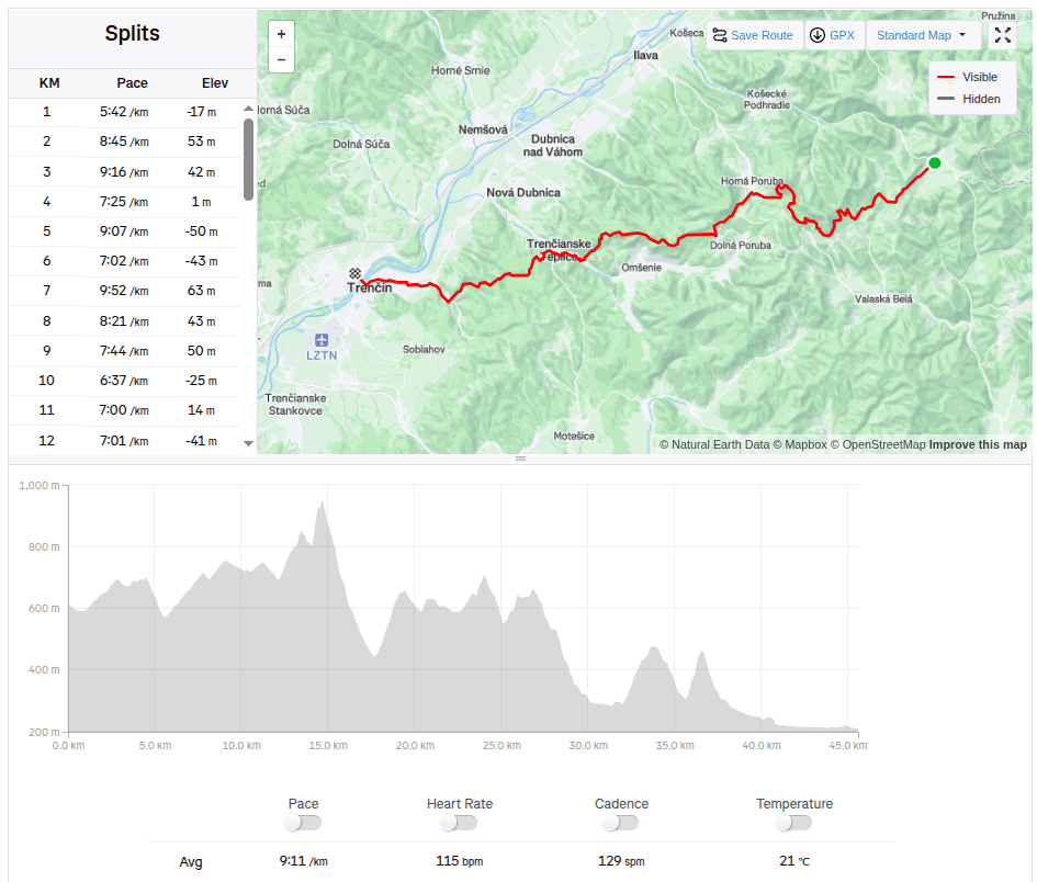
    This time we had a 45km long stage from Zliechov to Trenčín. In the morning at 7:00 we stopped the car in front of the same grocery store where we ended the stage last time. It was an above-average warm day for November, the sun shone through the clouds, ideal weather for running.

    Steep part of the climb

    The path undulated up and down through meadows, later turning into a forest path and we slowly climbed to Vápeč. The climb was long, I think about 10 kilometers, but only very gentle. The very end was steeper, but Vápeč rewarded us with a beautiful circular view of the wide surroundings.

    On Vápeč
    View from Vápeč

    Then we descended to Horná Poruba and continued along a long forest path covered with leaves. The leaves covered puddles, mud and even roots or stones, so each of us jumped into at least one puddle. Somewhere near the stone gate we met Jožko, who was going to drive the car to the destination in Trenčín and was running towards us. We were all looking forward to some refreshments in Trenčianske Teplice. We found a pub by the lake and the non-alcoholic radler just disappeared inside us.

    After Horná Poruba

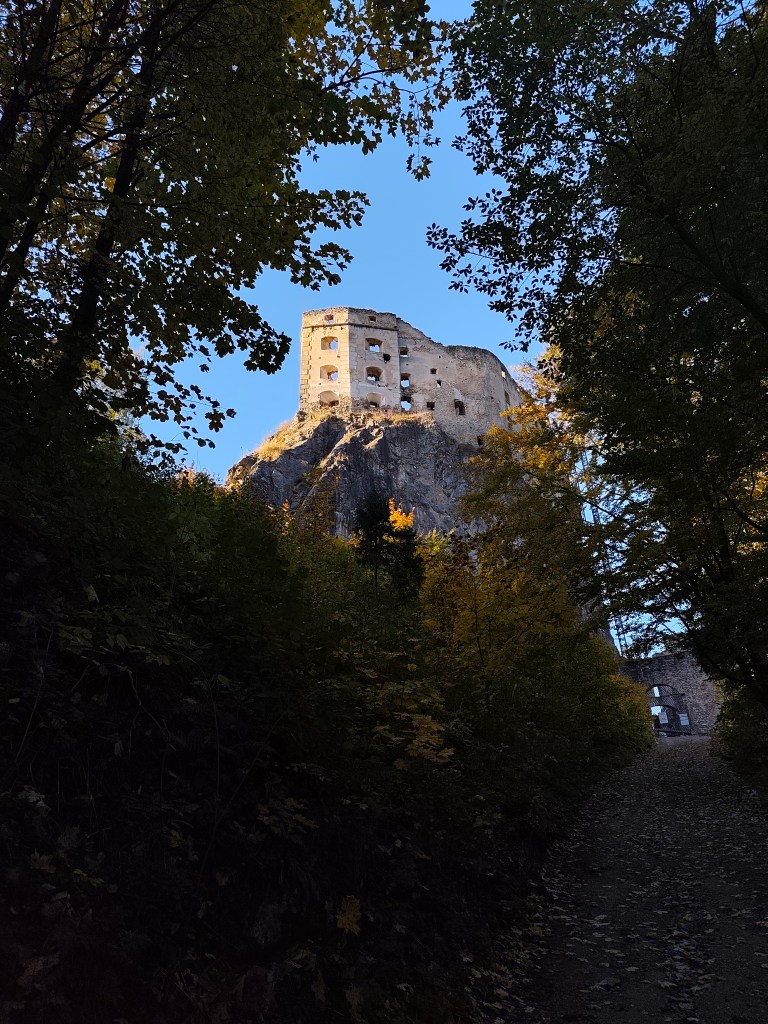
    From Teplice to Trenčín it was again a leafy forest path, so to speak just over the hill. However, Trenčín tormented us, 5 kilometers on asphalt, running from one side of the road to the other and the only interesting thing it offered us along the way was the silhouette of the castle in the background.

    But overall we enjoyed it, this autumn day was perfect for such a beautiful stage with rustling leaves.

    45.5km, 6h 58min, 1645 m ascend
  • SNP girl’s project deň 9

    SNP girl’s project deň 9

    Tento krát na náš čakala 45km dlhá etapa zo Zliechova do Trenčína. O 7mej ráno sme zastavili auto pred tými istými potravinami, kde sme minule končili etapu. Na november bol nadpriemerne teplý deň, slniečko presvitalo cez oblaky, ideálne počasie na behanie.

    Strmá časť výstupu

    Cestička sa vlnila hore dole lúkami, neskôr sa zmenila na lesnú cestu a pomaly sme stúpali na Vápeč. Stúpanie bolo dlhé, hádam aj 10 kilometrov, ale len veľmi mierne. Až samotný záver bol strmší, ale zato nás Vápeč odmenil krásnym kruhovým výhľadom do širokého okolia.

    Na vrchu Vápeč
    Výhľady z Vápeču

    Následne sme sklesali do Hornej Poruby a pokračovali dlho lesnou cestou pokrytou lístím. Lístie zakrývalo mláky, bahno a aj korene či kamene, takže každý z nás skočil aspoň do jednej mláky. Niekde pri kamenných vrátach sme stretli Jožka, ktorý išiel zaviezť auto do cieľa v Trenčíne a bežal nám oproti. Už sme sa všetci tešili na nejaké ošvieženei v Trenčianskych Tepliciach. Našli sme si krčmičku v baračke pri jazierku a nealko radler v nás len tak mizol.

    Za Hornou Porubou

    Z Teplíc do Trenčína to bolo zas lístím zapadaním lesním chodníčkom, tak povediac len cez kopec. Trenčín nás však vytrápil, 5 kilometrov po asfalte, prebiehanie z jednej strany cesty na druhú a jediná zaujímavosť čo nám po ceste ponúkol, bola silueta hradu v pozadí.

    Ale celkovo sme si to užili, tento jesenný deň bol ako stvorený na takúto krásnu etapu šuchotavím lístím.

    45.5km, 6h 58min, 1645 nastúpaných metrov
  • Veľký choč

    Veľký choč

    A beautiful sunny autumn Sunday, perfect for the mountains.

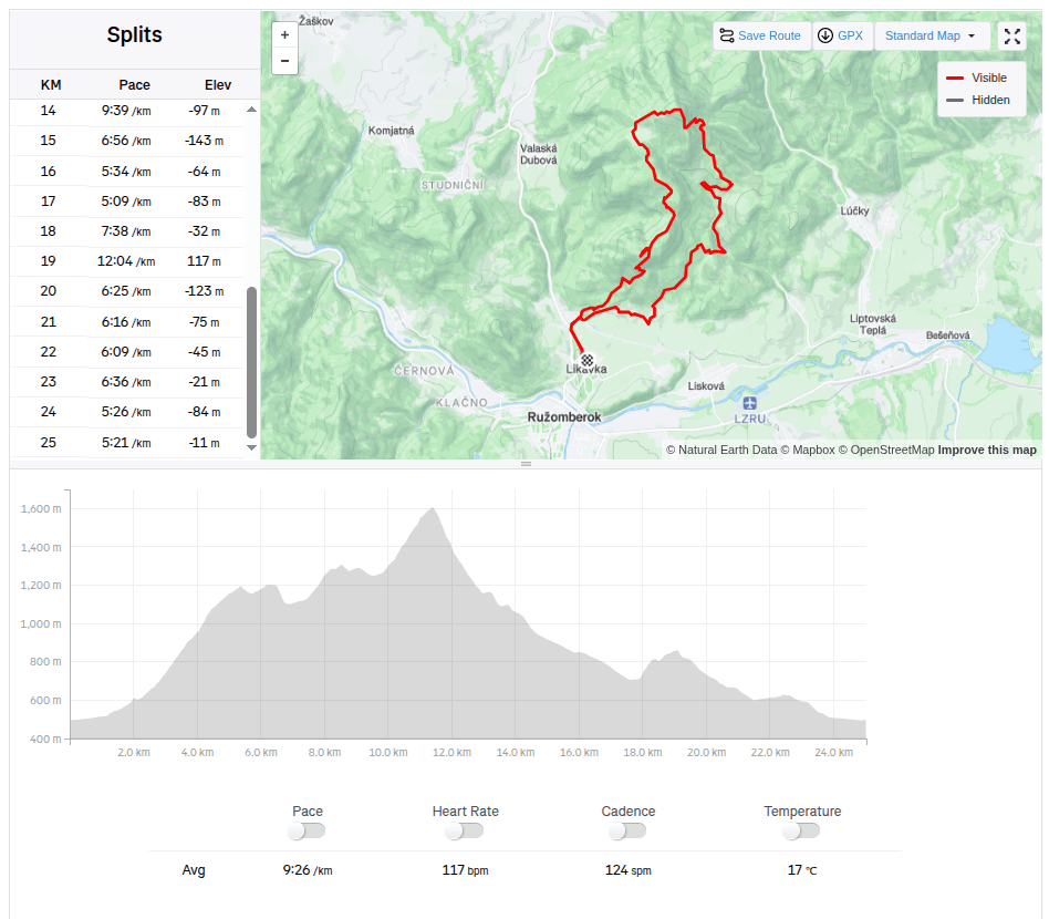
    We started in Likavka near Ružomberok and after just a few kilometers we came across the first attraction – Likavka Castle, but we only saw its outer walls because it has been closed for a long time due to reconstruction.

    Castle Likava

    Even so, it stands majestically on the rocky spur of Predný Choč and is worth visiting, as Likava is one of the largest castle buildings in central Slovakia, and the massiveness and height of the palace-like complex of the upper castle (more than 36 m measured at the highest point of the northern palace) ranks it among the highest castles in Slovakia.

    Výhľad na hrad Likava

    We continue with the red mark, at the crossroads we also go to a viewpoint on a meadow below the peak of Predný Choč. The viewpoint is located at an altitude of 1170 m above sea level and consists of a meadow, surrounded by a forest on three sides. The viewpoint provides a view mainly to the south. From the viewpoint we will have a view of the city of Ružomberok, the Dolný Liptov region and the Veľká Fatra and Nízke Tatry mountains.

    At the Spuštiak saddle we continue to Stredná Poľana, from where we choose the winter road to Veľký Choč.

    Veľký Choč (1,611.0 m above sea level) is the highest peak in the Choč Mountains in Slovakia. The peak is very popular with tourists. It has the shape of an irregular pyramid with numerous cliffs. There is an excellent circular view from the top of Choč. Its peak is covered with pine trees, from Valaská Dubová it has a slightly rising shape, while from the north and from Lúčky it is in a steep slope. And it was this steep slope that we descended. Due to the snow, mud and rocky ground, we descended carefully and slowly. Fortunately, the most dangerous places were secured with chains.

    At Žimerová we turned off the red one and headed towards Turícký tajch. It is a really small body of water, but at least it served as a reference point for us (we turned off here onto an inconspicuous forest path, which led us back to the blue tourist trail. We continued along the blue trail to Likavka (well, almost, because we took a wrong turn and ran across the field to the castle :D)

    25km, 3h56min active time, 4:38 total, 1566 metre ascend
  • Veľký choč

    Veľký choč

    Krásna slnečná jesenná nedeľa ako stvorená na hory.

    Začínali sme v Likavke pri Ružomberku a už po pár kilometroch sme natrafili na prvú zaujímavosť- hrad Likava, videli sme však len jeho vonkajšie múry, pretože je z dôvodu rekonštrukcie dlhodobo uzavretý.

    Hrad Likava

    Aj tak sa majestátne vypína na skalnatom výbežku Predného Choča a stojí za to ho vdieť, keďže Likava patrí k najväčším hradným stavbám na území stredného Slovenska, mohutnosťou a výškou palácovitého komplexu horného hradu (viac ako 36 m nameraných v najvyššom bode severného paláca) sa zaraďuje medzi najvyššie hrady na Slovensku.

    Výhľad na hrad Likava

    Pokračujeme červenou značkou, na rázcestí zachádzame aj na vyhliadkové miesto na lúke pod vrcholom Predného Choča. Vyhliadka sa nachádza vo výške 1170 m n. m. a tvorí ju lúka, okolo ktorej je z troch strán les. Vyhliadka poskytuje výhľad najmä na juh.  vyhliadky sa nám naskytne výhľad na mesto Ružomberok, región Dolný Liptov a pohoria Veľká Fatra a Nízke Tatry.

    V sedle Spuštiak pokračujeme na Strednú Poľanu, z ktorej volíme zimnú cestu na Veľký Choč.

    Veľký Choč (1 611,0 m n. m.) je najvyšší vrch v Chočských vrchoch na Slovensku. Vrchol je turisticky veľmi vyhľadávaný. Má tvar nepravidelnej pyramídy s početnými bralnými partiami. Z vrcholu Choča je vynikajúci kruhový výhľad. Jeho vrchol je porastený kosodrevinou, od Valaskej Dubovej má mierne stúpajúci tvar, kým zo severu a od Lúčok je v príkrom zráze. A práve týmto príkrym zrázom sme zostupovali. Kvôli snehu, blatu a skalnatému podložiu sme zostupovali opatrne a pomaly. Najnebezpečnejšie miesta boli naštastie istené reťazami.

    Na Žimerovej sme z červenej odbočili a nasmerovali sme si to k Turíckemu tajchu. Jedná sa o naozaj maličkú vodnú plochu, ale aspoň nám poslúžil ako orientačný bod (odbočili sme tu nenápadnou lesnou cestičkou, ktorá nás naviedla zas na modrú turistickú značku. Po modrej sme už pokračovali až do Likavky (teda skoro, lebo sme zle odbočili a ponad pole sme zas zbehli až k hradu:D)

    25km, 3h56min aktívny čas, 4:38 spolu, 1566 nastúpaných metrov
  • Slovenia 2025

    Slovenia 2025

    4 day short trip to Slovenia, on the edge of Triglav National Park. The guys were running the Julian Alps Trail Run and Lucka and I went to support them and do a little running.
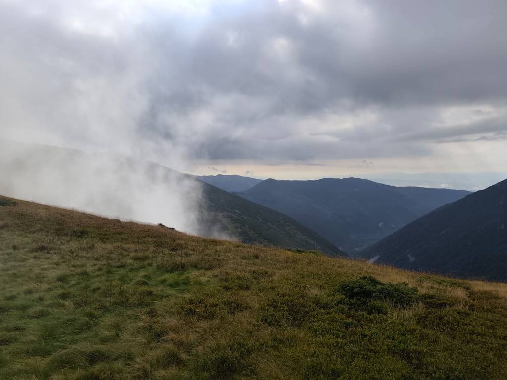
    The first day we arrived in the afternoon so the only thing on the to do list was to find a good restaurant, buy groceries and see Lake Jasna.

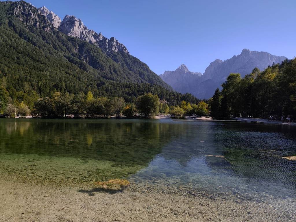
    Lake Jasna is the name of two interconnected lakes located just a short distance from Kranjska Gora. It is an alpine lake with crystal clear water and breathtaking mountain scenery.

    We also walked through the center of Krajnska Gora, where it was already bustling with the upcoming race. It is a smaller alpine town with a bunch of good restaurants and stalls in the center.

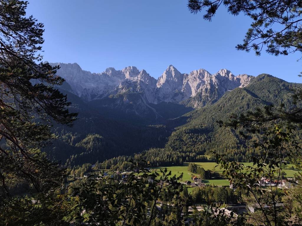
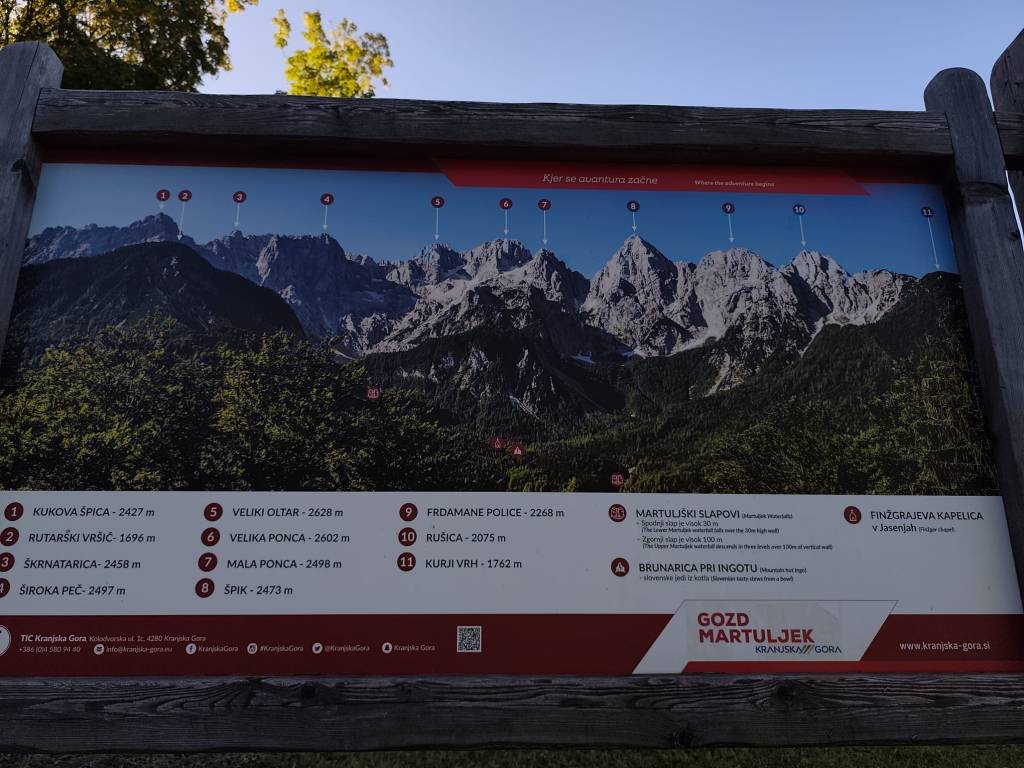
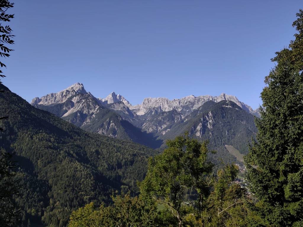
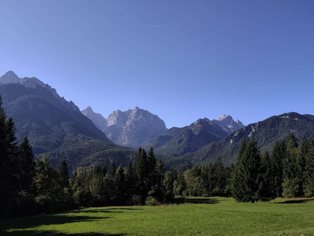
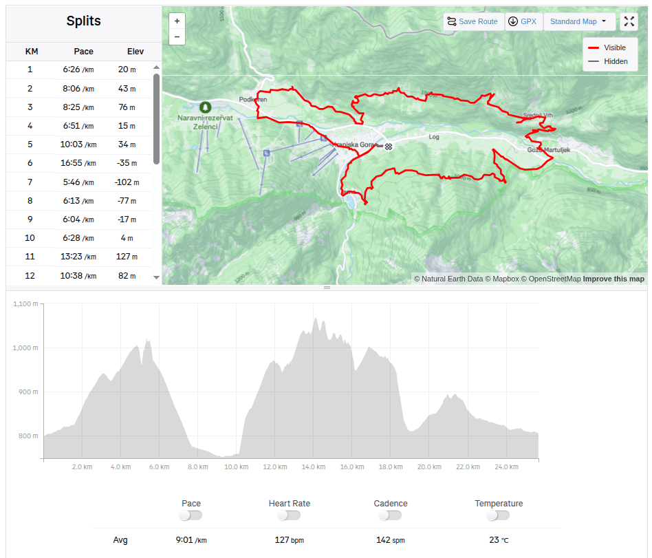
    The guys were supposed to start on Friday evening, and Lucka and I went to run one of the shorter routes from the Julian Alps Trail Run in the morning. We chose a 25km route that took us into the hills above the valley with great views of the Julian Alps, especially the Špik peak. But for our taste, there was quite a lot of asphalt on this route and not enough water:D It took us almost 4 hours to run. In the afternoon, we returned to the restaurant from the previous day (Figo restaurant) where we really enjoyed it.

    25.67km, 3h 51min, 875m ascend

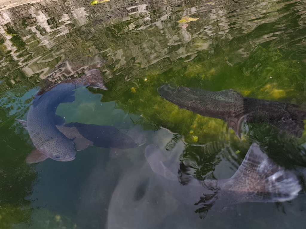
    On Saturday, the plan was to encourage the boys, so we packed the stroller and bike for Anton and ran 15km to the village of Gozd Matjulek – on the way we noticed a turnoff to the waterfalls and that really caught my attention. I would have liked to see them. But there was no time, we got to the refreshment station about half an hour before Jožko, so for now we walked through the village of Dovje, in the middle of it there was a reservoir with water and giant trout in it.

    Trouts

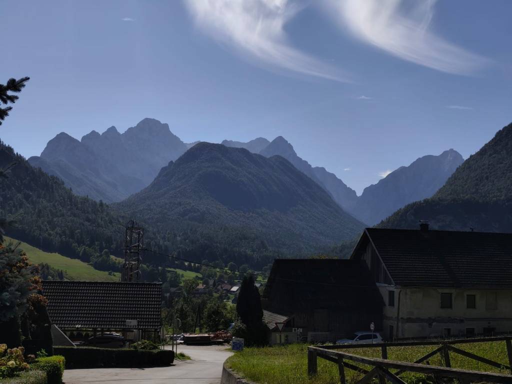
    And it had beautiful views of the Alps. Jožko finished his 107 kilometer at about 3 pm, he was really overheated and his stomach was protesting, but his legs were still going. Miloš was supposed to arrive at 6 pm and that was quite late, we couldn’t wait for him. So we continued running to the last refreshment stop and from there quickly to the finish line where we managed to arrive before Jožko by about a minute 🙂

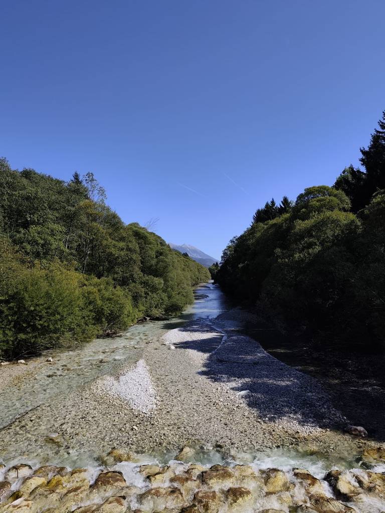
    From cycle path to Dovje

    And since we wanted to encourage Miloš too, we went back for the last refreshment stop and then back to the finish line. Both guys did it brilliantly in under 24 hours.

    Village Dovje

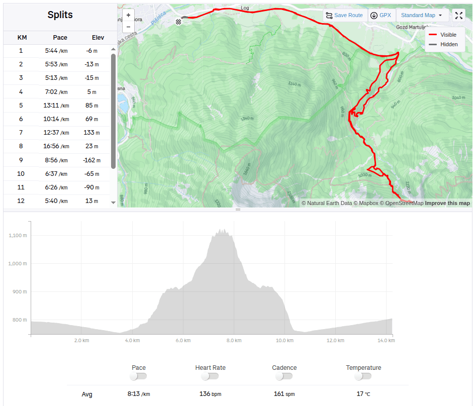
    On Sunday, no one wanted to go, but I just couldn’t get the waterfalls out of my head, so I set my alarm so I could get around them before the planned departure at 10 a.m. After 3 kilometers of asphalt, I ran into the Martujlek Valley, which is named after the Martujlek stream, which springs high in the mountains. As the stream descends, beautiful waterfalls appear.

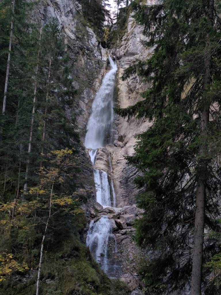
    The Lower Martuljek Waterfall is the largest and most impressive of the waterfalls, cascading into a picturesque canyon from a height of over 50 meters. It can be admired from viewing platforms on the hiking trail.

    Lower Martuljeks waterfall

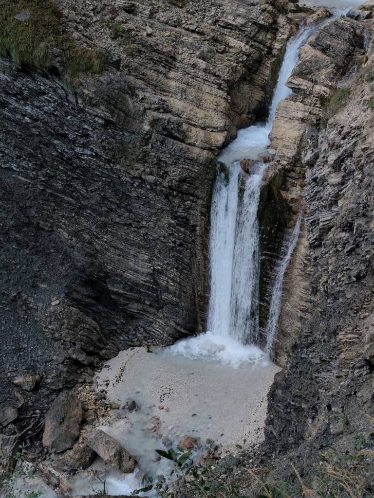
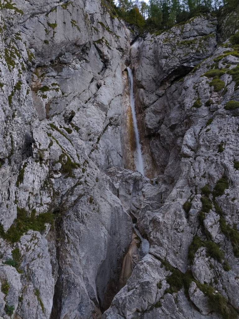
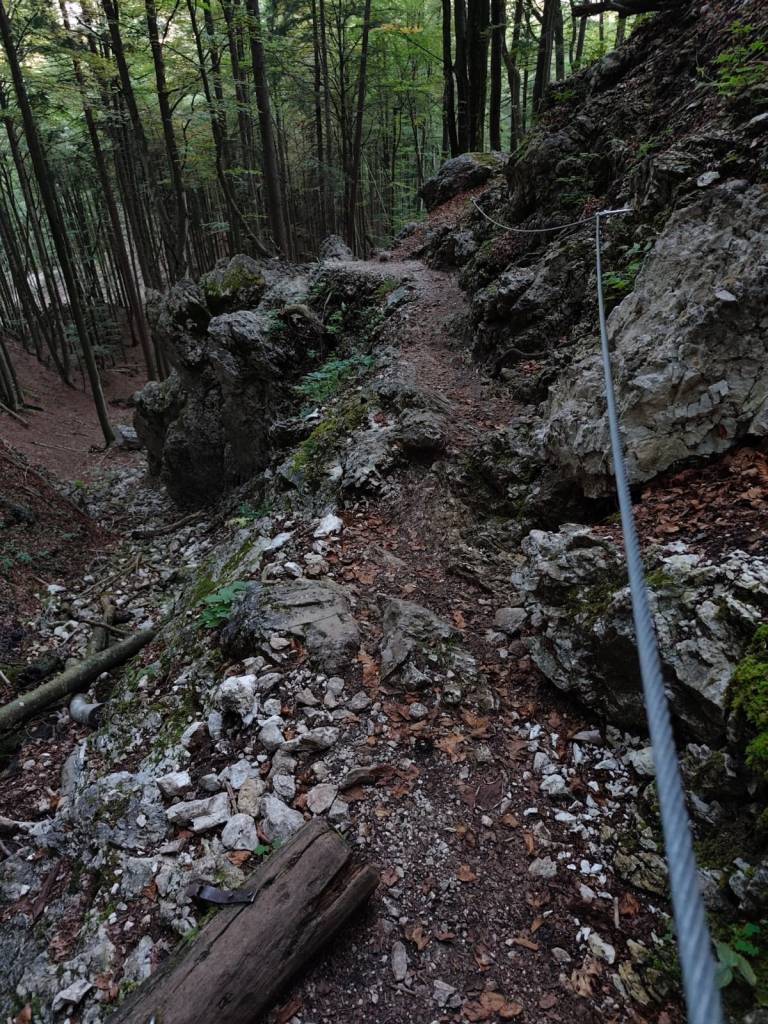
    Above the lower waterfall is the upper Martuljek waterfall, a hidden gem hidden among the rocks of the gorge. The upper waterfall is smaller, but no less magnificent. It is reached by a path secured with safety ropes.

    Upper Martuljeks waterfall
    Some parts of the path were even marked as a ferrata on the map (however, in the photo, the part is marked as a ladder)
    14.25km, 1h 57 min, 479m ascend
  • Slovinsko 2025

    Slovinsko 2025

    4 dňový krátky výlet do Slovinska, na okraj Triglavského národného parku. Chalani bežali Julian alps trail run a my s Luckou sme ich išli podporiť a trochu si zabehať.

    Prvý deň sme prišli poobede a tak bolo na programe už len nájsť dobrú reštauráciu, nakúpiť potraviny a pozrieť si jazero Jasna.

    Jazero Jasna je názov dvoch navzájom prepojených jazier, ktoré sa nachádzajú len kúsok od Krajnskej gory. Je to alpské jazero s kryštáľovo čistou vodou a úchvatnou horskou scenériou.

    Taktiež sme sa prešli centrom Krajnskej gory, kde to už žilo nastávajúcimi pretekami. Je to menšie alpské mestečko s kopou dobrých reštaurácií a stánkami v centre.

    V piatok večer mali chalani štartovať a my s luckou sme doobeda išli odbehnúť jednu z kratších trás z Julian alps trail run. Vybrali sme si 25km trasu, ktorá nás zaviedla do kopcov nad údolie s parádnymi výhľadmi na Julské alpy, hlavne vrch Špik. Na náš vkus ale na tejto trase bolo dosť veľa asfaltu a primálo vody:D Odbehnúť nám to trvalo necelé 4 hoďky. Poobede sme sa zas vrátili do reštiky z predchádzajúceho dňa (Figo restaurant) kde nám naozaj chutilo.

    25.67km, 3h 51min, 875nastúpaných metrov

    V sobotu bolo na pláne povzbudiť chalanov a tak sme zbalili kočík a bike pre Antonka a zabehli 15km do dediny Gozd Matjulek – cestou sme si všimli odbočku na vodopády a tá ma vcelku zaujala. Chcela by som ich vidieť. Ale nebolo času, na občerstvovačku sme sa dostali asi pol hodinku pred Jožkom a tak sme si zatiaľ prešli dedinku Dovje, v jej strede bola nádrž s vodou a v nej boli obrie pstruhy.

    Pstruhy

    A mala krásne výhľady na Alpy. Jožko dobehol na svoj 107kilometer asi o 3tej poobede, bol riadne prehriaty a žalúdok protestoval, ale nohy celkom išli. Miloš mal predpokladaný príchod až o 6tej a to bolo dosť neskoro, na neho sme nemohli čakať. A tak sme behom pokračovali na poslednú občerstvovačku a z tade rýchlo do ciela kde sme stihli prísť pred jožkom asi len o minútu:)

    Z cyklomosta cestou do Dovje

    A keďže sme chceli povzbudiť aj Miloša, zas sme sa vrátili na poslednú občerstvovačku a potom znovu do ciela. Obaja chalani to zvládli parádne pod 24hodín.

    Dedinka Dovje

    v nedeľu sa už nikomu nechcelo, ale mne tie vodopády proste nedali a tak som si nastavila budík aby som ich stihla obehnúť ešte pred plánovaných odchodom o 10tej. po 3kilometroch asfaltu som vbehla do údolia Martujlek, ktoré je pomenované podľa potoka Martujlek prameniaceho vysoko v horách, pri klesaní potoka sa objavujú nádherné vodopády.

    Dolný vodopád Martuljek je najväčší a najpôsobivejší z vodopádov, ktorého voda padá kaskádami do malebného kaňonu z výšky viac ako 50 metrov. Je možné ho obdivovať z vyhliadkových plošín na turistickom chodníku.

    Dolný Martuljekov vodopád

    Nad dolným vodopádom sa nachádza horný vodopád Martuljek, skrytý klenok ukrytý medzi skalami rokliny. Horný vodopád je síce menší, ale nemenej veľkolepý. Vedie k nemu chodníček zabezpečený istiacimi lanami.

    Horný Martuljekov vodopád
    Niektoré časti cestičky boli dokonca na mape značené ako ferrata (na foto je však časť značená ako rebrík)
    14.25km, 1h 57 min, 479 nastúpaných metrov
  • Skymaraton Chopok

    Skymaraton Chopok

    I haven’t raced in a long time, mainly because we have a lot of our own projects and few free weekends:)

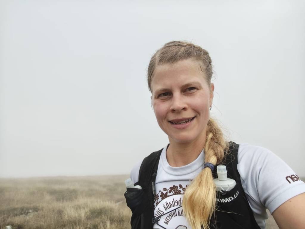
    But when I received the entry fee for the Chopok Skymarathon, I didn’t refuse and so on September 6, 2025 I stood at the start under Chopok in front of the Srdiečko hotel.

    The starting gun was accompanied by thunder in the background and even though the storms were predicted for the afternoon, they arrived right in the morning. Within 30 minutes I was soaked to the bone and the conditions were even more difficult, slippery roots, wet stones, mud.. But at least it wasn’t hot.

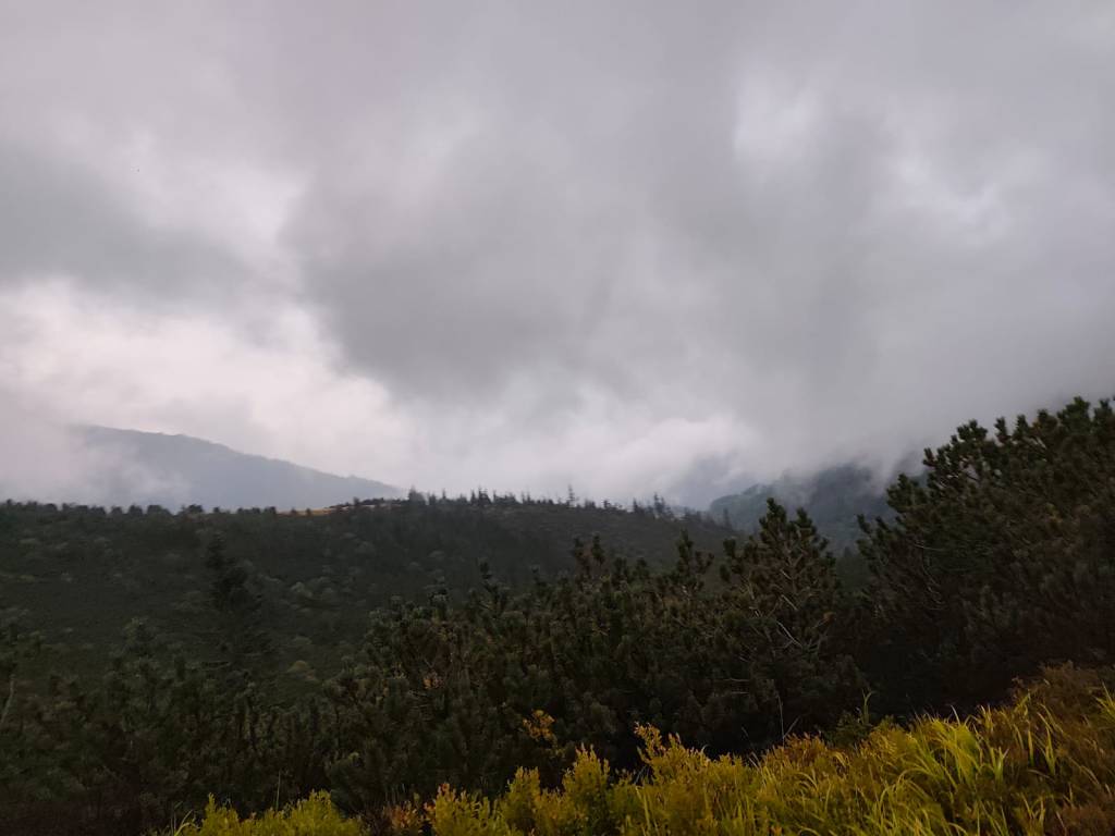
    During the storm

    After the initial climb to Kosodrevina, there was a traverse almost to the M.R. Štefánik hut and quite a few sections were runnable, from the hut there was a fairly long steep section down to the cave of dead bats, where it was quite slippery. I went relatively slowly and managed it without falling. There was a nice, quite runnable path back to Kosodrevina and so I ran as much as I could.

    There is sun after the storm

    I ran the refreshment stop only with a refill of ionts and a long, really long climb to the Krížské sedlo awaited me. Here I started to feel that my strength was waning and there was a reason, almost 20km and I had eaten almost nothing.. mistake..

    After first half

    I mostly walked to the refreshment stop on Chopok, where I stuffed myself with a banana and a chocolate bar, replenished my fluids, and jumped over the Tatra granite to the Demänovský saddle, where the trail started to rise again. I already felt that today would be very difficult, because I had less strength than I would have liked, especially uphill.

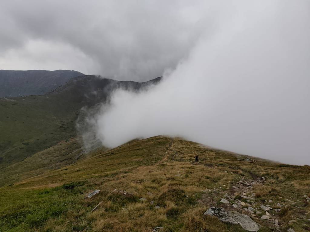
    Half foggy, half sunny

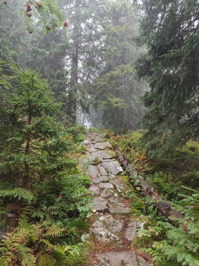
    The descent from Krúpov saddle was steep, rocky, muddy and strenuous, it took a lot of my strength, but the forest from Záver širokej doliny was beautifully foggy, mystical, covered in moss, I enjoyed it..

    Mystical forest

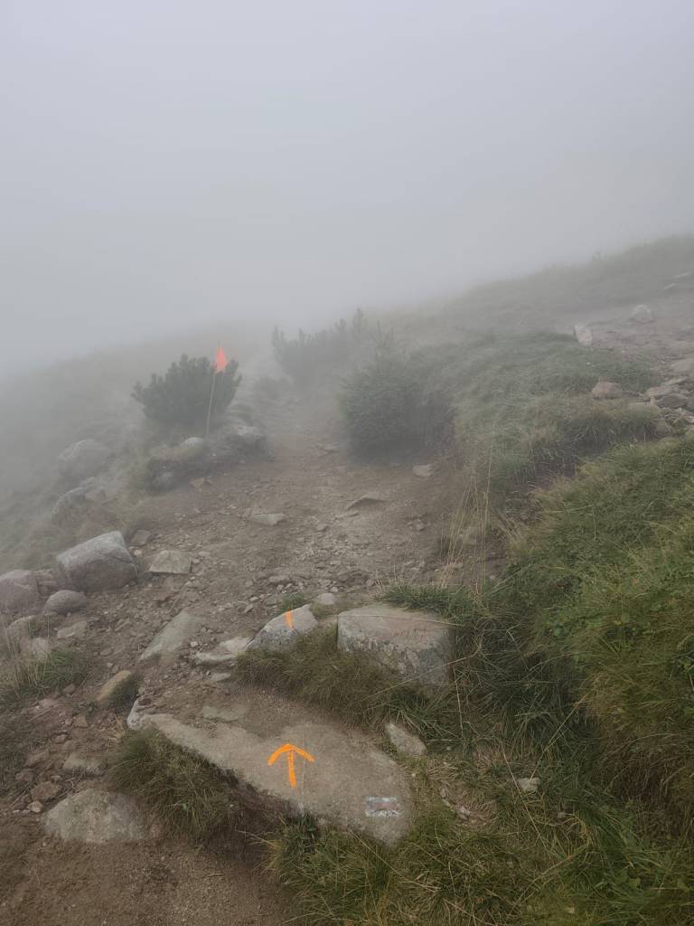
    The last refreshment stop on Biela Púť and now it’s just a climb, I tried to replenish my energy, but I knew that it would be more walking than running.. It was quite easy up to Orlia Skala, I walked quite briskly. But up the slope? That completely turned me off and I could barely move from one foot to the other, my head was starting to hurt, my stomach was protesting… It wasn’t the performance of the year, but I didn’t give up, and I walked all the way to the finish line, I was the 6th woman at the finish line with a time of 7h 33min.

    Slowly and gloomily up the slope, in places the sign was almost invisible
    43,4 km, 7h 33min, 2680m ascend
  • Skymaraton Chopok

    Skymaraton Chopok

    Už dávno som nepretekala,hlavne z dôvodu, že máme kopu vlastných projektov a málo voľných víkendov:)

    Ale keď som dostala štartovné na skymaraton Chopok, neodmietla som a tak som sa 6.9.2025 postavila na štart pod Chopkom pred hotelom Srdiečko.

    Startovací výstrel spravádzalo hrmenie v pozadí a aj keĎ búrky predpovedali až na poobedie, prišli hneď ráno. V priebehu 30 minút som bola do nitky mokrá a podmienky boli o to ťažšie, šmykľavé korene, mokré kamene, blato.. Ale aspoň nebolo horúco.

    Počas búrky

    Po úvodnom stúpaní na Kosodrevinu nasledoval traverz skoro až po chatu M.R. Štefánika a dosť veľa úsekov sa dalo bežať, od chaty nasledoval dosť dlhý strmý úsek dole k jaskyni mŕtvych netopierov, kde bolo celkom šmykľavo, išla som relatívne pomaly a ustála som to bez pádu. Späť na Kosodrevinu viedol pekný celkom behateľný chodníček a tak som bežala koľko to len šlo.

    Po búrke aj slnko vyšlo

    Občerstvovačku som prebehla len s doplnením iontov a čakalo ma dlhé, naozaj dlhé stúpanie do Krížskeho sedla, tu som začala cítiť, že mi sily ubúdajú a veru mali prečo, skoro 20km a skoro nič som nezjedla.. chyba..

    prvá polka za mnou

    Na občerstvoačku na Chopku som to väčšinou odkráčala a tam som do seba napchala banán a horalku, doplnila tekutiny a po tatranskej žula preskákala až do Demänovského sedla, kde sa chodníček začal znovu dvíhať.. Už som cítila, že dnes to bude veľmi náročné, lebo síl bolo menej ako by som chcela, najmä do kopca..

    Ale zo strany od jasnej sa stále valila hmla

    Zbeh z Krúpovho sedla bol strmý, kamenisto blatitý a namáhavý, zobral mi veľa síl, ale lesík od Záveru širokej doliny bol nádherne hmlistý, mystický, machom pokrytý, ten som si užila.

    Mystický lesík

    Posledná občerstvovačka na Bielej púti a už len stúpanie, snažila som sa doplniť energiu, ale vedela som, že už to bude viac kráčanie ako behanie.. Až po Orliu skalu to ale celkom išlo, išla som celkom rezkým krokom. Ale hore zjazdovkou? To ma už totálne vyplo a ledva som išla z nohy na nohy, hlava ma chcela bolieť, žalúdok protestoval… Nebol to síce výkon roka, ale nevzdala som to, a vykráčala som to až do ciela, v ciely som bola ako 6ta žena s časom 7h 33min.

    Pomaly a ponuro hore zjazdovkou, miestami skoro značky nebolo vidieť
    43,4 km, 7h 33min, 2680m stúpania